Mirabello, Emilia–Romagna
| Mirabello | |
|---|---|
| Comune | |
| Comune di Mirabello | |
 Mirabello Location of Mirabello in Italy | |
| Coordinates: 44°49′N 11°28′E / 44.817°N 11.467°ECoordinates: 44°49′N 11°28′E / 44.817°N 11.467°E | |
| Country | Italy |
| Region | Emilia-Romagna |
| Province / Metropolitan city | Province of Ferrara (FE) |
| Area | |
| • Total | 16.1 km2 (6.2 sq mi) |
| Elevation | 15 m (49 ft) |
| Population (Dec. 2004) | |
| • Total | 3,407 |
| • Density | 210/km2 (550/sq mi) |
| Demonym(s) | Mirabellesi |
| Time zone | CET (UTC+1) |
| • Summer (DST) | CEST (UTC+2) |
| Postal code | 44043 |
| Dialing code | 0532 |
| Website | Official website |
Mirabello is a comune (municipality) in the Province of Ferrara in the Italian region of Emilia-Romagna, located about 35 kilometres (22 mi) north of Bologna and about 12 kilometres (7 mi) west of Ferrara. As of 31 December 2004, it had a population of 3,407 and an area of 16.1 square kilometres (6.2 sq mi).[1]
Mirabello borders the following municipalities: Bondeno, Poggio Renatico, Sant'Agostino, Vigarano Mainarda.
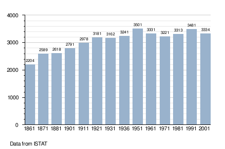
Demographic evolution
References
External links
This article is issued from Wikipedia - version of the 1/31/2015. The text is available under the Creative Commons Attribution/Share Alike but additional terms may apply for the media files.