Miandoab
| Miandoab qoshachay | |
|---|---|
| city | |
 Miandoab | |
| Coordinates: 36°58′10″N 46°06′10″E / 36.96944°N 46.10278°ECoordinates: 36°58′10″N 46°06′10″E / 36.96944°N 46.10278°E | |
| Country |
|
| Province | West Azerbaijan |
| County | Miandoab |
| Bakhsh | Central |
| Government | |
| • Mayor | Abdollah Abdollahi[1] |
| • Parliament | Hashemi & Mohebbinia |
| Population (2012[2]) | |
| • Total | 135,880 & 260,628 |
| City & County | |
| Time zone | IRST (UTC+3:30) |
| • Summer (DST) | IRDT (UTC+4:30) |
| Area code(s) | 0481 |
| Website | www.e481.ir |
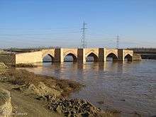
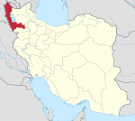
Miandoab (Persian: مياندوآب; also Romanized as Mīāndoāb, Meyāndoāb, Mīāndowāb, Mīāndow Āb, Mīāndūāb, Mīyāndoāb, and Miyāndūāb; Azerbaijani: قوشاچای - Qoşaçay)[3] is a city in and the capital of Miandoab County, West Azerbaijan Province, Iran. At the 2012 census, its population was 135,880, in 38,704 families.

Miandoab, as its name suggests, is situated in a delta region of the two rivers Zarrineh-Rud and Simineh-Rud. Miandoab enjoys very fertile soil and excellent Mediterranean climate. Due to the establishment of a sugar factory in the early 20th century, there has been large industrial activity compared to nearby towns.
Geography
The city of Miandoab is on the Zarriné-Rūd river and located in the center of the plain that slopes down to Lake Urmia. It is 1,314 metres (4,311 ft) above the sea level, at 46°6′E latitude and 36°58′N longitude.
The city is a transportation connection point between West Azerbaijan Province and East Azerbaijan Province. Thus, the city has been a transportation crossroads between the two large provinces, and has attracted political and economic interest from local and international governments.
- Miandoab County
The area of Miandoab County is 2694 square kilometers. Miandoab County is located between the Iranian counties of Bukan, Malekan, Mahabad, and Shahin Dezh.
Demographics
The majority of Miandoab's inhabitants are Azeri Turks who are followers of Shia of Islam.[4][5][6][7] There is also a small minority of Kurds, Armenians and Jews in and around the city. There is also a small minority of Ahl-e Haqq in Miandoab and surrounding villages. Miandoab used to have a sizable Bahá'í population, but due to the religious persecution by the government of the Islamic Republic, most have migrated to other cities within Iran or overseas.
Economy
Miandoab is an agricultural and rather industrial town, has the second rank of agriculture and livestock in the province after Urmia -as the capital-, and has the third rank of industry in the province after Urmia and Khoy. Promisingly, Miandoab has attracted lots of economical interests owing to its position among three provinces. Consequently, it has become one of the main resources of economy at South of the province.
References
| Wikimedia Commons has media related to Miandoab. |
- ↑ http://www.dana.ir/News/350647.html
- ↑ Population according to statistical center of Iran in Persian
- ↑ Miandoab can be found at GEOnet Names Server, at this link, by opening the Advanced Search box, entering "-3074888" in the "Unique Feature Id" form, and clicking on "Search Database".
- ↑ http://looklex.com/e.o/miandoab.htm
- ↑ http://www.miandoab-ag.ir/tabid/1522/Default.aspx
- ↑ زبان و گویش میاندوآب
- ↑ http://nedayeurmia.ir/index.aspx?siteid=8&pageid=265&newsview=45914
