Moamba District
| Moamba | |
|---|---|
| District | |
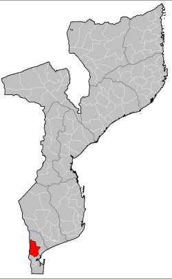 Moamba District on the map of Mozambique | |
| Country | Mozambique |
| Province | Maputo |
| Capital | Moamba |
| Area | |
| • Total | 4,628 km2 (1,787 sq mi) |
| Population (2007 census) | |
| • Total | 56,335 |
| • Density | 12/km2 (32/sq mi) |
Moamba District is a district of Maputo Province in southern Mozambique. The principal town is Moamba. The district is located in the center of the province, and borders with Magude District in the north, Manhiça and Marracuene Districts in the south, the city of Maputo in the southeast, Boane District in the south, Namaacha District in the southwest, and with Transvaal Province of South Africa in the west. The area of the district is 4,628 square kilometres (1,787 sq mi).[1] It has a population of 56,335 as of 2007.[2]
Geography
The Incomati River crosses the district from west to east. There are a number of seasonal rivers as well, which only flow during the rainy season.[1]
The climate is subtropical dry, with the annual rainfall ranging between 580 millimetres (23 in) and 590 millimetres (23 in).[1]
History
In 1730, the area was populated by Ronga-speaking people and divided between local chiefs. Since 1833, the area was occupied by the Portuguese.[1]
Demographics
As of 2005, 40% of the population of the district was younger than 15 years. 49% of the population spoke Portuguese. The most common mothertongue among the population was Xichangana. 55% were analphabetic, mostly women.[1]
Administrative divisions
The district is divided into four postos, Moamba (one locality), Ressano Garcia (one locality), Pessene (three localities), and Sábiè (five localities).[1]
Economy
9% of the households in the district have access to electricity.[1]
Agriculture
In the district, there are 10,000 farms which have on average 1.3 hectares (0.0050 sq mi) of land. The main agricultural products are corn, cassava, cowpea, peanut, and sweet potato.[1]
Transportation
There is a road network in the district, which includes 119 kilometres (74 mi) of the national road EN4, running between Maputo and Ressano Garcia, as well as secondary roads. A railway between Maputo and Ressano Garcia runs through Moamba; another railway line, between Moamba and Xinavane, is not in operation.[1]
References
- 1 2 3 4 5 6 7 8 9 "Perfil do Distrito de Moamba" (PDF) (in Portuguese). Ministry of State Administration. 2005. Retrieved 31 October 2016.
- ↑ "População da Provincia de Maputo". Censo 2007 (in Portuguese). Instituto Nacional de Estatística. Archived from the original on 8 March 2008. Retrieved 20 March 2008.
Coordinates: 25°36′14″S 32°14′46″E / 25.604°S 32.246°E