Vilanculos District
| Vilanculos | |
|---|---|
| District | |
|
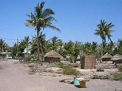
Traditional buildings in Vilankulo | |
 Vilanculos District on the map of Mozambique | |
| Country | Mozambique |
| Province | Inhambane |
| Capital | Vilankulo |
| Area | |
| • Total | 5,867 km2 (2,265 sq mi) |
| Population (2007 census) | |
| • Total | 135,710 |
| • Density | 23/km2 (60/sq mi) |
Vilankulo District or Vilanculos District is a district of Inhambane Province in south-east Mozambique. Its principal town is Vilankulo. The district is located at the east of the province, and borders with Inhassoro District in the north and Massinga District in the south and in the west. In the east, the district is bounded by the Indian Ocean. The area of the district is 5,867 square kilometres (2,265 sq mi).[1] It has a population of 135,710 as of 2007.[2]
Geography
The climate is tropical arid in the interior of the district and tropical humid at the coast. The annual rainfall at the coast achieves 1,500 millimetres (59 in), mainly falling in February and March.[1]
Administrative divisions
The district is divided into two postos, Vilankulo (three localities) and Mapinhane (three localities).[1]
Demographics
As of 2005, 42% of the population of the district was younger than 15 years. 39% did speak Portuguese. The population was predominantly speaking Chopi language. 64% were analphabetic, mostly women.[1]
Economy
In 2005, 1% of the households in the district had electricity. Woodcutting and fishery belong to traditional meand of subsistence of the population of the district.[1]
Agriculture
In 2005, the district had 26,000 farms exploiting on average the area of 1.5 hectares (0.0058 sq mi) each. The main agricultural products are maize, cassava, cowpea, and peanuts.[1]
Transportation
There is a road network in the district which includes the 122 kilometres (76 mi) stretch of the national road EN1 (20 kilometres (12 mi)) is a connection to Vilankulo), crossing the eastern part of the district, and about 220 kilometres (140 mi) of secondary roads.[1]
Vilankulo has an international airport. It, in particular, serves as a base for charter flights to Bazaruto Island Airport located on the Bazaruto Archipelago.[3]
References
- 1 2 3 4 5 6 7 "Perfil do Distrito de Vilankulo" (PDF) (in Portuguese). Ministry of State Administration. 2005. Retrieved 23 October 2016.
- ↑ "População da Provincia de Inhambane". Censo 2007 (in Portuguese). Instituto Nacional de Estatística. Archived from the original on 8 March 2008. Retrieved 20 March 2008.
- ↑ "Getting there". Bazaruto Archipelago. Retrieved 20 October 2016.
Coordinates: 22°00′00″S 35°19′00″E / 22.0000°S 35.3167°E