Guro District, Manica Province
| Guro | |
|---|---|
| District | |
|
Mount Calinga-Muci | |
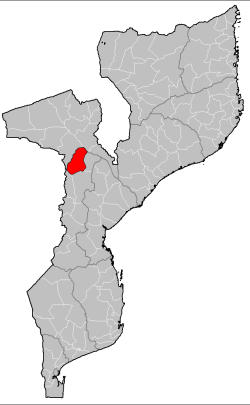 Guro District on the map of Mozambique | |
| Country | Mozambique |
| Province | Manica |
| Capital | Guro |
| Area | |
| • Total | 6,928 km2 (2,675 sq mi) |
| Population (2007 census) | |
| • Total | 68,526 |
| • Density | 9.9/km2 (26/sq mi) |
.jpg)
Guro District is a district of Manica Province in western Mozambique. The principal town is Guro. The district is located in the north of the province, and borders with Changara District of Tete Province in the north, Tambara District in the east, Macossa District in the south, and Báruè District in the southwest. The area of the district is 6,928 square kilometres (2,675 sq mi).[1] It had a population of 68,526 as of 2007[2] and 83,972 as of 2013[3]
Geography
The major rivers on the borders of the district (the Luenha and Zambezi) have perennial flow, while others are intermittent (Nhamacombe, Mupha, Nhaduzi), fed by stormwaters.[1]
The climate of the district is semi-arid with most rain falling from November to March. The average annual rainfall is 632 millimetres (24.9 in).[1]
Demographics
As of 2005, 51% of the population of the district was younger than 15 years. 22% did speak Portuguese. The most common mothertongue is Chitwe language. 79% were analphabetic, mostly women.[1]
Administrative divisions
The district is divided into four postos, Guro (one locality), Dacata (one locality), Mandie (five localities), and Nhamassonge (one locality).[1]
Economy
Less than 1% of the households in the district have access to electricity.[1]
Agriculture
In the district, there are 10,000 farms which have on average 2.5 hectares (0.0097 sq mi) of land. The main agricultural products are corn, cassava, cowpea, peanut, sorghum, pearl millet, and sweet potato.[1] Livelihoods are dominated by smallholder agriculture, with millet and sorghum in well drained soils, and maize and black-eyed peas in more humid areas. Irregularity of rain is a major constraint on the district.
Transportation
There is a road network in the district which is 576 kilometres (358 mi) long. Most of the roads are in a bad state.[1]
References
- 1 2 3 4 5 6 7 8 "Perfil do Distrito de Guro" (PDF) (in Portuguese). Ministry of State Administration. 2005. Retrieved 13 November 2016.
- ↑ "População da Provincia de Manica". Censo 2007 (in Portuguese). Instituto Nacional de Estatística. Archived from the original on 8 March 2008. Retrieved 20 March 2008.
- ↑ "Estatísticas do Distrito Guro" (PDF). Estatísticas / Territoriais (Distritais). INSTITUTO NACIONAL DE ESTATISTICA. Retrieved 9 January 2016.
Coordinates: 17°25′30″S 33°21′22″E / 17.425°S 33.356°E