Monkland, Oregon
| Monkland, Oregon | |
|---|---|
| Unincorporated community | |
 Monkland, Oregon  Monkland, Oregon | |
| Coordinates: 45°29′10″N 120°37′37″W / 45.486°N 120.627°WCoordinates: 45°29′10″N 120°37′37″W / 45.486°N 120.627°W | |
| Country | United States |
| State | Oregon |
| County | Sherman |
| Elevation | 1,654 ft (504 m) |
| Time zone | Pacific (PST) (UTC-8) |
| • Summer (DST) | PDT (UTC-7) |
| ZIP code | 97039 |
| Area code(s) | 458 and 541 |
Monkland is an unincorporated community in Sherman County, Oregon, United States,[1] on Monkland Lane between Sherman Highway 97 and Wasco-Heppner Highway 206. Its post office opened in 1886 and closed in 1919 now served by the Moro, Oregon 97039 post office.
The community may have been named for Monkland, Ontario, as many people near the community came from the town in Ontario.[2]
References
- ↑ Oregon Hometown Locator
- ↑ McArthur, Lewis A.; McArthur, Lewis L (2003) [1928]. Oregon geographic names. Portland, Oregon: Oregon Historical Society Press. pp. 655–656. ISBN 0-87595-277-1.
Municipalities and communities of Sherman County, Oregon, United States | ||
|---|---|---|
| Cities | 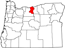 | |
| CDP | ||
| Other communities | ||
This article is issued from Wikipedia - version of the 11/2/2016. The text is available under the Creative Commons Attribution/Share Alike but additional terms may apply for the media files.