Monte Giberto
| Monte Giberto | |
|---|---|
| Comune | |
| Comune di Monte Giberto | |
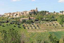 | |
 Monte Giberto Location of Monte Giberto in Italy | |
| Coordinates: 43°6′N 13°38′E / 43.100°N 13.633°ECoordinates: 43°6′N 13°38′E / 43.100°N 13.633°E | |
| Country | Italy |
| Region | Marche |
| Province / Metropolitan city | Province of Fermo |
| Area | |
| • Total | 12.7 km2 (4.9 sq mi) |
| Elevation | 323 m (1,060 ft) |
| Population (Dec. 2004) | |
| • Total | 865 |
| • Density | 68/km2 (180/sq mi) |
| Demonym(s) | Montegibertesi |
| Time zone | CET (UTC+1) |
| • Summer (DST) | CEST (UTC+2) |
| Postal code | 63020 |
| Dialing code | 0734 |
| Website | Official website |
Monte Giberto is a comune (municipality) in the Province of Fermo in the Italian region Marche, located about 60 kilometres (37 mi) south of Ancona and about 30 kilometres (19 mi) north of Ascoli Piceno. As of 31 December 2004, it had a population of 865 and an area of 12.7 square kilometres (4.9 sq mi).[1]
Monte Giberto borders the following municipalities: Grottazzolina, Monte Vidon Combatte, Montottone, Petritoli, Ponzano di Fermo.
Demographic evolution

References
External links
This article is issued from Wikipedia - version of the 1/31/2015. The text is available under the Creative Commons Attribution/Share Alike but additional terms may apply for the media files.