Mothel
| Mothel Maothail | |
|---|---|
| Village | |
 Mothel Location in Ireland | |
| Coordinates: 52°17′57″N 7°25′10″W / 52.299232°N 7.419468°WCoordinates: 52°17′57″N 7°25′10″W / 52.299232°N 7.419468°W | |
| Country |
|
| Province | Munster |
| County | County Waterford |
| Time zone | WET (UTC+0) |
| • Summer (DST) | IST (WEST) (UTC-1) |
Mothel (Irish: Maothail, meaning " Soft or Spongy Land") is a small village near the Comeragh Mountains in the northern part of County Waterford, Ireland.[1] The closest centres of population to Mothel are Portlaw and Carrick-on-Suir.
Heritage
Mothel Abbey was founded in the 6th century by St. Cuan or St. Breoghan.[2] It was refounded for the Augustinians by the Power family in the 13th century. It was closely associated with St. Catherine's Abbey in Waterford.
A Cross Pillar stone, also known as a termon-stone, stands by the roadside in Mothel. The squared sandstone pillar stands four feet high and is inscribed with ornamental crosses.[3]
Traditionally, local people walk through the stream at Mothel holy well seven times on the local Pattern day, known as Lá Chuain Airbhre.
Sport
Cyclist Sean Kelly grew up in the townland of Curraghduff, approximately 1 km from Mothel.
See also
External links
References
- ↑ "Ordnance Survey Ireland Map Viewer". Retrieved 11 January 2015.
- ↑ "Archaeological Survey Database SMR No WA007-010001". National Monuments Service. Retrieved 11 January 2015.
- ↑ "Archaeological Survey Database SMR No WA007-011". National Monuments Service. Retrieved 11 January 2015.
Places in County Waterford | ||
|---|---|---|
| Towns | 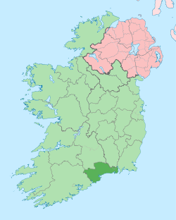 | |
| Villages and Townlands |
| |
| ||