Mount Hikurangi (Gisborne District)
| Mount Hikurangi | |
|---|---|
| Te Ara ki Hikurangi (Māori)[1] | |
.jpg) Mount Hikurangi, as seen from the Waiapu Valley | |
| Highest point | |
| Elevation | 1,752 m (5,748 ft) [1] |
| Listing | List of mountains of New Zealand by height |
| Coordinates | 37°55′1.49″S 178°3′36.20″E / 37.9170806°S 178.0600556°ECoordinates: 37°55′1.49″S 178°3′36.20″E / 37.9170806°S 178.0600556°E [2] |
| Geography | |
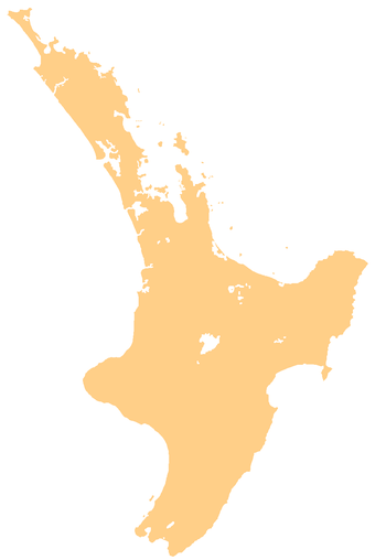 Mount Hikurangi Location in the North Island of New Zealand | |
| Location | Gisborne District, New Zealand |
| Parent range | Raukūmara Range |
Mount Hikurangi (or Te Ara ki Hikurangi in Māori) is a 1,752 m (5,748 ft) peak in the eastern corner of New Zealand's North Island, about 80 kilometres (50 mi) north of Gisborne, and 50 kilometres (31 mi) southwest of the East Cape Lighthouse.[2] On a spur of the Raukūmara Range in the Waiapu Valley, it is the North Island's highest non-volcanic peak.[3]
Mount Hikurangi is within the rohe of Ngāti Porou, and is the iwi's most significant icon.[4] In Māori mythology, it was the first part of the North Island to emerge when Māui pulled it as a giant fish from the ocean.[4] According to these beliefs, his waka, Nukutaimemeha, became stranded on the mountain, and lies petrified near the mountain's summit.[3][4] Nine large whakairo (carvings) depicting Māui and his whānau were erected on the mountain to commemorate the millennium in 2000.[3]
Nearby summits include Whanokao (1,428 m or 4,685 ft), Aorangi (1,272 m or 4,173 ft), Wharekia (1,106 m or 3,629 ft) and Taitai (678 m or 2,224 ft). Together, these mountains provide what Te Ara - the Encyclopedia of New Zealand calls an "awe-inspiring vista".[3]
The first sunrise of the new day
The peak is traditionally regarded as the first land in the world to catch the rays of the new day's sun, although this claim, like any such claim of its type, is open to interpretation. Certainly it is not true at any time of the year other than the Southern Hemisphere summer, as both Fiji and Tonga are to the east. In summer, however, because of the tilt of the Earth's axis, it does receive the sun's rays earlier than these places.[5] It does not receive them earlier than the Chatham Islands (or, of course, Antarctica), however. This did not stop the mountain gaining world prominence in the celebrations for the new Millennium, however.
According to the Department of Conservation, the mountain is "recognised and accepted as the first point on the mainland to greet the morning sun".[1] The traditional greeting of South Island iwi Ngāi Tahu to North Island visitors, "Haere mai, e te Rāwhiti!" (Welcome, O Sunrise!), references this fact.[6]:56 Celebrations by Ngāti Porou to commemorate the first dawn of the new millennium in 2000, including karakia led by Tamati and Amster Reedy, took place on the summit of the mountain.[7][8] In addition, nine massive whakairo depicting Māui's story and his whānau were erected on the mountain as part of the celebrations.[3][9] They were carved under Derek Lardelli's guidance by students from Toihoukura, the Eastern Institute of Technology's School of Māori Visual Arts.[9]
History
Before the arrival of Europeans, Mount Hikurangi was within Ngāti Porou's territory.[4] Ngāti Porou believe they are descendants of Māui, and thus have had a connection with the mountain since it arose from the sea.[4] In the 1870s, the Crown acquired the mountain and turned it into a state forest park.[10] In November 1990, ownership of Mount Hikurangi was returned to Ngāti Porou, who now manage the mountain, and facilitate the public's access to it.[10]
19th-century gold prospecting
NB: This section is derived from text in Mackay, Joseph Angus (1949). Historic Poverty Bay and the East Coast, N.I., N.Z, available here at the The New Zealand Electronic Text Centre.
There were several “gold rushes” on Mount Hikurangi in the early days of European settlement. In 1874, about 100 Māori went prospecting on and around Mount Hikurangi. However, Sir James Hector, who examined the Waiapu Valley, found no signs of gold. In 1875 “Scotty” Siddons, mate of the Beautiful Star, claimed to have met a Māori person on the East Coast who had a few ounces of gold. He, and a mate named Hill, found a lot of mundic on the north-west side of the mountain, but only outcrops of limestone on the higher slopes. In 1886 Reupane te Ana, of Makarika, discovered what he fondly imagined was an enormous deposit of gold in the area. With what Joseph Angus Mackay called “noble unselfishness”, he let all his friends into the secret. Drays, wheelbarrows and receptacles of all kinds were rushed to the scene, and large quantities of the “precious metal” were removed to a safe place. When it turned out that the metal was only mundic, Reupane became an object of ridicule, and, afterwards, was known as “Tommy Poorfellow.”[11]
Significance to Māori
Mount Hikurangi is of great spiritual, cultural, and physical significance to Ngāti Porou.[3] It is the iwi's most important icon, and in Māori mythology, was the first part of the North Island to emerge when Māui, an ancestor of Ngāti Porou, pulled it as a giant fish from the ocean.[4] According to these beliefs, his waka, Nukutaimemeha, became stranded on the mountain, and lies petrified near the mountain's summit.[3][4] Another of Ngāti Porou's mythological ancestors, Paikea, is also associated with the mountain. According to myth, Paikea's younger half-brother, Ruatapu, attempted to kill about 70 of his older kin ("brothers") at sea in Hawaiki to exact revenge on his father for belittling him as a low-born son of a slave. The massacre, called Te Huripūreiata, was survived only by Paikea, who called on the sea gods and ancestors to save him.[12] Paikea travelled to New Zealand on the back of a whale, but Ruatapu sent a great flood to kill the survivors in New Zealand, called Te Tai a Ruatapu.[4][12] Mt. Hikurangi became a refuge for the people from this deluge.[4]
The mountain is often referenced in Ngāti Porou's karakia (incantations), waiata (songs), haka (war dances), and pēpeha or whakatauākī (proverbs).[1] Examples of these include:
- Ko Hikurangi te maunga, Ko Waiapu te awa, Ko Ngāti Porou te iwi (Hikurangi the mountain, Waiapu the river, Ngati Porou the people). Ngāti Porou's proverb of identity.[4][13]
- He atua! He tangata! He atua! He tangata! Ho! (Behold, it is divine! It is human! It is divine! It is human! Ah!). Referring to Mt. Hikurangi, this is from the Ngāti Porou haka, Rūaumoko, named after the earthquake god.[4]
- Whakaeteete mai ko Hikurangi (Thrusting upward, is Hikurangi). From the haka, Whakarongo ake ki te hīrea waha o Māui (Hearken to the faint call of the voice of Māui), celebrating the mythological rise of the mountain from the ocean.[12]
- He kākā tāwari ki Hikurangi, he moki ki te moana ([A] kākā feeding on the tāwari at Hikurangi, [is as fat as the] moki in the sea). This saying represents plentiful food.[6]:82[14]
- Ka rukuruku a Te Rangi-tāwaea i ōna pūeru (Te Rangi-tāwaea [a Ngāti Porou ancestor] dons his garments). Said when Mount Hikurangi is covered in snow.[6]:184
Some famous Māori quotes involving Hikurangi include:
- Ehara a Hikurangi i te maunga haere (Hikurangi is not a travelling mountain). The mountain of Hikurangi did not have a legend involving movement, and Te Kani-a-Takirau referenced this to justify his unwillingness to leave the area when he turned down the Māori Kingship, also saying he was "a king already through [his] ancestors".[6]:22
- Kāti, tukua mai ki Hikurangi, ki te maunga e tauria e te huka (Enough, let him come hither to Hikurangi, to the mountain on which rests the snow). Said by Te Aotaki, instructing his tribe to welcome Tūwhakairiora, who came to avenge the murder of Poroumātā, his grandfather, and no doubt to undergo tohi (a rite to cause bravery), and possibly marry one of his daughters.[6]:189;409 Another version of the quote is Tukuna mai ki a au, ki Hikurangi, te maunga e tauria ana e te huka (Let him come to me, to Hikurangi, the mountain covered with snow).[6]:409
Flora and fauna

The summit of Mount Hikurangi is the northernmost place where New Zealand's alpine vegetation can be seen.[1] Among the alpine shrubs and delicate herbs found there are large buttercups (Ranunculus spp.), and prickly wild Spaniards (Aciphylla spp.).[1]
The mountain contains the only known habitat of a small sub-alpine shrub, the Hikurangi tutu (Coriaria pottsiana), found on the grassy scree slope behind the Mount Hikurangi Tramping Hut at 37°54′22″S 178°3′31″E / 37.90611°S 178.05861°E.[1][15]
Mount Hikurangi was the location of the last known mainland sighting of the North Island saddleback in 1910, before its reintroduction to the North Island on the 16th of June 2002 at Zealandia in Wellington.[16][17] In Māori times, kākā would fatten themselves on the berries of the tāwari trees growing on the mountain.[6]:82[14] In the 1960s, members of the Gisborne Tramping Club heard what they thought may have been the call of a kākāpō on the mountain, a parrot whose last documented existence in the North Island was in 1895.[16][18]
The nearby Raukūmara Forest Park's forests include a wide range of podocarp-broadleaved species such as rimu, rātā, tawa, hīnau, rewarewa, kāmahi, kahikatea, miro, beech and tōtara.[19] Native birds and animals found in the area include fantails, tūī, whio, kākā, falcons, kererū, brown kiwi, Hochstetter's frogs, snails, lizards, skinks, Motuweta riparia (Raukūmara tusked wētā), and short- and long-tailed bats.[19][20] Introduced animals include deer, goats, possums, pigs, cattle and mustelidae, all of which pose a threat to the native wildlife.[19]
Recreation
Mount Hikurangi is about 130 km (81 mi) north of Gisborne by road. Visitors to the mountain are asked to contact Te Rūnanga o Ngāti Porou before arriving, as the track crosses their private land, which is sometimes closed for short periods for cultural or farming reasons. While there is no public vehicle or bicycle access beyond the car park near the bottom, 4x4 tours to the carvings can be organised through Te Rūnanga o Ngāti Porou, who also offer a summit guide and an overnight guide. From the car park, it is about a 7-hour walk to the summit. There is a hut for public use 4–5 hours up the mountain, but visitors must bring their own cooker and water. Bookings for the hut are also made through Te Rūnanga o Ngāti Porou. Visitors are advised to be cautious of the mountain's unpredictable weather, and to bring clothing suitable for all weather conditions.[21]
Hunting of introduced species is permitted in the nearby Raukūmara Forest Park.[20]
See also
References
- 1 2 3 4 5 6 7 "Mount Hikurangi - Te Ara ki Hikurangi". Places to visit. Wellington, New Zealand: Department of Conservation. Retrieved 11 May 2012.
- 1 2 Google (11 May 2012). "Hikurangi, Gisborne 4083" (Map). Google Maps. Google. Retrieved 11 May 2012.
- 1 2 3 4 5 6 7 Soutar, Monty (23 August 2011). "East Coast places - Waiapu River valley". Te Ara - the Encyclopedia of New Zealand. Wellington, New Zealand: Manatū Taonga |
Ministry for Culture and Heritage. Retrieved 11 May 2012. line feed character inDocumentation[create]
|publisher=at position 57 (help); External link in|publisher=(help) - 1 2 3 4 5 6 7 8 9 10 11 Reedy, Tamati Muturangi (4 March 2009). "Ngāti Porou - Tribal boundaries and resources". Te Ara - the Encyclopedia of New Zealand. Wellington, New Zealand: Manatū Taonga |
Ministry for Culture and Heritage. Retrieved 11 May 2012. line feed character inDocumentation[create]
|publisher=at position 57 (help); External link in|publisher=(help) - ↑ Handford, R. "Gisborne still first for the sun," New Zealand herald, 4 Jan 2012. Retrieved 2 September 2013.
- 1 2 3 4 5 6 7 Mead, Hirini Moko; Grove, Neil (2003). Ngā Pēpeha a ngā Tīpuna [The Sayings of the Ancestors]. Wellington, New Zealand: Victoria University Press. ISBN 978-0-86473-462-4. OCLC 174934126.
- ↑ Reedy, Tamati Muturangi (24 September 2011). "Ngāti Porou: The importance of Hikurangi to Ngāti Porou". Te Ara - the Encyclopedia of New Zealand. Wellington, New Zealand: Manatū Taonga |
Ministry for Culture and Heritage. Retrieved 11 May 2012. line feed character inDocumentation[create]
|publisher=at position 57 (help); External link in|publisher=(help) - ↑ Reedy, Tamati Muturangi (24 September 2011). "Ngāti Porou: Millennium celebrations on Mt Hikurangi". Te Ara - the Encyclopedia of New Zealand. Wellington, New Zealand: Manatū Taonga |
Ministry for Culture and Heritage. Retrieved 11 May 2012. line feed character inDocumentation[create]
|publisher=at position 57 (help); External link in|publisher=(help) - 1 2 Reedy, Tamati Muturangi (24 September 2011). "Ngāti Porou: Māui on Mt Hikurangi". Te Ara - the Encyclopedia of New Zealand. Wellington, New Zealand: Manatū Taonga |
Ministry for Culture and Heritage. Retrieved 11 May 2012. line feed character inDocumentation[create]
|publisher=at position 57 (help); External link in|publisher=(help) - 1 2 Reedy, Tamati Muturangi (24 September 2011). "Ngāti Porou: Mt Hikurangi". Te Ara - the Encyclopedia of New Zealand. Wellington, New Zealand: Manatū Taonga |
Ministry for Culture and Heritage. Retrieved 11 May 2012. line feed character inDocumentation[create]
|publisher=at position 57 (help); External link in|publisher=(help) - ↑ Mackay, Joseph Angus (1949). "Chapter XXXIX — Local Government: Waiapu County". Historic Poverty Bay and the East Coast, N.I., N.Z. Gisborne, New Zealand: Joseph Angus Mackay. pp. 402–3. Retrieved 11 May 2012. Online version provided by The New Zealand Electronic Text Centre.
- 1 2 3 Reedy, Tamati Muturangi (18 February 2011). "Ngāti Porou - Ancestors". Te Ara - the Encyclopedia of New Zealand. Wellington, New Zealand: Manatū Taonga |
Ministry for Culture and Heritage. Retrieved 11 May 2012. line feed character inDocumentation[create]
|publisher=at position 57 (help); External link in|publisher=(help) - ↑ Harmsworth, Garth; Warmenhoven, Tui Aroha (2002). "The Waiapu project: Maori community goals for enhancing ecosystem health" (DOC). Hamilton, New Zealand: New Zealand Association of Resource Management. Retrieved 28 April 2012.
- 1 2 Best, Elsdon (1977) [1942]. "Bird Lore: How Birds Were Taken — The kaka or Brown Parrot (Nestor meridionalis)". Forest Lore of the Maori. Memoirs of the Polynesian Society. 18. Dominion Museum bulletin. 14. Wellington, New Zealand: E.C. Keating, Government Printer. p. 193. OCLC 639613989. Retrieved 11 May 2012.
- ↑ "Mt Hikurangi > Points". New Zealand Tramper. Retrieved 11 May 2012.
- 1 2 Parkinson, Brian. "Poverty Bay and East Cape - Mt Hikurangi". Brian Parkinson's Guide to Unique Wildlife of New Zealand. Waipu, New Zealand: Ecotours New Zealand. Retrieved 11 May 2012.
- ↑ "North Island saddleback factsheet" (PDF). Wellington, New Zealand: Karori Wildlife Sanctuary. 2005. Retrieved 11 May 2012.
- ↑ Best, Elsdon (1977) [1942]. "Bird Lore: How Birds Were Taken — Kākāpō (Strigops habroptilus)". Forest Lore of the Maori. Memoirs of the Polynesian Society. 18. Dominion Museum bulletin. 14. Wellington, New Zealand: E.C. Keating, Government Printer. p. 171. OCLC 639613989. Retrieved 11 May 2012.
- 1 2 3 "Raukumara Forest Park: Natural features". Places to visit. Wellington, New Zealand: Department of Conservation. Retrieved 11 May 2012.
- 1 2 "Gisborne Raukumara hunting: Raukumara Forest Park". Hunting. Wellington, New Zealand: Department of Conservation. Retrieved 11 May 2012.
- ↑ "Mount Hikurangi - Te Ara ki Hikurangi". Tracks & walks. Wellington, New Zealand: Department of Conservation. Retrieved 11 May 2012.
- Moorfield, John C. "Te Aka Māori-English, English-Māori Dictionary and Index (Online version)". New Zealand: Pearson Education; Auckland University of Technology. Retrieved 11 May 2012.
External links
-
 Media related to Mount Hikurangi at Wikimedia Commons
 - Mt Hikurangi article with photo in Te Ara - the Encyclopedia of New Zealand
- Waiapu River valley article in Te Ara - the Encyclopedia of New Zealand, with photo here
- Photos of carvings of Māui and other members of his whānau on the mountain.
- The importance of Hikurangi to Ngāti Porou video (in te reo Māori, with English notes)