Mount Mimuro
| Mount Mimuro | |
|---|---|
| 三室山 | |
 A View of Mount Mimuro from south | |
| Highest point | |
| Elevation | 1,358.0 m (4,455.4 ft) |
| Coordinates | 35°14′N 134°27′E / 35.233°N 134.450°E |
| Naming | |
| Pronunciation | [mimuɽojama] |
| Geography | |
| Location | On the border of Shisō, Hyōgo and Wakasa, Yazu Tottori in Japan |
| Parent range | Chūgoku Mountains |
| Geology | |
| Mountain type | Fault-block |
Mount Mimuro (三室山 Mimuro-yama) is a mountain on the border of Shisō, Hyōgo Prefecture, and Wakasa, Tottori Prefecture, Japan. The height is 1,358.0 m (4,455 ft), and this mountains is the second highest mountain in Hyōgo Prefecture after Mount Hyōno.
Outline
Mount Mimuro is one of the fault-block of mountains typical in Chūgoku Mountains. This mountain belongs to the Hyōnosen-Ushiroyama-Nagisan Quasi-National Park. This mountain is one of Hyōgo 50 mountains, and also one of Kinki 100 mountains, Chūgoku 100 mountains.
Access
- Kawachi Bus Stop of Shinki Bus
Gallery
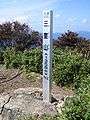 At the top of Mount Mimuro (10/2008)
 Mount Hyō from Mount Mimuro (10/2008)
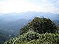 Mount Ushiro from Mount Mimuro (10/2008)
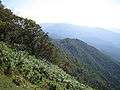 Mount Takero from Mount Mimuro (10/2008)
References
- Ministry of Environment of Japan
- Official Home Page of the Geographical Survey Institute in Japan
- ‘Shinban Furusato Hyōgo 50 San’, Hyōgo-ken Sangaku Renmei
This article is issued from Wikipedia - version of the 3/19/2013. The text is available under the Creative Commons Attribution/Share Alike but additional terms may apply for the media files.