Mount Mourne, North Carolina
| Mount Mourne, North Carolina | |
|---|---|
| Unincorporated community | |
 Mount Mourne, North Carolina  Mount Mourne, North Carolina | |
| Coordinates: 35°32′35″N 80°50′50″W / 35.54306°N 80.84722°WCoordinates: 35°32′35″N 80°50′50″W / 35.54306°N 80.84722°W | |
| Country | United States |
| State | North Carolina |
| County | Iredell |
| Elevation | 850 ft (260 m) |
| Time zone | Eastern (EST) (UTC-5) |
| • Summer (DST) | EDT (UTC-4) |
| ZIP code | 28123 |
| Area code(s) | 704 & 980 |
| GNIS feature ID | 1021550[1] |
Mount Mourne is an unincorporated community in Iredell County, North Carolina, United States. Mount Mourne is located on North Carolina Highway 115 3.5 miles (5.6 km) southwest of Mooresville.[2] Mount Mourne has a post office with ZIP code 28123.[3] The community is named after Mount Mourne Plantation, an antebellum cotton plantation founded by Rufus Reid (1797-1854).
In addition to Mount Mourne Plantation, the Centre Presbyterian Church, Session House and Cemeteries, Coddle Creek Associate Reformed Presbyterian Church, Session House and Cemetery, George Houston House, and Wood Lawn are listed on the National Register of Historic Places.[4]
References
- ↑ U.S. Geological Survey Geographic Names Information System: Mount Mourne, North Carolina
- ↑ Iredell County, North Carolina (Map). North Carolina Department of Transportation. Retrieved 2010-11-19.
- ↑ ZIP Code Lookup
- ↑ National Park Service (2010-07-09). "National Register Information System". National Register of Historic Places. National Park Service.
Municipalities and communities of Iredell County, North Carolina, United States | ||
|---|---|---|
| City | 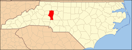 | |
| Towns | ||
| CDP | ||
| Unincorporated communities | ||
| Footnotes | ‡This populated place also has portions in an adjacent county or counties | |
This article is issued from Wikipedia - version of the 7/27/2016. The text is available under the Creative Commons Attribution/Share Alike but additional terms may apply for the media files.