Mount Tsubakuro
| Mount Tsubakuro | |
|---|---|
| 燕岳 | |
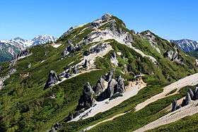 Mount Tsubakuro (June 2015) | |
| Highest point | |
| Elevation | 2,762.85 m (9,064.5 ft) [1] |
| Listing | List of mountains in Japan |
| Coordinates | 36°24′25″N 137°42′46″E / 36.40694°N 137.71278°ECoordinates: 36°24′25″N 137°42′46″E / 36.40694°N 137.71278°E [2] |
| Naming | |
| Pronunciation | [tsu͍bakuɽodake] |
| Geography | |
 Ōmachi, Nagano Prefecture | |
| Parent range | Hida Mountains |
| Topo map |
Geospatial Information Authority 25000:1 槍ヶ岳[2] 50000:1 槍ヶ岳 |
| Climbing | |
| Easiest route | Hike |
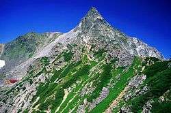
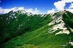
Mount Tsubakuro (燕岳 Tsubakuro-dake) is a 2,763 metres (9,065 ft) high mountain in Azumino, Nagano Prefecture, Japan. It is situated in Japan's Hida Mountains in Nagano Prefecture. It was specified for Chūbu-Sangaku National Park on December 4, 1934.[3]
Mountain hut
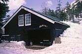
The mountain climbing trail between Mount Tsubakuro and Mount Yari is called Main Street (表銀座 Omote-Ginza) owing to its extensive use over time. It has two mountain huts along the way. Tsubakuro mountain cottage (燕山荘 Enzansō) is located at near the summit and is one of the oldest mountain huts in Japan, completed in 1921[4]
 |
 |
 |
| Enzanso (Tsubakuro mt. cottage) |
Kassen-goya (Kassen hut) |
Trail as seen from Mt. Ohensho |
|---|
Geography
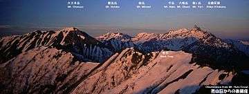
Nearby mountains
The following are the main mountains in the surrounding.
| Image | Mountain | Elevation | Distance from the Top |
Note |
|---|---|---|---|---|
 |
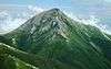
Mt. Gaki 餓鬼岳 |
2,647.19 m (8,685 ft) | 5.0 km (3.1 mi) | 200 Famous Japanese Mountains |
 |
Mt. Tsubakuro 燕岳 |
2,839.58 m (9,316 ft) | 0 km (0.0 mi) | 200 Famous Japanese Mountains |
 |
Mt. Otensho 大天井岳 |
2,921.91 m (9,586 ft) | 4.7 km (2.9 mi) | 200 Famous Japanese Mountains |
 |
Mt. Jōnen 常念岳 |
2,857 m (9,373 ft) | 9.1 km (5.7 mi) | 100 Famous Japanese Mountains |
 |
Mt. Yari 槍ヶ岳 |
3,180 m (10,433 ft) | 9.3 km (5.8 mi) | 100 Famous Japanese Mountains |
Rivers
The mountain is the source of the following rivers, each of which flows to the Sea of Japan.
- Nakabusa River (tributary of the Shinano River)
- tributary of Takase River
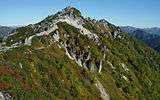
Gallery
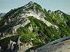
View from Mount Tsubakuro
Scenery of Mount Tsubakuro
 |
 |
 |
 |
| Top | in Spring | Mt. Tubakuro & Hut | in Autumn |
|---|
References
- ↑ "Information inspection service of the Triangulation station" (in Japanese). Geospatial Information Authority of Japan,(高山-槍ヶ岳-槍ヶ岳). Retrieved December 30, 2010.
- 1 2 "Map inspection service" (in Japanese). Geospatial Information Authority of Japan,(高山-槍ヶ岳-槍ヶ岳). Retrieved December 30, 2010.
- ↑ "Chūbu-Sangaku National Park". Ministry of the Environment (Japan). Retrieved December 30, 2010.
- ↑ "Home Page" (in Japanese). Enzanso Group. Retrieved 8 April 2016.
See also
| Wikimedia Commons has media related to Mount Tsubakuro. |