Chūbu-Sangaku National Park
| Chūbu-Sangaku National Park | |
|---|---|
|
中部山岳国立公園 Chūbu-Sangaku Kokuritsu Kōen | |
|
IUCN category II (national park) | |
 | |
 Chūbu-Sangaku National Park | |
| Location | Honshū, Japan |
| Coordinates | 36°45′30″N 137°47′30″E / 36.75833°N 137.79167°ECoordinates: 36°45′30″N 137°47′30″E / 36.75833°N 137.79167°E |
| Area | 1,743.23 square kilometres (673.06 sq mi) |
| Established | December 4, 1934 |
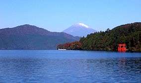
Chūbu-Sangaku National Park (中部山岳国立公園 Chūbu Sangaku Kokuritsu Kōen) is a national park in the Chūbu region, Honshū, Japan. It was established around the Hida Mountains and encompasses parts of Nagano, Gifu, Toyama and Niigata prefectures. It was designated a national park on December 4, 1934, along with Daisetsuzan National Park, Akan National Park, Nikkō National Park, and Aso Kujū National Park.[1]
Geography
The Hida Mountains, or Northern Alps make up the majority of the park. There are many points in the Hida Mountains within the park that are above 3,000 m (9,843 ft), including Kamikōchi, the Norikura Plateau, Mount Hotaka and Mount Tate. The park is home to numerous gorges, ravines, and dramatically shaped escarpments.[1]
Recreation
The Chūbu-Sangaku National Park has become the most important hiking area in Japan.[1] Often tourists visit the nearby mountainous highland valley, Kamikochi.
See also
References
- 1 2 3 "Chūbu Sangaku National Park". Encyclopedia of Japan. Tokyo: Shogakukan. 2012. OCLC 56431036. Archived from the original on 2007-08-25. Retrieved 2012-07-25.
External links
| Wikimedia Commons has media related to Chubu-Sangaku National Park. |