Msambweni
| Msambweni | |
|---|---|
| Town and constituency | |
|
View of the coast from Msambweni Beach Hotel | |
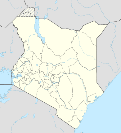 Msambweni Location of Msambweni | |
| Coordinates: 4°28′S 39°29′E / 4.47°S 39.48°ECoordinates: 4°28′S 39°29′E / 4.47°S 39.48°E | |
| Country |
|
| County | Kwale County |
| Population (2009) | |
| • Town and constituency | 288,393 (constituency) |
| • Metro | 11,985 |
| Time zone | EAT (UTC+3) |

Msambweni (meaning "land of Sable Antelope" in Swahili[1][2]) is a small fishing town and constituency in Kwale County of southeastern Kenya, formerly in Kwale District of Coast Province. By road, Msambweni is 55.4 kilometres (34.4 mi) south of Mombasa and 46.5 kilometres (28.9 mi) northeast of Lunga Lunga on the Tanzanian border. As of 2009, the town had a population of 11,985 people.[3]
Fishing is the primary source of income, although coconut palm, buxa coloring,[4][upper-alpha 1] cashew nuts and fruits are produced for trade. Because of its reef and extensive beaches, the snorkeling industry is gaining in popularity in Msambweni, and holiday cottages and hotels have sprung up in the area, such as the Msambweni Beach House. The town is noted for its leprosarium and contains the Msambweni District Hospital. The Koromojo Dam is immediately north of the town.
Geography
By road, Msambweni is 55.4 kilometres (34.4 mi) south of Mombasa, 46.9 kilometres (29.1 mi) southeast of Kwale, and 46.5 kilometres (28.9 mi) northeast of Lunga Lunga on the Tanzanian border.[5] It lies along the A14 road (Ukunda-Ramisi Road) between the villages of Ukunda and Shimoni.[2][5]
Msambweni forms a constituency[6] that starts from the Mwachema River at the border of Tiwi and Diani Beach to the north, and down to Vanga at the border of Kenya and Tanzania to the south.
The area's scenery is characterized by its beaches, rocky outcrops and low cliff tops and is relatively unspoiled.[7][8] At one end of the beach is a "rocky headland of fossilized coral, which is a jumble of cracks, caves and chimneys that make an ideal roost for bats" and there are baobab trees in the vicinity.[9] There is a reef channel at Msambweni and aquifer which is about 25 kilometres (16 mi) south of the Tiwi aquifer.[10] The reef, which stretches from Msambweni to Malindi in the north, is the world's largest continuous fringing reef.[11] At the northern end of Msambweni Bay is Chale Island, a headland rather than an island, which is known as a sacred kaya (worshipping place).[12] Many of the locals are superstitious and believe in witchcraft and spirits (jinis).[13]
Bedrock in the area was likely formed by Mazeras Sandstones.[10] Msambweni has an average rainfall of 55.18 inches a year.[14]
Politics
Msambweni Central forms a constituency with an elected Member of Parliament. As of 2001 the Msambweni Constituency had an area of 3,267 square kilometres (1,261 sq mi) with a population of 211,011 people.[15] By 2009 it had a population of 288,393 people.[16] Kassim Mwamzandi was MP from 1988-1997.[17][18] As of 2010, Robert Challo was MP for Msambweni Central and Minister for Agriculture.[19]
Economy
Msambweni grew from a small village into a bustling little town.[20] Fishing is important to the local community of Msambweni and is the primary source of income.[4] The area is mainly Muslim and inhabited by Digo peoples.[4][21] The Kwake District Development Plan 2002-2008 attempted to improve fish landing sites and beach access for fisherman on the coast of Msambweni.[22] Coconut palm is grown,[14] as are cashew nuts, fruits and buxa coloring.[4][23] Maize, cassava, cowpeas and rice are grown for domestic consumption.[4] There are numerous stalls along the main road in the town selling fruit and vegetables. Silica sand is mined at Msambweni and transported to Nairobi to make bottle glass.[24] Beekeeping and seaweed farming are also local occupation and its commercialization in the area has been supported by ACT! Kenya with financial assistance from the European Union.[25]
A result of its reef, the tourist industry is taking off in Msambweni attracting snorkelers. Holiday cottages and hotels have sprung up.[2][12] Club Green Oasis caters mainly to German tourists.[2] Although supplied with electricity, in the 1990s the government expressed concerns about access to an ample clean water supply in the division.[26]
Landmarks

Msambweni is noted for its leprosarium,[27] and contains the Msambweni District Hospital, which is reportedly one of the best hospitals on the coast,[28][29] and Kari Medical Clinic, Vingujini Primary School, and Msambweni Secondary School.[5] The Msambweni Campus of Kenya Medical Training College (KMTC), formerly the Matuga Medical Training College in Matuga, is located next to the hospital. It was established in 1977 and shifted location to Msambweni in August 2006.[30] It trains pupils in the Environmental Health Sciences, and since 2005 they have offered a three-year pre-service diploma course.
On a 40 feet (12 m) clifftop is the Msambweni Beach House, set in 28 acres with a 700 feet (210 m) stretch of private beach.[1] Although predominantly Muslim, the town has an interdenominational church.[31] Immediately to the north of Msambweni is the Koromojo Dam.[32] and between Msambweni and Kwale is the Shimba Hills National Reserve. There is a marine reserve at Shimoni beyond Funzi Island to the south.[33]
References
Footnotes
- ↑ See Bixa orellana
Endnotes
- 1 2 "About us". Msambweni-beach-house.com. Retrieved 10 December 2013.
- 1 2 3 4 Koornhof, Anton (1 March 1997). The Dive Sites of Kenya and Tanzania: Including Pemba, Zanzibar and Mafia. Lincolnwood, Illinois: Passport Books. pp. 73, 82–3. ISBN 978-0-8442-4861-5.
- ↑ "Kenya cities". Citypopulation.de. Retrieved 12 December 2013.
- 1 2 3 4 5 Hambly, Helen; Angura, Tobias Onweng (1996). Grassroots Indicators for Desertification: Experience and Perspectives from Eastern and Southern Africa. Ottawa Ontario: IDRC. p. 86. ISBN 978-0-88936-794-4.
- 1 2 3 Google (10 December 2013). "Msambweni" (Map). Google Maps. Google. Retrieved 10 December 2013.
- ↑ Kenya Gazette. 4 August 2006. p. 1745.
- ↑ Glenday, Bridget; Southwick, Susan; Westley, Joan (1 December 1994). Fielding's Kenya: guide to Kenya's best hotels, lodges & homestays. Redondo, Beach, California: Fielding Worldwide, Inc. p. 252. ISBN 978-1-56952-038-3.
- ↑ "Msambweni". Kenya-coast.com. Retrieved 15 December 2013.
- ↑ Watson, Rupert (2007). The African Baobab. Cape Town London: Struik New Holland distributor. p. 55. ISBN 978-1-77007-430-9.
- 1 2 Paron, Paolo; Olago, Daniel O.; Omuto., Christian T. (22 October 2013). Kenya: A Natural Outlook:geo-environmental resources and hazards. Burlington: Elsevier Science/Newnes. p. 95. ISBN 978-0-444-59547-8.
- ↑ McClanahan, T. R.; Young, T. P. (1996). East African Ecosystems and Their Conservation. New York: Oxford University Press. p. 70. ISBN 978-0-19-510817-0.
- 1 2 Hartley, Jean (2005). This is Kenya. London: New Holland/Struik. pp. 15–. ISBN 978-1-84537-151-7.
- ↑ "Cultural practices that hinder Children's Rights among the Digo community - Msambweni District, Kwale County - Kenya". Save the Children. 22 July 2013. Retrieved 10 December 2013.
- 1 2 Haynes, W. S. (1951). Tuberculosis in Kenya. Government Printer, South Africa. p. 49.
- ↑ "Kwale District Strategic Plan 2005-2010" (PDF). National Coordinating Agency for Population and Development. Retrieved 10 December 2013.
- ↑ "Constituency Density 2009". Government of Kenya. Retrieved 10 December 2013.
- ↑ The Weekly Review. Stellascope Limited. January 1988. p. 11.
- ↑ Hiltermann, Joost R.; Hogendoorn, Ernst Jan (2002). Playing with Fire: Weapons Proliferation, Political Violence, and Human Rights in Kenya. Human Rights Watch. p. 28.
- ↑ Ochola, Philip A. (13 August 2010). Absolutely Powerful!. Xlibris Corporation. p. 382. ISBN 978-1-4535-2572-2.
- ↑ Chess, Stella; Thomas, Alexander; Carey, William B.; McDevit, Sean C. (1994). Prevention and early intervention: individual differences as risk factors for the mental health of children : a festschrift for Stella Chess and Alexander Thomas. New York : Brunner/Mazel. p. 136. ISBN 978-1-134-85834-7.
- ↑ Pawlick, Thomas (1 January 2002). The Baringo Kid: Confrontations with Africa. Lanham, Maryland: University Press of America. p. 123. ISBN 978-0-7618-2225-7.
- ↑ Planning, Kenya. Ministry of Finance and (2002). District Development Plan, 2002-2008: Kwale. Republic of Kenya, Ministry of Finance and Planning.
- ↑ Mollison, Simon (1971). Kenya's Coast. East African. p. 121.
- ↑ Schlèuter, Thomas; Schlüter, Thomas (19 April 2008). Geological Atlas of Africa: With Notes on Stratigraphy, Tectonics, Economic Geology, Geohazards, Geosites and Geoscientific Education of Each Country. Berlin London: Springer. p. 137. ISBN 978-3-540-76373-4.
- ↑ "Act! Kenya : Commercialization of Seaweed Farming and Beekeeping in Msambweni". Mombasa, Kenya: Kwetukenya.org Kwetu Training Centre For Sustainable Development. Retrieved 10 December 2013.
- ↑ Development, Kenya. Office of the Vice-President and Ministry of Planning and National (1994). District Development Plan, 1994-1996: Kwale. Republic of Kenya, Office of the Vice-President and Ministry of Planning and National Development. p. 29.
- ↑ Trillo, Richard (2002). Kenya. London: Rough Guides. p. 512. ISBN 978-1-85828-859-8.
- ↑ Kenya National Assembly Official Record (Hansard) (in Swahili). 5 July 1994. p. 347.
- ↑ Hodd, Michael; Ballard, Sebastian (1994). East African handbook, 1995: with Mauritius, Madagascar and Seychelles. Lincolnwood (Chicago), IL. USA Bath, England: Trade & Travel Publications. p. 122. ISBN 978-0-8442-8983-0.
- ↑ "Msambweni". Kenya Medical Training College. Retrieved 10 December 2013.
- ↑ The interface between research and dialogue: Christian-Muslim relations in Africa. Adjunct proceedings of the XVIIIth quinquennial congress of the International Association for the History of Religions. Durban, South Africa. Münster: LIT Verlag Münster (published 2004). 5–11 August 2000. p. 41. ISBN 978-3-8258-6669-3.
- ↑ Kenya National Assembly Official Record (Hansard) (in Swahili). 5 December 2001. p. 8.
- ↑ Marsh, H. Dugong (1 January 2002). Dugong: Status Report and Action Plans for Countries and TerritoriesNairobi, Kenya: United Nations Environment Programme, 2002. UNEP/Earthprint. p. 19. ISBN 978-92-807-2130-0.