Mukō
| Mukō 向日市 | ||
|---|---|---|
| City | ||
| ||
 Location of Mukō in Kyoto Prefecture | ||
 Mukō Location in Japan | ||
| Coordinates: 34°57′N 135°42′E / 34.950°N 135.700°ECoordinates: 34°57′N 135°42′E / 34.950°N 135.700°E | ||
| Country | Japan | |
| Region | Kansai | |
| Prefecture | Kyoto Prefecture | |
| Government | ||
| • Mayor | Kushima Tsutomu | |
| Area | ||
| • Total | 7.67 km2 (2.96 sq mi) | |
| Population (2014) | ||
| • Total | 53,587[1] | |
| Symbols | ||
| • Tree | Sakura, Bamboo[1] | |
| • Flower | Sunflower, Azalea[1] | |
| Time zone | Japan Standard Time (UTC+9) | |
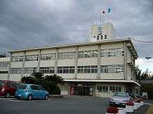
| City hall address |
20,Nakano,Terada-cho,Muko-shi,Kyoto-fu 617-0002 | |
| Website |
www | |

Mukō (向日市 Mukō-shi) is a city in Kyoto Prefecture, Japan, which served as the capital city of Japan (Nagaoka-kyō) for a decade from 784 to 794. Its neighbor cities are Kyoto and Nagaokakyō. As of 2014, the city has an estimated population of 53,587 and a population density of 6,986.57 persons per km². The total area is 7.67 km²(2.96 sq mi). According to the provisional results of the 2010 national census of Japan, the population of Muko is 54,328; of which male and female are 26,159 and 28,169 respectively.[2]
History
Classical Mukō
At the end of the 8th century, Emperor Kammu moved his capital from Nara to Nagaokakyō. The new capital encompassed a large part of modern Muko, where modern research has revealed the palace to have been located. In the south, it also included parts of Nagaokakyō. In 794, because of the location's moist temperature and reputation as a breeding ground for disease, Kammu relocated his capital from Nagaoka to Heian, now known as Kyoto.[3]
Medieval Mukō
Muko town was established in 1592, during Azuchi–Momoyama period. The town main main road, called Saigoku Kaido, flourished because it connected Tō-ji in Kyoto and Nishinomiya Shrine in Settsu Province. Saigoku Kaido, which still presents a traditional and historical setting, changed name National Route 171 as important road.[3]
Modern Mukō
Mukōmachi Station opened on July 26, 1876. Higashi-Mukō Station and Nishi-Mukō Station opened on December 1, 1928. The Muko city was founded on October 1, 1972.[2]
Geography

Muko adjoins northern Nagaoka, is surrounded by Kyoto on other three sides.There are bamboo groves are found on the hillside on the west of the city. Residential area for Kyoto and Osaka is expanded to the hill, encroachs on bamboo groves.
Demographics
| Historical population | ||
|---|---|---|
| Year | Pop. | ±% |
| 1886 | 3,528 | — |
| 1920 | 4,712 | +33.6% |
| 1925 | 5,188 | +10.1% |
| 1930 | 5,959 | +14.9% |
| 1940 | 8,072 | +35.5% |
| 1950 | 9,243 | +14.5% |
| 1960 | 12,734 | +37.8% |
| 1970 | 36,988 | +190.5% |
| 1980 | 50,604 | +36.8% |
| 1990 | 52,928 | +4.6% |
| 2000 | 53,425 | +0.9% |
| 2010 | 54,328 | +1.7% |
| 2014 | 53,587 | −1.4% |
| * = population estimate.[1][4] | ||
Muko is a residential district that has developed since the 1970s. Accordingly, its population suddenly increased.
Politics and government
Mukō is governed by the mayor Tsutomu Kushima, an independent. The city assembly has 24 members. In 2007 the Japanese Communist Party had a strong presence in local politics with eight members in the assembly.
- Elections
Sister cities
Mukō has been a sister city to Saratoga, California, United States since 1983.[5]
Facilities
Mukomachi Saty Center Mukomachi Saty is a six-level shopping center with car parking located approximately 170 metres (a three-minute walk) from Higashi Muko station on Hankyu Kyoto line and 630 metres (an eight-minute walk) from JR Mukomachi station. There is an Aeon Department Store, a Japanese restaurant and a casual dining area. A specialty tea stand on the first floor sells a variety of tea from around Japan.
References
- 1 2 3 4 向日市の概要 (in Japanese). Muko city. Retrieved 27 August 2014.
- 1 2 向日市:統計情報:国勢調査人口(確定値) (in Japanese). Muko city. Retrieved 27 August 2014.
- 1 2 "Muko-city:Muko-city Home Page". Muko city. Retrieved 27 August 2014.
- ↑ "人口推移及び世帯数の推移(Historical populations)" (in Japanese). Muko City. Retrieved 27 August 2014.
- ↑ "Saratoga and Muko, Japan, celebrate 30 years as sister cities". mercurynews. Retrieved 27 August 2014.
External links
 Media related to Mukō, Kyoto at Wikimedia Commons
- Mukō City official website (Japanese)
| Wards of Kyoto | ||
|---|---|---|
| Cities | ||
| Funai District | ||
| Kuse District | ||
| Otokuni District | ||
| Sōraku District | ||
| Tsuzuki District | ||
| Yosa District | ||