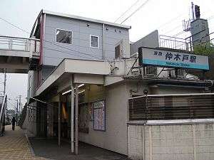
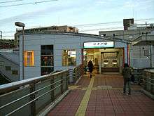
Nakakido Station
Nakakido Station 仲木戸駅 | |
|---|---|
 Nakakido Station | |
| Location |
Higashi-Kanagawa 1-chome, Kanagawa-ku, Yokohama, Kanagawa (神奈川県横浜市神奈川区東神奈川1丁目) Japan |
| Operated by | Keikyū |
| Line(s) | Keikyū Main Line |
| Connections |
|
| Other information | |
| Station code | KK35 |
| History | |
| Opened | 1905 |
| Traffic | |
| Passengers (2008) | 15,457 daily |
Nakakido Station (仲木戸駅 Nakakido-eki) is a railway station operated by the Keikyū Keikyū Main Line located in Kanagawa-ku, Yokohama, Kanagawa Prefecture, Japan. It is located 20.5 rail kilometers from the northern terminus of the Keikyū Main Line at Shinagawa Station, in Tokyo.

History
Nakakido Station opened on December 24, 1905 as Nakakido Station (中木戸駅 Nakakido-eki). It was renamed to its present kanji spelling at some point between 1915 and 1921. The station was rebuilt as an elevated station in August 1910, but was destroyed in the Yokohama air raid on May 29, 1945 and again by a fire in July 1957. The platforms were lengthened in 1971, and a pedestrian walkway was added in 2004.
Lines
Station layout
| 1 | ■ Keikyū Main Line | for Yokohama, Shin-Zushi, Uraga, Misakiguchi |
| 2 | ■ Keikyū Main Line | for Keikyū Kamata, Haneda Airport, Shinagawa, Sengakuji, Oshiage |
Nakakido Station is an elevated station with two opposed side platforms serving two tracks. The tracks are on an embankment, with the station building underneath.
Adjacent stations
| « | Service | » | ||
|---|---|---|---|---|
| Keikyū Main Line | ||||
| Kanagawa-Shinmachi | Local | Kanagawa | ||
| Kanagawa-Shinmachi | Airport Express | Yokohama | ||
| Ltd. Express: Does not stop at this station | ||||
| Rapid Ltd. Express: Does not stop at this station | ||||
| "Keikyu Wing": Does not stop at this station | ||||
Surrounding area
- Higashi-Kanagawa Station (connected by a pedestrian deck)
References
- Miura, Kazuo. Keikyū Kakuekiteisha to Kamakura Monogatari. Inban Publishing (1998). ISBN 4-8083-0624-7 (Japanese)
External links
- Keikyu Nakakido Station (Japanese)
| Wikimedia Commons has media related to Nakakido Station. |
Coordinates: 35°28′39″N 139°38′05″E / 35.4776°N 139.6346°E