Namling
| Namling | |
|---|---|
| Town | |
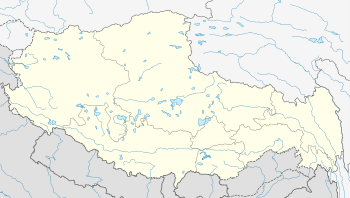 Namling Location within Tibet | |
| Coordinates: 29°40′57″N 89°5′50″E / 29.68250°N 89.09722°ECoordinates: 29°40′57″N 89°5′50″E / 29.68250°N 89.09722°E | |
| Country | China |
| Region | Tibet |
| Prefecture | Shigatse |
| County | Namling |
| Population | |
| • Major Nationalities | Tibetan |
| • Regional dialect | Tibetan language |
| Time zone | China Standard (UTC+8) |
Namling or Namlingxoi (Chinese: 南木林) is a town and seat of Namling County in the Tibet Autonomous Region of China, about 72 kilometres (45 mi) by road northeast of Shigatse (the second largest town in Tibet), north of Dobjoi.
Geography
It lies at an altitude of 4683 metres (15,367 feet), at a bend in the Tsangpo River.[1] The township of Namling covers an area of 391 square kilometres (151 sq mi) and has a population of about 7000 people.[2] Several strong forts are seen along the hills ranges of the river valley and one such fort is the Namling Dzong.[1] Vegetation in the area is sparse today, almost devoid of any vegetation looks like a desert country. However, ashes and fossils (assessed to be of 15 million years age) unearthed here reveal that leaves, willows, alders, maples, rhododendrons and conifers existed here.[3] The village is situated on a cone-shaped hill.[4]
Education
Namling has developed in recent times into a regional educational centre, overlooked by the Bureau of Education.[5] In 1993, the Namling County Schools Project received funding from the USA-based Boulder-Lhasa Sister City Project. The schools of this project achieved the best results in 1994, in Tibet.[6]
Notable landmarks
Namling Dzong is a prominent fortress in the area, which has been likened to European castles along the Rhine.[1] In the early 17th century, the 5th Dalai Lama founded the Ganden Chökhor monastery in Namling, reached via a chain bridge; it was the first of thirteen monasteries of his era.[7] There were 300 monks at the monastery in 1908.[4] It was the seat of the Teshu Lamas.[8]
Villages
The township contains the following villages:[2]
- Ren′ou Village (仁欧村)
- Xuedui Village (雪堆村)
- Gangba Village (岗巴村)
- Qiawa Village (恰娃村)
- Gangga Village (岗嘎村)
- Xuemai Village (雪麦村)
- Gabu Village (嘎布村)
- Kong′a Village (孔阿村)
- Miru Village (米如村)
- Baimadang Village (白玛当村)
- Jilong Village (吉龙村)
- Dalong Village (达龙村)
References
- 1 2 3 Lesdain, Count De (1 January 1996). From Pekin to Sikkim: Through the Ordos, the Gobi Desert and Tibet. Asian Educational Services. p. 294. ISBN 978-81-206-1046-0. Retrieved 26 January 2013.
- 1 2 "Namling". Cfguide.com. Retrieved 26 January 2013.
- ↑ Searle, Mike (March 2013). Colliding Continents: A geological exploration of the Himalaya, Karakoram, and Tibet. Oxford University Press. p. 297. ISBN 978-0-19-965300-3. Retrieved 26 January 2013.
- 1 2 Scottish Geographical Magazine (Public domain ed.). Royal Scottish Geographical Society. 1908. pp. 150–. Retrieved 26 January 2013.
- ↑ 周爱明 (2004). 西藏教育/英文版/中国西藏基本情况丛书/Tibetan education: 英文版. 五洲传播出版社. p. 104. ISBN 978-7-5085-0570-1. Retrieved 26 January 2013.
- ↑ Bass, Catriona (1998). Education in Tibet: Policy and Practice Since 1950. Zed Books. p. 129. ISBN 978-1-85649-674-2. Retrieved 26 January 2013.
- ↑ Hale, Thomas (January 2000). A Light Shines in Central Asia: A Journey Into the Tibetan Buddhist World. William Carey Library. pp. 51–. ISBN 978-0-87808-350-3. Retrieved 26 January 2013.
- ↑ Holdich, Thomas Hungerford (1 December 1996). Tibet the Mysterious. Asian Educational Services. p. 97. ISBN 978-81-206-1146-7. Retrieved 26 January 2013.
| County-level divisions |  | |||||||
|---|---|---|---|---|---|---|---|---|
| Settlements | ||||||||
| Landmarks | ||||||||
| Geography | ||||||||
| Transport |
| |||||||