Zhongba County
| Zhongba County 仲巴县 • འབྲོང་པ་རྫོང་། | |
|---|---|
| County | |
 | |
.png) Location of Zhongba County within Tibet | |
| Coordinates: 29°46′12″N 84°01′53″E / 29.77000°N 84.03139°ECoordinates: 29°46′12″N 84°01′53″E / 29.77000°N 84.03139°E | |
| Country | China |
| Province | Tibet |
| Prefecture-level city | Xigazê |
| Capital | Labrang |
| Time zone | China Standard (UTC+8) |
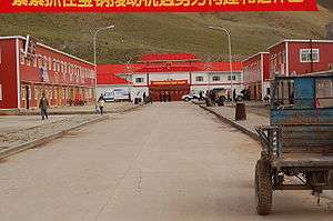
Zhongba County (Tibetan: འབྲོང་པ་རྫོང༌།, ZYPY: Zhongba Zong ; Chinese: 仲巴县; pinyin: Zhōngbā Xiàn; literally: "Place of Gaur") is a county of Xigazê Prefecture in China's Tibet Autonomous Region. Located in western Tibet, it is the largest county in the prefecture.
Zhongba County has a population of approximately 18,000 and covers 43,594 square kilometers. It is prone to earthquakes and suffered a large one, 6.8 on the Richter scale, on 30 August 2008. Although the temblor left a 10 km north-south crack at the epicenter located at 31° north and 83.6° east, and houses were damaged and roads blocked by falling rocks, there were no reported injuries. [1] The county is dotted with lakes such as Taruo Lake, Ang Laren Lake and Renqingxiubu Lake.
Borders
Zhongba County shares the Tibet Autonomous Region's southern border with most of western Nepal's Karnali and Dhaulagiri Zones with a border crossing into Mustang District leading through the former Lo Kingdom to its historic capital Lo Manthang.
Town and townships
- Baryang Township (བར་ཡངས་, 帕羊镇)
- Labrang Township (ལ་བྲང་, 拉让乡)
- Bodoi Township (སྤོ་སྟོད་, 布多乡)
- Gêla Township (སྐེད་ལ་, 吉拉乡)
- Gyêma Township (སྐྱེ་མ་, 吉玛乡)
- Horpa Township (ཧོར་པ་, 霍尔巴乡)
- Lunggar Township (ལུང་དཀར་, 隆嘎尔乡)
- Nagqu Township (ནག་ཆུ་, 纳久乡)
- Penchi Township (ཕན་ཕྱི་, 偏吉乡)
- Barma Township (བར་མ་, 帕玛乡)
- Qonkor Township (ཆོས་འཁོར་, 琼果乡)
- Rintor Township (རི་འཐོར་, 仁多乡)
- Yagra Township (ཡག་ར་, 亚热乡)
Transport
Footnotes
- ↑ http://news.xinhuanet.com/english/2008-08/30/content_9739195.htm "Strong Earthquake in Tibet leaves no casualties, but big crack."
| County-level divisions |  | |||||||
|---|---|---|---|---|---|---|---|---|
| Settlements | ||||||||
| Landmarks | ||||||||
| Geography | ||||||||
| Transport |
| |||||||