Shigatse Peace Airport
| Xigazê Peace Airport 日喀则和平机场 Rìkāzé Hépíng Jīchǎng | |||||||||||
|---|---|---|---|---|---|---|---|---|---|---|---|
| IATA: RKZ – ICAO: ZURK | |||||||||||
| Summary | |||||||||||
| Airport type | Military/Public | ||||||||||
| Location | Xigazê, Tibet, China | ||||||||||
| Elevation AMSL | 3,782 m / 12,408 ft | ||||||||||
| Coordinates | 29°21′06″N 89°18′25″E / 29.35167°N 89.30694°ECoordinates: 29°21′06″N 89°18′25″E / 29.35167°N 89.30694°E | ||||||||||
| Map | |||||||||||
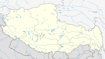
 RKZ Location of airport in Tibet | |||||||||||
| Runways | |||||||||||
| |||||||||||
|
Source:[1] | |||||||||||
| Xigazê Peace Airport | |||||||
| Simplified Chinese | 日喀则和平机场 | ||||||
|---|---|---|---|---|---|---|---|
| |||||||
Xigazê Peace Airport (IATA: RKZ, ICAO: ZURK), Xigazê Heping Airport, or Xigazê Air Base, is a dual-use military and civilian airport serving Xigazê, the second largest city in Tibet Autonomous Region, China. It is located in Jiangdang Township, 43 kilometers from Xigazê. Situated at an elevation of 3,782 metres (12,408 ft), it is one of the highest airports in the world.[2]
Construction of Xigazê Airport started in 1968 and was completed in 1973. It was solely for military use until 2010, when a 532 million yuan expansion was completed. On 30 October 2010, the airport was opened as the fifth civilian airport in Tibet.[2]
Facilities
The airport has a 5,000 meter runway with a 60-meter asphalt overrun at each end. It also features a 4,500 square-meter terminal building. It is projected to handle 230,000 passengers and 1,150 tons of cargo annually by 2020.[2][1]
Airlines and destinations
| Airlines | Destinations |
|---|---|
| Tibet Airlines | Chengdu |
See also
- List of airports in China
- List of the busiest airports in China
- List of People's Liberation Army Air Force airbases
References
- 1 2 Airport information for Shigatse Airport at Great Circle Mapper.
- 1 2 3 西藏第五个民用机场日喀则机场正式通航