National Highway 1 (India, old numbering)
| ||||
|---|---|---|---|---|
|
Road map of India with National Highway 1 highlighted in solid blue colour | ||||
| Route information | ||||
|
Part of | ||||
| Length: |
456 km (283 mi) NS: 380 km (240 mi) (New Delhi - Jalandhar) Phase III: 49 km (30 mi) | |||
| Major junctions | ||||
| South end: | Delhi | |||
|
NH 2 in Delhi | ||||
| North end: | Attari, Punjab | |||
| Location | ||||
| States: |
Delhi: 22 km (14 mi) Haryana: 180 km (110 mi) Punjab: 254 km (158 mi) | |||
| Primary destinations: | Delhi - Sonipat- Kurukshetra - Ambala - Jalandhar - Ludhiana - Phagwara - Amritsar - Indo-Pak Border | |||
| Highway system | ||||
| ||||

.png)
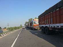
National Highway 1 or NH 1 is a National Highway in Northern India that links the national capital New Delhi to the town of Attari in Punjab near the India–Pakistan border. This was a part of the historical Grand Trunk Road, that ran from Bengal to Kabul, built on earlier roads that existed from time immemorial. The National Highways Authority of India (NHAI) divided it into two parts—called as NH 1 west of Delhi, and as NH 2 east of it. The highway is maintained by National Highways Authority of India.[1] This is one of the longest and oldest highways of India.
About The Road
The NH 1 passes through Amritsar, Jalandhar, Phagwara, Ludhiana, Rajpura, Ambala, Kurukshetra, Karnal, Panipat, Sonipat and Delhi. It runs for a distance of 456 km (283 mi). The Delhi–Lahore Bus travels on NH 1 in India. It does not have a uniform laning. From the Wagah Border (between India and Pakistan) through Amritsar up to Jalandhar it is 4-laned. From Jalandhar up to the border between Haryana's Sonipat and the national capital Delhi, it is 6-laned. Its entire stretch in Delhi is 8-laned. The NH 1 terminates into Delhi's arterial roads—the Outer Ring Road and Ring Road. The Outer Ring Road makes accessing the UP stretch of GT Road, through Ghaziabad, possible. Also, it would be connected to NH 8 through the Kundli-Manesar-Palwal corridor by the end of year 2017.
NH 1 in Punjab
The northernmost stretch of NH 1 falls in the Indian state of Punjab. It initiates at the Wagah Border between India and Pakistan, at the Attari village and runs 30 km down to the city of Amritsar. From there, it passes through the districts of Kapurthala, Jalandhar, Ludhiana, Sangrur and Patiala. The cities of Kapurthala, Sangrur and Patiala, however, do not fall along the NH 1. In Patiala district, the highway passes through the town of Rajpura, which has gained prominence due to its important location on the GT Road.
This stretch of NH 1 was witness to the mass-movement and selective massacre of refugees across what is today the border between India and Pakistan, during the Partition of India.
NH 1 in Haryana
The NH 1 enters Haryana at the Ambala district. Thereon, it passes southward through the districts of Kurukshetra, Karnal, Panipat and Sonipat. The city of Sonipat does not fall along the GT Road, while the city of Kurukshetra is marginally off it. In Ambala, it passes through one of Northern Railways' major railway junctions—the Ambala Cantonment, close to the Ambala City.
After Sonipat, the highway enters its last leg, into the national capital Delhi. The minor stretch of NH 1 in Sonipat district, leading up to the Delhi border, has been witnessing massive real-estate development along it.
NH 1 in Delhi
Delhi marks the last leg of the NH 1. It enters Delhi at the Singhu Border in the northern district and passes through all of North Delhi up to the ISBT Kashmiri Gate. There it merges into the Ring Road and proceeds beyond as NH 2, up to the Bangladesh border. In Delhi, the region through which the highway passes is the most underdeveloped and encroached district of the city, that is, North West Delhi. It is mostly industrial and ill-planned and full of slums. The Guru Tegh Bahadur Memorial falls along the NH 1 close to the Singhu Border, in Delhi.
Spur Routes of NH 1
NH 1 presently has 4 different spur routes designated as 1A, 1B, 1C and 1D. Except for 1A, all these spurs are entirely within the state of Jammu and Kashmir. These spurs are strategically important as they connect remote cities and towns in the Himalayas with the rest of India.
- NH 1A: Jalandhar - Madhopur - Jammu - Banihal - Srinagar - Baramula - Uri
- NH 1B: Batote - Doda - Kishtwar - Sinthan pass - Khanabal
- NH 1C: Domel - Katra
- NH 1D: Srinagar - Kargil - Leh, meets Leh-Manali Highway in Leh
National Highways Development Project
Approximately 380 km (240 mi) stretch of NH 1 from Jalandhar to Delhi is a part of the North-South Corridor.[2]
See also
| Wikimedia Commons has media related to NH 1 (India). |
References

Sonipat district topics | ||
|---|---|---|
| Cities and towns |  | |
| Education | ||
| Transport | ||
| Lok Sabha constituencies | ||