New Windsor, Maryland
| New Windsor, Maryland | |
|---|---|
| Town | |
|
Houses in New Windsor | |
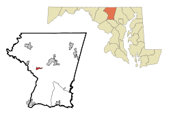 Location of New Windsor, Maryland | |
| Coordinates: 39°32′36″N 77°6′15″W / 39.54333°N 77.10417°WCoordinates: 39°32′36″N 77°6′15″W / 39.54333°N 77.10417°W | |
| Country | United States |
| State | Maryland |
| County | Carroll |
| Government | |
| • Mayor | Neal Roop |
| Area[1] | |
| • Total | 0.75 sq mi (1.94 km2) |
| • Land | 0.74 sq mi (1.92 km2) |
| • Water | 0.01 sq mi (0.03 km2) |
| Elevation | 499 ft (152 m) |
| Population (2010)[2] | |
| • Total | 1,396 |
| • Estimate (2012[3]) | 1,392 |
| • Density | 1,886.5/sq mi (728.4/km2) |
| Time zone | Eastern (EST) (UTC-5) |
| • Summer (DST) | EDT (UTC-4) |
| ZIP code | 21776 |
| Area code(s) | 410,443,667 |
| FIPS code | 24-55925 |
| GNIS feature ID | 0593887 |
| Website |
www |
.jpg)
New Windsor is a town in Carroll County, Maryland, United States. The population was 1,396 at the 2010 census.[4] It is located 6 miles (10 km) west of Westminster on Maryland Route 31.
History
New Windsor was laid out in 1797 and originally named Sulphur Springs. It was renamed in the early 19th century, possibly after its English namesake. Since 1942, it has been headquarters for the international missionary efforts of the Church of the Brethren. These efforts inspired the international focus of the Peace Corps, whose first director, Sargent Shriver, had roots in the area.[5] The town was considered an escape for the rich, and because of the Sulphur Springs, had a renowned spa by the water.
New Windsor was home to Calvert College from 1852-1873 and later to New Windsor College.
Much of the town was added to the National Register of Historic Places as the New Windsor Historic District in 1997.[6] Avalon, a historic home, was listed in 1987 and the Appler-Englar House in 2001.[6]
Geography
New Windsor is located at 39°32′36″N 77°6′15″W / 39.54333°N 77.10417°W (39.543451, -77.104065).[7]
According to the United States Census Bureau, the town has a total area of 0.75 square miles (1.94 km2), of which, 0.74 square miles (1.92 km2) is land and 0.01 square miles (0.03 km2) is water.[1]
Demographics
| Historical population | |||
|---|---|---|---|
| Census | Pop. | %± | |
| 1870 | 396 | — | |
| 1880 | 426 | 7.6% | |
| 1890 | 414 | −2.8% | |
| 1900 | 430 | 3.9% | |
| 1910 | 446 | 3.7% | |
| 1920 | 512 | 14.8% | |
| 1930 | 503 | −1.8% | |
| 1940 | 529 | 5.2% | |
| 1950 | 707 | 33.6% | |
| 1960 | 738 | 4.4% | |
| 1970 | 788 | 6.8% | |
| 1980 | 799 | 1.4% | |
| 1990 | 757 | −5.3% | |
| 2000 | 1,303 | 72.1% | |
| 2010 | 1,396 | 7.1% | |
| Est. 2015 | 1,400 | [8] | 0.3% |
The town is also the location of the New Windsor Conference Center, owned by the Church of the Brethren, along with a gift shop selling crafts made by the poor in developing nations.
2010 census
As of the census[2] of 2010, there were 1,396 people, 526 households, and 364 families residing in the town. The population density was 1,886.5 inhabitants per square mile (728.4/km2). There were 566 housing units at an average density of 764.9 per square mile (295.3/km2). The racial makeup of the town was 92.3% White, 3.9% African American, 0.1% Native American, 1.1% Asian, 0.4% Pacific Islander, 0.4% from other races, and 1.9% from two or more races. Hispanic or Latino of any race were 1.6% of the population.
There were 526 households of which 39.5% had children under the age of 18 living with them, 53.8% were married couples living together, 10.3% had a female householder with no husband present, 5.1% had a male householder with no wife present, and 30.8% were non-families. 26.4% of all households were made up of individuals and 12.2% had someone living alone who was 65 years of age or older. The average household size was 2.65 and the average family size was 3.24.
The median age in the town was 37.6 years. 27.9% of residents were under the age of 18; 8% were between the ages of 18 and 24; 27.5% were from 25 to 44; 24.9% were from 45 to 64; and 12% were 65 years of age or older. The gender makeup of the town was 47.6% male and 52.4% female.
2000 census
As of the census[10] of 2000, there were 1,303 people, 491 households, and 369 families residing in the town. The population density was 1,833.1 people per square mile (708.6/km²). There were 522 housing units at an average density of 734.4 per square mile (283.9/km²). The racial makeup of the town was 95.24% White, 3.84% African American, 0.08% Native American, 0.08% Asian, 0.08% from other races, and 0.69% from two or more races. Hispanic or Latino of any race were 0.92% of the population.
There were 491 households out of which 40.7% had children under the age of 18 living with them, 60.3% were married couples living together, 11.8% had a female householder with no husband present, and 24.8% were non-families. 22.2% of all households were made up of individuals and 9.6% had someone living alone who was 65 years of age or older. The average household size was 2.65 and the average family size was 3.11.
In the town the population was spread out with 30.4% under the age of 18, 6.1% from 18 to 24, 34.8% from 25 to 44, 16.0% from 45 to 64, and 12.7% who were 65 years of age or older. The median age was 33 years. For every 100 females there were 94.2 males. For every 100 females age 18 and over, there were 89.0 males.
The median income for a household in the town was $51,779, and the median income for a family was $55,972. Males had a median income of $40,403 versus $27,986 for females. The per capita income for the town was $20,090. About 3.3% of families and 2.7% of the population were below the poverty line, including 4.0% of those under age 18 and 3.7% of those age 65 or over.
References
- 1 2 "US Gazetteer files 2010". United States Census Bureau. Retrieved 2013-01-25.
- 1 2 "American FactFinder". United States Census Bureau. Retrieved 2013-01-25.
- ↑ "Population Estimates". United States Census Bureau. Retrieved 2013-06-26.
- ↑ "Profile of General Population and Housing Characteristics: 2010 Demographic Profile Data (DP-1): New Windsor town, Maryland". U.S. Census Bureau, American Factfinder. Retrieved August 6, 2012.
- ↑ Arnett, Earl, Brugger, Robert J., and Edward C. Papenfuse. Maryland: A New Guide to the Old Line State (2nd ed.) The Johns Hopkins University Press, Baltimore, 1999, p. 494.
- 1 2 National Park Service (2008-04-15). "National Register Information System". National Register of Historic Places. National Park Service.
- ↑ "US Gazetteer files: 2010, 2000, and 1990". United States Census Bureau. 2011-02-12. Retrieved 2011-04-23.
- ↑ "Annual Estimates of the Resident Population for Incorporated Places: April 1, 2010 to July 1, 2015". Retrieved July 2, 2016.
- ↑ "Census of Population and Housing". Census.gov. Retrieved June 4, 2015.
- ↑ "American FactFinder". United States Census Bureau. Retrieved 2008-01-31.
External links
Municipalities and communities of Carroll County, Maryland, United States | ||
|---|---|---|
| Cities | 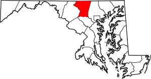 | |
| Towns | ||
| CDP | ||
| Other communities |
| |
| Footnotes | ‡This populated place also has portions in an adjacent county | |