North Beer
| North Beer | |
 North Beer from South Beer |
|
 North Beer |
|
| OS grid reference | SX307919 |
|---|---|
| Civil parish | Boyton |
| Unitary authority | Cornwall |
| Ceremonial county | Cornwall |
| Region | South West |
| Country | England |
| Sovereign state | United Kingdom |
| EU Parliament | South West England |
Coordinates: 50°42′07″N 4°24′00″W / 50.702°N 4.40°W
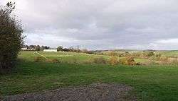
North Beer is a hamlet in the parish of Boyton in north Cornwall, England.[1] North Beer is west of Boyton.[2]
References
Cornwall Portal | |
| Unitary authorities | |
| Major settlements |
|
| Rivers | |
| Topics | |
This article is issued from Wikipedia - version of the 2/11/2016. The text is available under the Creative Commons Attribution/Share Alike but additional terms may apply for the media files.