Obara, Aichi
| Obara 小原村 | |
|---|---|
| Former municipality | |
 Location of Obara in Aichi Prefecture | |
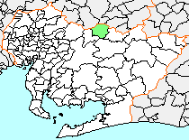
 Obara Location in Japan | |
| Coordinates: 35°13′46.5″N 137°17′6.3″E / 35.229583°N 137.285083°ECoordinates: 35°13′46.5″N 137°17′6.3″E / 35.229583°N 137.285083°E | |
| Country | Japan |
| Region | Chūbu (Tōkai) |
| Prefecture | Aichi Prefecture |
| District | Nishikamo |
| Merged |
April 1, 2005 (now part of Toyota) |
| Area | |
| • Total | 74.54 km2 (28.78 sq mi) |
| Population (December 1, 2004) | |
| • Total | 4,353 |
| • Density | 58.4/km2 (151/sq mi) |
| Symbols | |
| • Tree | Prunus serrulata |
| • Flower | Lilium japonicum |
| • Bird | Japanese bush-warbler |
| Time zone | Japan Standard Time (UTC+9) |
Obara (小原村 Obara-mura) was a village located in Nishikamo District, north-central Aichi Prefecture, Japan.
As of December 1, 2004, the village had an estimated population of 4,353 and a population density of 58.4 persons per km2. Its total area was 74.54 km2. Obara was well known as the home of traditional Japanese "Washi" mulberry paper.
Obara Village was created on July 1, 1906 through the merger of the hamlets of Kiyohara, Honjo, Fukuhara and Toyohara. On July 13, 1972, the village was partly destroyed by landslides following heavy rains, with the loss of 32 lives.
On April 1, 2005, Obara, along with the town of Fujioka (also from Nishikamo District), the towns of Asuke, Asahi and Inabu, and the village of Shimoyama (all from Higashikamo District), was merged into the expanded city of Toyota, and has ceased to exist as an independent municipality.