Obed River
| Obed River | |
| River | |
 Obed River | |
| Country | United States |
|---|---|
| State | Tennessee |
| Tributaries | |
| - right | Little Obed River |
| Source | southwest of Crossville in Cumberland County, Tennessee |
| - elevation | 1,860 ft (567 m) [1] |
| - coordinates | 35°55′07″N 85°06′46″W / 35.91861°N 85.11278°W [1] |
| Mouth | Emory River, southwest of Wartburg in Morgan County, Tennessee |
| - elevation | 846 ft (258 m) [1] |
| - coordinates | 36°04′31″N 84°38′58″W / 36.07528°N 84.64944°WCoordinates: 36°04′31″N 84°38′58″W / 36.07528°N 84.64944°W [1] |
| Length | 45 mi (72 km) [2] |
| Basin | 520 sq mi (1,347 km2) [3] |
| Discharge | for Alley Ford, 1.5 miles (2.4 km) above the mouth |
| - average | 1,062 cu ft/s (30 m3/s) (mean for water years 1957-1968, 1974-1983)[4] |
| - max | 105,000 cu ft/s (2,973 m3/s) May 1973[4] |
| - min | .4 cu ft/s (0.0 m3/s) October 1963[4] |
 The Emory/Obed drainage basin | |
| Website: Obed Wild and Scenic River | |
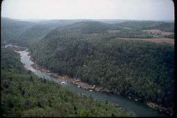
Obed River is a stream draining a part of the Cumberland Plateau in Tennessee. It, and particularly its tributaries, are important streams for whitewater enthusiasts.
The Obed River rises in Cumberland County, Tennessee, just south of Crossville. It is bridged by U.S. Highway 70 between downtown Crossville and the municipal airport, and meets its confluence with the Little Obed River near a bridge on U.S. Highway 70N and an abandoned railroad bridge which was formerly part of the rail system linking Nashville and Knoxville. Shortly thereafter, it is bridged by U.S. Highway 127 and Interstate 40. Except during periods of very high flow, the stream is scarcely visible from these bridges because of the depth of its gorge.
Obed Wild and Scenic River
From there the stream enters a rather remote area. After several miles it is bridged by State Route 298 (Genesis Road). From this point to its mouth it is designated as a National Wild and Scenic River along with Clear Creek and Daddys Creek.[5] Maintained by the National Park Service.
The direction of flow changes gradually from largely south to north to largely west to east. Shortly after crossing into Morgan County it receives the flow of Daddys Creek, which is a good whitewater rafting stream. Downstream from this is the mouth of Clear Creek. This stream is also part of the Obed River "Wild and Scenic" designation; like Daddys Creek, it too is a premiere whitewater stream during periods of high flow.
Amenities
The National Park Service maintains a visitor center located at 208 North Maiden Street in Wartburg. They also maintain the Rock Creek Campground and the Nemo Picnic Area.
Emory River confluence
Several miles below the mouth of Clear Creek is the confluence with the Emory River. Although the Obed River is the larger of the two, the river takes the name of the Emory River below the confluence.
See also
References
- 1 2 3 4 U.S. Geological Survey Geographic Names Information System: Obed River
- ↑ Obed Wild and Scenic River, U.S. National Park Service website. Accessed: 6 June 2015.
- ↑ Rodney Knight, William Wolfe, George Law, "Hydrologic Data for the Obed River Watershed, Tennessee, 2014, p. 1. U.S. Geological Survey website. Accessed: 6 June 2015.
- 1 2 3 United States Geological Survey, Water Resources Data Tennessee: Water Year 1983, Water Data Report TN-83-1, p. 141. Gaging station 03539800.
- ↑ "Obed River". National Wild and Scenic Rivers. Retrieved July 11, 2011.
External links
| Wikimedia Commons has media related to Obed River. |
- Obed Wild and Scenic River
- Obed Watershed Community Association
- Tennessee Scenic Rivers Association (TSRA)