Big South Fork National River and Recreation Area
| Big South Fork National River and Recreation Area | |
|---|---|
|
IUCN category V (protected landscape/seascape) | |
 | |
| Location | Tennessee & Kentucky, United States |
| Nearest city | Oneida, Tennessee, and Whitley City, Kentucky |
| Coordinates | 36°29′11″N 84°41′55″W / 36.4865°N 84.6985°WCoordinates: 36°29′11″N 84°41′55″W / 36.4865°N 84.6985°W |
| Area | 125,310 acres (50,710 ha)[1] |
| Established | March 7, 1974 |
| Visitors | 600,161 (in 2012)[2] |
| Governing body | National Park Service |
| Website | Big South Fork National River and Recreation Area |
The Big South Fork National River and Recreation Area preserves the Big South Fork of the Cumberland River and its tributaries in northeastern Tennessee and southeastern Kentucky. In addition, the former mining community of Blue Heron is preserved and interpreted via signage.
The Big South Fork region contains one of the highest concentrations of natural bridges in the eastern United States and the area is located in parts of Scott, Fentress, Pickett, and Morgan counties in Tennessee, and McCreary County in Kentucky. Charit Creek Lodge is a wilderness lodge, accessible by trail, located within the park.[3]
Geology
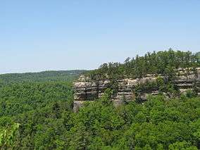
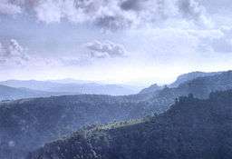
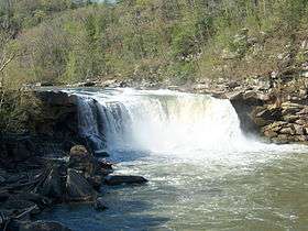
The Big South Fork's most prominent feature is the river gorge cutting through the softer Mississippian age rock beneath the hard Pennsylvanian capstone of the Cumberland Plateau. Water is the most influential agent of geologic change in the Big South Fork region. Over time water action has left many unique and amazing geologic features ranging from the river gorge with its magnificent bluffs to the natural arches and unusual hoodoos.[4]
Due to the substantial amount of annual rainfall of the region and the action of the Cumberland River and surrounding tributaries the water acts to erode the softer Mississippian rock composed of limestone, shale, and calcareous sandstone from beneath the much harder and erosion resistant capstone composed of Pennsylvanian sandstone. Flowing water hollows out the softer layers beneath and forms waterfalls and gorges. Where there is hard capstone intact, arches can form creating natural bridges across streams or a dry ravines. Direct erosion widens a joint and forms a cavity below the more resilient rock thus creating a void between the hard capstone and the area below. As result, water eroded arches are formed in the Big South Fork. Hoodoos are a rare but intriguing feature occurring in the Big South Fork. These hoodoos form in a similar manner to those found in the western United States. Where tough capstone still exists on the side of a hill for instance, it prevents the erosion of the softer material below. The result is a naturally formed erect columnar rock where once was located a hill.[5]
Sources
- ↑ "Listing of acreage as of December 31, 2011". Land Resource Division, National Park Service. Retrieved 2012-12-16.
- ↑ "NPS Annual Recreation Visits Report". National Park Service. Retrieved 2013-12-23.
- ↑ http://www.charitcreeklodge.com/
- ↑ Russ Manning. (1994). "Exploring the Big South Fork." Norris: Mountain Laural Place.
- ↑ Russ Manning. (1999). "The Historic Cumberland Plateau." Knoxville: The University of Tennessee Press.
Gallery
-

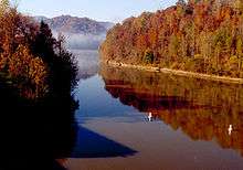
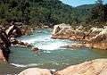
Big South Fork Cumberland River
-

Natural arch in the Big South Fork National River and Recreation Area
-
Big South Fork Cumberland River
-

Charit Creek Lodge
-
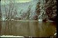
Big South Fork in winter
External links
| Wikivoyage has a travel guide for Big South Fork National River and Recreation Area. |
| Wikimedia Commons has media related to Big South Fork. |
- "Big South Fork NPS Site". National Park Service. Retrieved 2011-08-08.
- "Big South Fork Landforms". Tom Dunigan. Retrieved 2011-08-08.