Oddernes
| Oddernes Oddernes, Kristiansand | ||
|---|---|---|
| Borough of Kristiansand | ||
|
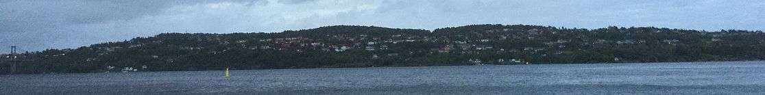
Varoddbrua form Vige to Søm | ||
| ||
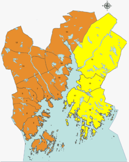 Location of Oddernes, shown in yellow, in Kristiansand | ||
| Country |
| |
| County |
| |
| City | Kristiansand | |
| Population (2015) | ||
| • Total | 19,800 | |
| ZIP Code prefix | 460*, 462*, 463*, 465*, 477*, 469* | |
| Website | kristiansand.kommune.no | |


Oddernes is a borough in Kristiansand. The borough covers eastern Kristiansand on the east side of Varoddbrua. It is also a former municipality in Vest-Agder county in Norway. It is located in the present-day municipality of Kristiansand. The former municipality of Oddernes encircled the city of Kristiansand, and it encompassed villages such as Flekkerøy, Vågsbygd, Slettheia, Lund, Strai, Mosby and Justvik.
Name
The municipality (originally the parish) is named after the old Oddernæs farm (Old Norse: Otruness). The first part of the name comes from its location along the Otra river, and nes means peninsula, so the peninsula along the Otra river.[1][2]
History
The parish of Oddernæs was established as a municipality on 1 January 1838 (see formannskapsdistrikt). According to the 1835 census, the municipality had a population of 2,373.[3] On 31 December 1893, the area of Randesund was separated from Oddernes to contstitute a municipality of its own. The split left Oddernes with 3,076 inhabitants.
On 1 July 1921, the area of Lund (population: 2,164) was moved from Oddernes to Kristiansand, constituting a new borough there. On 1 January 1965, the rest of Oddernes was incorporated into Kristiansand, along with the neighboring municipalities of Randesund and Tveit. Prior to the merger, Oddernes had a population of 18,668.[4]
Population and demographic
| Nr | District | Population [5] |
|---|---|---|
| 1 | Søm | 10,950 |
| 2 | Hånes | 4,200 |
| 3 | Randesund | 2,900 |
| 4 | Tveit | 1,880 |
Neighborhoods in Oddernes:
- Bliksheia
- Bjørndalen
- Boen
- Brattbakken
- Brattvollsheia
- Butangen
- Drangsholt
- Dvergsnes
- Dønnestad
- Einerhaven
- Eplehagen
- Fidje
- Fidjeåsen
- Foss
- Frikstad
- Fuglevika
- Fuglevikkleiva
- Grovikheia
- Gudbrandslia
- Hamre
- Hamreheia
- Hamresanden
- Haumyrheia
- Holte
- Hånestangen
- Hånni
- Kantarellåsen
- Knarrevik
- Kjelleviktoppen
- Kjevik
- Korsvik
- Kråkebumoen
- Lauvåsen
- Liane
- Moneheia
- Nedre Hånes
- Nordlia
- Odderhei
- Rona
- Ronatoppen
- Ronsbukta
- Ryen
- Rønnemoen
- Saltbustad
- Småslettene
- Solsletta
- Strømme
- Strømsdalen
- Sømskleiva
- Sømslia
- Timenes
- Timenessletta
- Topdalen
- Torsvikkleiva
- Tømmerstø
- Vardåsen
- Ve
- Vrånes
- Vigvoll
- Vigvollåsen
Photos
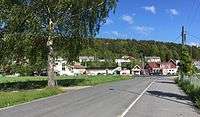 Hamre
Hamre Holte
Holte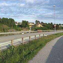 Holte
Holte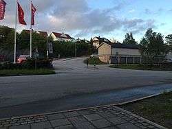 Hånni
Hånni Lauvåsen
 Nordlia
 Rabbesvik
 Ryen
Ryen Solsletta
 Småslettene
 Strømsdalen
 Ve
Ve Vigvollåsen
 Nordlia
 Torsvik
 Torsvikkleiva
 Rødhettes vei
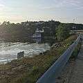 Fidjekilen
 Tømmerstø with Dreggveien
 Odderhei
 Odderhei Terrasse
Education

| Name | Location | Type [6] |
|---|---|---|
| Dvergsnes skole | Dvergsnes | Elementary school |
| Haumyrheia skole | Søm | Junior High |
| Heståsen skole | Hånes | Elementary |
| Holte skole | Tømmerstø | Elementary |
| Hånes skole | Hånes | Elementary |
| Kringsjå skole | Randesund | Elementary |
| Strømme skole | Strømme | Elementary |
| Sørlandet Maritime videregående | Tømmerstø | High School |
| Vardåsen skole | Søm | Elementary |
| Ve skole | Tveit | Elementary and Junior High |
| Vigvoll skole | Vigvoll | Junior High |
Transportation
.jpg)


Kristiansand Airport, Kjevik is located at Tveit and is the main airport serving Kristiansand and Southern Norway. In 2014 there were around 1 million travelers. The airport is served with domestic routes to some of Norway's largest cities and international routes to European cities and some charter flights to southern Europe.[7]
European route E18 is the main road and a highway, it goes through Oddernes from the neighbor municipality and county Lillesand, Aust-Agder. E18 goes past the zoo and Sørlandsparken, then between Hånes and Søm before exiting the borough on the bridge Varoddbrua to Lund. Norwegian National Road 41 comes from Birkenes municipality and enters Kristiansand north in Tveit. The road also connects to the airport and ends with E18 at Timenes. County road 401 goes from E18 at Rona and through Søm and Randesund before exiting Kristiansand to Høvåg in Lillesand. In Lillesand County road 401 meets the County road 420 witch stars with Sørlandsparken in Kristiansand and ends in Arendal, Aust-Agder. County road 420 used to be the old E18 before the new one opened in 2009.[8]
| Route | Destination |
|---|---|
| E18 | Oslo - Sørlandsparken - Haumyrheia - Downtown |
| Rv41 | Birkeland - Timenes |
| Rv451 | Kristiansand Airport, Kjevik - Kjevik |
| Fv3 | Søm - Frikstad - Drangestrand |
| Fv4 | Tømmerstø - Kongshaven |
| Fv10 | Strømme - Korsvik |
| Fv11 | Holte - Frikstad |
| Fv401 | Rona - Randesund |
| Fv420 | Arendal - Lillesand - Sørlandsparken |
| Fv453 | Ålefjær - Ryen |
Buses in Oddernes is mostly served by routes 01, M1, M2, M3, 17, 18, 35, 36, 37, 100 and 139. These routes goes all day and extra in the rush hours, while the others goes only to certain times. Regional buses to Oslo stops at one stop in Oddernes, Håneskrysset, before continuing.

| Line | Destination [9] |
|---|---|
| 01 | Sørlandsparken - Kvadraturen |
| M1 | Sørlandsparken-Dyreparken IKEA - Flekkerøy |
| A1 | Sørlandsparken - Kvadraturen |
| A2 | Hånes - Kvadraturen |
| A3 | Søm - Kvadraturen |
| A24 | Skibåsen - Kvadraturen |
| A26 | Sørlandsparken - Voiebyen |
| M2 | Hånes - Voiebyen |
| M2 | Hånes - Kvadraturen |
| M2 | Sørlandssenteret - Lauvåsen - Hånes - Voiebyen |
| M2 | Hånes / Kjevik-Tveit - Voiebyen |
| N2 | Hånes - Lund - Kvadraturen |
| N3 | Søm - Slettheia |
| N17 | Tømmerstø - Kvadraturen |
| M3 | Søm - Slettheia |
| N3 | Søm - Slettheia |
| 08 | Rona - Randesund |
| 17 | Tømmerstø - Hellemyr |
| 17 | Tømmerstø-Frikstad - Hellemyr |
| 18 | Tømmerstø Odderhei-Holte - Hellemyr |
| 18 | Dvergsnes - Hellemyr |
| A18 | Tømmerstø Odderhei-Holte - Eg-Sykehuset |
| 35 | Kristiansand - Kjevik-Brattvollsheia |
| 35 | Kristiansand - Kjevik-Brattvollsheia / Grødum |
| 35 | Rona - Kjevik-Tveit |
| 36 | Kristiansand - Tveit-Grødum |
| 36 | Ve - Tveit-Grødum |
| 37 | Kristiansand - Birkeland |
| 37 | Kristiansand - Birkeland om Dønnestad |
| 100 | Kristiansand - Lillesand - Grimstad - Arendal |
| 139 | Høvåg-Lillesand - Kristiansand |
| 220 | Ve - Solsletta-Grødum-Dønnestad |
| 266 | Søm - Kristiansand Cathedral School |
| 900 | Farsund-Mandal - Kristiansand - Kjevik |
Tourism
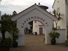
Kristiansand Zoo and Amusement Park is the largest zoo in Norway and the second most visited tourist attraction in Norway after Holmenkollen, Oslo. The park also includes a tivoli and a waterpark. There are some hotels located in the area for visitors. Abrahavn is a resort in the zoo.[10]
Randesund is a popular vacation area with a lot of cabins for rent at small islands or on the mainland.

Hamresanden camping is a popular camping place with the beach. There is also a bible camp there.
Kristiansand Travpark is a racetrack located between the zoo and Sørlandsparken.
Shopping
Sørlandsparken is located in Oddernes. The industrial shopping park includes Norway's largest mall Sørlandssenteret with over 195 stores. Other large brands like IKEA, Burger King, Toys R Us and car dealerships is located around the mall.[11]
Rona Mall is a local mall located at Rona, Søm. The mall includes a fitness center, dentist, pharmacy, grocery store and a hair salon. On top of the mall, there is apartments. Rona Mall is located off the highway E18 and besides County Road 401.
Hånes Mall is a small local mall for the neighborhoods at Hånes, it is a part of an apartment building and has a grocery store and a hair salon. Hånes Mall is located in the neighborhood Vigvoll.
Lauvåsen Mall is a mall with a fitness center and hair salon. It is located off Norwegian National Road 41 between Grovikheia and Landauvåsen.
Photos
 Sørlandssenteret
 Rona Mall
 Lauvåsen Mall
Centrums

Strømme Centrum is the largest centrum in Oddernes, it is located in Søm and is the centrum for Søm and Randesund. There is Regional Psychiatric Centre there along with other health stations. Randesund Police Station, which is a police station for Oddernes. Søm Church is located there along with Randesund Free Church. Randesund IL has their football stadium there, next to an indoor swimming pool. Strømme School is an elementary school located there. Østbyen Dagsenter is an retirement home. There is also two kindergartens in the centrum.
Hamresanden is a centrum for the district of Tveit. It has a fast-food restaurant, a grocery store, a gas station and local stores along with Tveit Free Church.
Religion
There are 4 churches in Oddernes.
In Randesund, Randesund Church was buildit in 1864, it has a capacity of 450 people and is located at Frikstad. The church is built out of tree and there is a graveyard with the church.
Søm Church was built in 2004. The windows was designed by Kjell Nupen and has a capacity of 400 people. The church was Kristiansand's "Thousand years building" since the construction started in the new millennium (Year 2000).
Hånes Church was built in 1986, it has the capacity of 300 people and built by bricks, there is no graveyard with Hånes church.
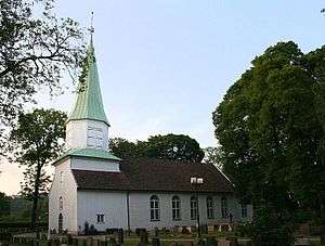
Tveit Church is the oldest church in Oddernes, it was built in 1100 by stone. In 1831, a tower was built on the top of the church and in 1867 a restaurant was built in the church. Tveit church has a capacity of 450 people, there is a graveyard with the church and it is a nave church. The church is located with Ryen of Norwegian National Road 41.
Oddernes Church itself is not located in the Oddernes but in the Lund borough with the University. The reason is that Lund was a part of the Oddernes municipality before it became a part of Kristiansand.
Photos
 Oddernes Church which is located at Lund
 Randesund Church
 Søm Church
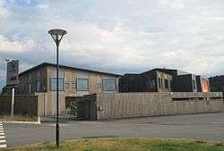 Hånes Free Church
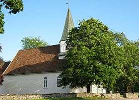 Tveit Church
Society And Environment
Oddernes is mostly consist of neighborhoods and farms. While Tveit and large parts of Randesund is more agricultural, the districts Søm, Hånes and neighborhoods Tømmerstø and Hamresanden is in the urban zone and neighborhoods in the town Kristiansand.
Randesund has large parts of the Southern Norway's archipelago. It is also popular to have cottage in the shore of Randesund. Populated island in the shore of Randesund is Herøya and Randøya. Tømmerstø, Rabbesvik, Holte, Odderhei and Dvergsnes all goes under the part of Randesund known as Tømmerstø. This part of Randesund consist of typical Norwegian neighborhoods, but with a bit larger houses and has been criticized as an upper-middle-class neighborhood, especially Dvergsnes. Besides from the suburban areas in Tømmerstø, the rest of Randesund is mostly agriculture as closer you get to Lillesand. Randesund has 2,000 people where 7% comes from a non-Norwegian background, it is the lowest percent in Kristiansand and Randesund is the second last on the list of most populated immigrant places in Kristiansand after Gimlekollen and before Flekkerøy.
Søm mostly consist of neighborhoods from all the way back to the 1970s when they started building out and was especially promoted the view of the city you got from the west side of Søm. Søm is today still building out large neighborhoods and has been criticized for being a very religious area in Christianity. Søm only has 10% non-Norwegian citizens and it's one of the parts in Kristiansand with lowest percent in immigration. Søm is however the most populated part of Oddernes with 9,000 people. Søm is a typical urban neighborhood of a city.
Hånes also mostly consist of neighborhoods. Some of Norway's most expensive properties was sold on Hånestangen. Other than that, Hånes has a wide range of apartment buildings and typical Norwegian neighborhoods. Hånes has a population of 4,000 and where 18% comes from an non-Norwegian background. Meaning Hånes is the place in Oddernes with most immigrants, and the 6th most popular place for immigrants in Kristiansand after Tinnheia.
Tveit is the largest part with the smallest population of only 1,000. Tveit consist of most farms in Kristiansand and a few neighborhoods like Hamresanden, Brattvollsheia and Solsletta.
Photos
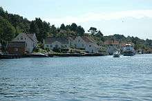
 Fidjekilen Harbor in Tømmerstø
- Farms at Tveit
 View of Søm from Marvika
Old Oddernes
Until 1965, Oddernes was its own municipality, but so was Randesund and Tveit. So Oddernes wasn't exactly located as it is today. In fact only the part Hånes was a part of Oddernes from the parts of Oddernes today. Other places in Kristiansand that was a part of Oddernes was the entire Vågsbygd borough (except Voiebyen), Hellemyr, Strai, Mosby, Lund and Justvik. Oddernes Church is located at Lund and still has the same name today. While Oddernes High School, located in Vågsbygd Centrum changed the name to Vågsbygd High School.
See also
References
- ↑ "Oddernes" (in Norwegian). Store norske leksikon. Retrieved 2009-11-10.
- ↑ Rygh, Oluf (1912). Norske gaardnavne: Lister og Mandals amt (in Norwegian) (9 ed.). Kristiania, Norge: W. C. Fabritius & sønners bogtrikkeri. p. 9.
- ↑ Registreringssentral for historiske data. "Hjemmehørende folkemengde Vest-Agder 1801-1960" (in Norwegian). University of Tromsø.
- ↑ Jukvam, Dag (1999). "Historisk oversikt over endringer i kommune- og fylkesinndelingen" (PDF) (in Norwegian). Statistisk sentralbyrå.
- ↑ "Befolkning i Kristiansand". ssb.no. Retrieved 2014. Check date values in:
|access-date=(help) - ↑ "MinSkole".
- ↑ "Avinor - Kristiansand Lufthavn, Kjevik" (in Norwegian). Avinor. Retrieved 2015. Check date values in:
|access-date=(help) - ↑ "Statens Vegvesen". vegvesen.no. Retrieved 2015. Check date values in:
|access-date=(help) - ↑ "AKT".
- ↑ "Kristiansand Dyrepark" (in Norwegian). Kristiansand Zoo and Amusement Park. Retrieved 2015. Check date values in:
|access-date=(help) - ↑ "Sørlandssenteret". sorlandssenteret.no. Retrieved 2015. Check date values in:
|access-date=(help)
External links
 Kristiansand travel guide from Wikivoyage