Flekkerøy
| Distrikt Flekkerøy | ||
|---|---|---|
| District | ||
| ||
 | ||
| Coordinates: 58°04′30″N 7°59′50″E / 58.07500°N 7.99722°ECoordinates: 58°04′30″N 7°59′50″E / 58.07500°N 7.99722°E | ||
| Country | Norway | |
| City | Kristiansand | |
| Borough | Vågsbygd | |
| Area | ||
| • Total | 6,2 km2 (24 sq mi) | |
| Population (2014) | ||
| • Total | 3,632 | |
| • Density | 59/km2 (150/sq mi) | |
| Time zone | CET (UTC+1) | |
| • Summer (DST) | CEST (UTC+2) | |
| ISO 3166 code | NO-030112 | |
| Website | kristiansand.kommune.no | |

Flekkerøy is a borough and an island of the city of Kristiansand, Norway.
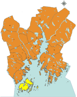
The borough consists of the following neighborhoods:
- Berge/Andås
- Kjære
- Lindebø/Skålevik
- Mæbø/Høyfjellet


Flekkerøy is an island situated outside the town of Kristiansand, part of Kristiansand municipality. Since 1989 it is connected to the mainland through the Flekkerøy Tunnel, a 2,320-metre (7,612 ft) long tunnel. It has 3,632 inhabitants (23 October 2013).
History
From the 15th century Flekkerøy was an important harbour for the Skagerrak, and from 1540 considered as the most important outport in the region. In 1555 the first fortifications were built, but it was torn down in 1561. In the early 17th century the harbour again became of strategic importance, and in 1635 the island was visited by king Christian IV who decided to build Christiansø Fortress to protect the harbour.[1] In 1656 a new fortress, Fredriksholm, was built, and Christiansø soon decayed.
In 1807 about 250 people lived on the island, and in September 1807 English ships anchored at the harbour. The local people fled, Fredriksholm fortress was blown up, and the island was pillaged. [2] In 1848 a canon battery was built, but in 1872 it was abandoned, and in 1874 the partially rebuilt Fredriksholm fortress was also closed down for good.
In 2005 remaining military properties on Flekkerøya were secured for public outdoor life by the Ministry of Climate and Environment.[3]
Politics
The 10 largest politics parties in Flekkerøy (2015):
| Kristiansand city council votes from Flekkerøy 2015[4] | |
| Christian Democratic Party | 48,4% (704 votes) |
| Conservative Party | 17,2% (250 votes) |
| Labour Party | 12,6% (183 votes) |
| Progress Party | 7,4% (107 votes) |
| The Democrats | 5,8% (83 votes) |
| Green Party | 2,3% (33 votes) |
| Liberal Party | 2,1% (31 votes) |
| The Christians | 1,2% (18 votes) |
| Socialist Left Party | 1% (15 votes) |
| Centre | 0,5% (7 votes) |
| Others | 0,4% (5 votes) |
| Total | 1431 votes |
Transportation
The main bustop on the island is with the roundabout where County Road 457 ends. Line 07 are the local line at the island
| Line | Destination [5] |
|---|---|
| M1 | Flekkerøy - Sørlandsparken-Dyreparken IKEA |
| M1 | Flekkerøy - Kvadraturen |
| N2 | Flekkerøy - Voiebyen - Kvadraturen |
| 07 | Åshavn - Flekkerøy - Skålevik |