Operation Flintlock (nuclear test)
| Operation Flintlock | |
|---|---|
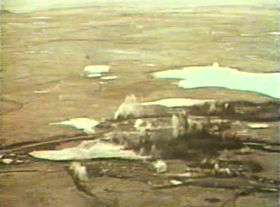 Flintlock Long Shot, on Amchitka Island in the Alaskan Aleutian Islands | |
| Information | |
| Country | United States |
| Test site | Amchitka Island, Alaska; NTS Area 12, Rainier Mesa; NTS Area 15; NTS Area 16, Shoshone Mountain; NTS Area 19, 20, Pahute Mesa; NTS Areas 5, 11, Frenchman Flat; NTS, Areas 1-4, 6-10, Yucca Flat |
| Period | 1965-1966 |
| Number of tests | 47 |
| Test type | underground shaft, underground tunnel |
| Max. yield | 365 kilotonnes of TNT (1,530 TJ) |
| Navigation | |
| Previous test series | Operation Whetstone |
| Next test series | Operation Latchkey |
The United States's Flintlock nuclear test series[1] was a group of 47 nuclear tests conducted in 1965-1966. These tests [note 1] followed the Operation Whetstone series and preceded the Operation Latchkey series.
| Name [note 2] | Date time (UT) | Local time zone [note 3][2] | Location [note 4] | Elevation + height [note 5] | Delivery [note 6] Purpose [note 7] |
Device [note 8] | Yield [note 9] | Fallout [note 10] | References | Notes |
|---|---|---|---|---|---|---|---|---|---|---|
| Izzer | 16 July 1965 13:04:24.1 | PST (-8 hrs) | NTS Area U9bp 37°06′54″N 116°01′59″W / 37.11495°N 116.03304°W | 1,273 m (4,177 ft) - 163.68 m (537.0 ft) | underground shaft, weapons development |
less than 20 kt | Venting detected | [1][3][4][5] | ||
| Pongee | 22 July 1965 13:21:08.11 | PST (-8 hrs) | NTS Area U2ah 37°07′54″N 116°04′04″W / 37.13175°N 116.06773°W | 1,274 m (4,180 ft) - 135.03 m (443.0 ft) | underground shaft, weapons development |
less than 20 kt | Venting detected on site, 6 Ci (220 GBq) | [1][3][4][5][6] | ||
| Bronze | 23 July 1965 17:00:00.04 | PST (-8 hrs) | NTS Area U7f 37°05′53″N 116°02′01″W / 37.09794°N 116.03374°W | 1,257 m (4,124 ft) - 530.96 m (1,742.0 ft) | underground shaft, weapons development |
67 kt | Venting detected, 1.7 kCi (63 TBq) | [1][3][4][5][6][7] | ||
| Mauve | 6 August 1965 17:23:30.04 | PST (-8 hrs) | NTS Area U3dp 37°01′04″N 116°02′27″W / 37.01771°N 116.04089°W | 1,185 m (3,888 ft) - 321 m (1,053 ft) | underground shaft, weapons development |
18 kt | [1][4][5][7][8] | |||
| Ticking | 21 August 1965 13:43:08.15 | PST (-8 hrs) | NTS Area U9bj 37°06′45″N 116°01′37″W / 37.11258°N 116.02689°W | 1,288 m (4,226 ft) - 210.31 m (690.0 ft) | underground shaft, weapons development |
250 t | Venting detected, 2.6 kCi (96 TBq) | [1][3][4][5][8] | ||
| Centaur | 27 August 1965 13:51:13.11 | PST (-8 hrs) | NTS Area U2ak 37°08′14″N 116°04′15″W / 37.13729°N 116.07097°W | 1,283 m (4,209 ft) - 171.91 m (564.0 ft) | underground shaft, weapons development |
1 kt | Venting detected on site, 57 Ci (2,100 GBq) | [1][3][4][5][6][9] | ||
| Moa - 1 (with Screamer) | 1 September 1965 20:08:00.04 | PST (-8 hrs) | NTS Area U3ed 37°02′14″N 116°00′53″W / 37.0373°N 116.01472°W | 1,194 m (3,917 ft) + | underground shaft, weapons development |
2.5 kt | Venting detected on site | [1][4][5] | simultaneous, separate. | |
| Screamer - 2 (with Moa) | 1 September 1965 20:08:00.04 | PST (-8 hrs) | NTS Area U3dg 37°01′23″N 116°00′36″W / 37.02292°N 116.00987°W | 1,184 m (3,885 ft) - 301.9 m (990 ft) | underground shaft, weapon effect |
9 kt | Venting detected on site, 63 kCi (2,300 TBq) | [1][3][4][5][6][7] | simultaneous, separate. | |
| Elkhart | 17 September 1965 15:08:23.1 | PST (-8 hrs) | NTS Area U9bs 37°06′40″N 116°02′08″W / 37.11098°N 116.03548°W | 1,267 m (4,157 ft) - 219.46 m (720.0 ft) | underground shaft, weapons development |
6 kt | Venting detected, 560 Ci (21,000 GBq) | [1][3][4][5][6][7] | ||
| Long Shot | 29 October 1965 21:00:00.08 | NST (-11 hrs) | Amchitka Island, Alaska 51°26′14″N 179°10′49″E / 51.43709°N 179.18032°E | 42 m (138 ft) - 700 m (2,300 ft) | underground shaft, joint verification |
80 kt | [1][5] | Designed to test detection of underground nuclear tests; see Vela Uniform. | ||
| Sepia | 12 November 1965 18:00:00.05 | PST (-8 hrs) | NTS Area U3en 37°03′00″N 116°01′22″W / 37.04996°N 116.02282°W | 1,202 m (3,944 ft) - 241.19 m (791.3 ft) | underground shaft, weapons development |
7 kt | I-131 venting detected, 0.0011 Ci (0.041 GBq) | [1][3][4][5][6][7] | ||
| Kermet | 23 November 1965 18:17:32.1 | PST (-8 hrs) | NTS Area U2c 37°09′43″N 116°04′18″W / 37.16187°N 116.0718°W | 1,304 m (4,278 ft) - 198.12 m (650.0 ft) | underground shaft, weapons development |
500 t | Venting detected on site, 18 Ci (670 GBq) | [1][3][4][5][6][8] | ||
| Corduroy | 3 December 1965 15:13:02.1 | PST (-8 hrs) | NTS Area U10k 37°09′53″N 116°03′11″W / 37.1646°N 116.05319°W | 1,275 m (4,183 ft) - 681.53 m (2,236.0 ft) | underground shaft, weapons development |
120 kt | Venting detected, 1.2 kCi (44 TBq) | [1][3][4][5][6][7] | ||
| Emerson | 16 December 1965 15:39:18.15 | PST (-8 hrs) | NTS Area U2al 37°08′27″N 116°03′51″W / 37.14079°N 116.06405°W | 1,280 m (4,200 ft) - 259.87 m (852.6 ft) | underground shaft, weapons development |
3 kt | Venting detected on site, 0.6 Ci (22 GBq) | [1][3][4][5][6][7] | ||
| Buff | 16 December 1965 19:15:00.04 | PST (-8 hrs) | NTS Area U3dh 37°04′21″N 116°01′48″W / 37.07251°N 116.02998°W | 1,223 m (4,012 ft) - 500.41 m (1,641.8 ft) | underground shaft, weapons development |
51 kt | [1][4][5][7][10] | |||
| Maxwell | 13 January 1966 15:37:43.1 | PST (-8 hrs) | NTS Area U9br 37°06′58″N 116°01′42″W / 37.11617°N 116.0284°W | 1,283 m (4,209 ft) - 183.09 m (600.7 ft) | underground shaft, weapons development |
less than 20 kt | Venting detected, 3 Ci (110 GBq) | [1][3][4][5][6] | ||
| Lampblack | 18 January 1966 18:35:00.04 | PST (-8 hrs) | NTS Area U7i 37°05′30″N 116°01′10″W / 37.09165°N 116.01956°W | 1,267 m (4,157 ft) - 561.48 m (1,842.1 ft) | underground shaft, weapons development |
38 kt | [1][4][5][10] | |||
| Sienna | 18 January 1966 18:35:00.04 | PST (-8 hrs) | NTS Area U3cj 37°02′14″N 116°01′09″W / 37.03726°N 116.01922°W | 1,193 m (3,914 ft) - 275.01 m (902.3 ft) | underground shaft, weapons development |
4 kt | Venting detected | [1][3][4][5][9] | ||
| Dovekie | 21 January 1966 18:28:00.04 | PST (-8 hrs) | NTS Area U3cd 37°01′54″N 116°00′59″W / 37.0318°N 116.01649°W | 1,189 m (3,901 ft) - 333.05 m (1,092.7 ft) | underground shaft, weapons development |
7 kt | [1][4][5][7] | |||
| Reo | 22 January 1966 15:17:19.1 | PST (-8 hrs) | NTS Area U10m 37°09′26″N 116°02′23″W / 37.15718°N 116.03959°W | 1,283 m (4,209 ft) - 213.36 m (700.0 ft) | underground shaft, weapons development |
150 t | Venting detected on site, 10 Ci (370 GBq) | [1][3][4][5][6][8] | ||
| Plaid 2 | 3 February 1966 18:17:37.1 | PST (-8 hrs) | NTS Area U2r 37°07′35″N 116°04′13″W / 37.12626°N 116.07034°W | 1,272 m (4,173 ft) - 270.05 m (886.0 ft) | underground shaft, weapons development |
3.5 kt | Venting detected on site, 7 Ci (260 GBq) | [1][3][4][5][6][7] | ||
| Rex | 24 February 1966 15:55:07.04 | PST (-8 hrs) | NTS Area U20h(e) 37°16′18″N 116°26′05″W / 37.27178°N 116.43472°W | 1,971 m (6,467 ft) - 671.69 m (2,203.7 ft) | underground shaft, weapons development |
19 kt | Venting detected, 310 Ci (11,000 GBq) | [1][3][4][5][6] | ||
| Red Hot | 5 March 1966 18:15:00.1 | PST (-8 hrs) | NTS Area U12g.06 37°10′28″N 116°12′33″W / 37.17445°N 116.20924°W | 2,299 m (7,543 ft) - 405.38 m (1,330.0 ft) | underground tunnel, weapon effect |
2 kt | Venting detected off site, 1 MCi (37 PBq) | [1][3][4][5][6] | ||
| Cinnamon - 2 (with Finfoot) | 7 March 1966 18:41:00.04 | PST (-8 hrs) | NTS Area U3dm 37°02′05″N 116°01′54″W / 37.03461°N 116.03166°W | 1,192 m (3,911 ft) + | underground shaft, safety experiment |
less than 20 kt | Venting detected on site | [1][4][5] | simultaneous, separate. | |
| Finfoot - 1 (with Cinnamon) | 7 March 1966 18:41:00.07 | PST (-8 hrs) | NTS Area U3du 37°02′14″N 116°01′49″W / 37.03736°N 116.03014°W | 1,193 m (3,914 ft) - 195.54 m (641.5 ft) | underground shaft, weapons development |
5 kt | I-131 venting detected, 0 | [1][3][4][5][6][7] | simultaneous, separate. | |
| Clymer | 12 March 1966 18:04:13.11 | PST (-8 hrs) | NTS Area U9ce 37°08′37″N 116°03′12″W / 37.14362°N 116.0534°W | 1,266 m (4,154 ft) - 397.09 m (1,302.8 ft) | underground shaft, weapons development |
3 kt | Venting detected, 450 Ci (17,000 GBq) | [1][3][4][5][6][7] | ||
| Purple | 18 March 1966 19:00:00.04 | PST (-8 hrs) | NTS Area U3ds 37°00′33″N 116°00′36″W / 37.0092°N 116.00996°W | 1,180 m (3,870 ft) - 332.79 m (1,091.8 ft) | underground shaft, weapons development |
7 kt | [1][4][5][7] | |||
| Templar | 24 March 1966 14:55:28.14 | PST (-8 hrs) | NTS Area U9bt 37°06′48″N 116°01′56″W / 37.11329°N 116.03223°W | 1,275 m (4,183 ft) - 151 m (495 ft) | underground shaft, peaceful research |
370 t | I-131 venting detected, 0 | [1][3][4][5][6] | Plowshare - excavation device development. | |
| Lime | 1 April 1966 18:40:00.04 | PST (-8 hrs) | NTS Area U7j 37°06′10″N 116°01′15″W / 37.10265°N 116.02081°W | 1,291 m (4,236 ft) - 561.44 m (1,842.0 ft) | underground shaft, weapons development |
less than 20 kt | [1][4][5] | |||
| Stutz | 6 April 1966 13:57:17.1 | PST (-8 hrs) | NTS Area U2ca 37°08′22″N 116°08′31″W / 37.13941°N 116.14203°W | 1,458 m (4,783 ft) - 225.34 m (739.3 ft) | underground shaft, weapons development |
5 kt | Venting detected, 1 Ci (37 GBq) | [1][4][5][6][7][8] | ||
| Tomato | 7 April 1966 22:27:30.04 | PST (-8 hrs) | NTS Area U3ek 37°01′03″N 115°59′35″W / 37.01737°N 115.99309°W | 1,195 m (3,921 ft) - 226.31 m (742.5 ft) | underground shaft, weapons development |
6 kt | [1][4][5][7] | |||
| Duryea | 14 April 1966 14:13:43.1 | PST (-8 hrs) | NTS Area U20a1 37°14′33″N 116°25′55″W / 37.2425°N 116.43192°W | 1,960 m (6,430 ft) - 544.25 m (1,785.6 ft) | underground shaft, weapons development |
70 kt | Venting detected, 2 Ci (74 GBq) | [1][3][4][5][6] | ||
| Fenton | 23 April 1966 14:55:26.14 | PST (-8 hrs) | NTS Area U2m1 37°09′38″N 116°05′02″W / 37.16052°N 116.08381°W | 1,321 m (4,334 ft) - 167.64 m (550.0 ft) | underground shaft, weapons development |
1.4 kt | Venting detected off site, 1.7 kCi (63 TBq) | [1][3][4][5][6][8] | ||
| Pin Stripe | 25 April 1966 18:38:00.14 | PST (-8 hrs) | NTS Area U11b 36°53′15″N 115°56′30″W / 36.8874°N 115.94159°W | 1,066 m (3,497 ft) - 295.66 m (970.0 ft) | underground shaft, weapon effect |
5 kt | Venting detected off site, 210 kCi (7,800 TBq) | [1][3][4][5][6][10] | ||
| Ochre | 29 April 1966 13:33:00.04 | PST (-8 hrs) | NTS Area U3ec 37°02′37″N 116°01′24″W / 37.04364°N 116.02323°W | 1,196 m (3,924 ft) - 126.14 m (413.8 ft) | underground shaft, safety experiment |
less than 20 kt | [1][4][5] | |||
| Traveler | 4 May 1966 13:32:17.09 | PST (-8 hrs) | NTS Area U2cd 37°08′13″N 116°08′17″W / 37.13705°N 116.13807°W | 1,430 m (4,690 ft) - 196.76 m (645.5 ft) | underground shaft, weapons development |
20 kt | Venting detected, 170 Ci (6,300 GBq) | [1][3][4][5][6][7] | ||
| Cyclamen | 5 May 1966 14:00:00.04 | PST (-8 hrs) | NTS Area U3cx 37°03′02″N 116°02′19″W / 37.05056°N 116.03873°W | 1,203 m (3,947 ft) - 304.97 m (1,000.6 ft) | underground shaft, weapons development |
12 kt | [1][4][5][7] | included heavy element experiment. | ||
| Chartreuse | 6 May 1966 15:00:00.08 | PST (-8 hrs) | NTS Area U19d 37°20′53″N 116°19′22″W / 37.34795°N 116.32283°W | 2,064 m (6,772 ft) - 666.75 m (2,187.5 ft) | underground shaft, weapons development |
73 kt | [1][4][5] | |||
| Tapestry | 12 May 1966 19:37:26.2 | PST (-8 hrs) | NTS Area U2an 37°08′03″N 116°04′19″W / 37.13423°N 116.07198°W | 1,281 m (4,203 ft) - 247.19 m (811.0 ft) | underground shaft, weapons development |
10 kt | Venting detected on site, 8.6 kCi (320 TBq) | [1][4][5][6][7][8] | ||
| Piranha | 13 May 1966 13:30:00.04 | PST (-8 hrs) | NTS Area U7e 37°05′13″N 116°02′04″W / 37.08681°N 116.03431°W | 1,237 m (4,058 ft) - 548.72 m (1,800.3 ft) | underground shaft, weapons development |
120 kt | [1][4][5][7][10] | |||
| Dumont | 19 May 1966 13:56:28.14 | PST (-8 hrs) | NTS Area U2t 37°06′40″N 116°03′32″W / 37.11109°N 116.05879°W | 1,252 m (4,108 ft) - 670.77 m (2,200.7 ft) | underground shaft, weapons development |
200 kt | Venting detected, 35 Ci (1,300 GBq) | [1][3][4][5][6][7] | ||
| Discus Thrower | 27 May 1966 20:00:00.04 | PST (-8 hrs) | NTS Area U8a 37°10′42″N 116°05′55″W / 37.17834°N 116.09862°W | 1,380 m (4,530 ft) - 337.06 m (1,105.8 ft) | underground shaft, weapon effect |
22 kt | [1][4][5][7] | |||
| Pile Driver | 2 June 1966 15:30:00.09 | PST (-8 hrs) | NTS Area U15a.01 37°13′37″N 116°03′23″W / 37.22701°N 116.0564°W | 1,525 m (5,003 ft) - 462.69 m (1,518.0 ft) | underground shaft, weapon effect |
62 kt | Venting detected on site, 37 kCi (1,400 TBq) | [1][3][4][5][6][10] | Investigate the simulated effects of a nuclear surface detonation on a deeply buried, superhard command and control center in a granite rock formation. | |
| Tan | 3 June 1966 14:00:00.04 | PST (-8 hrs) | NTS Area U7k 37°04′06″N 116°02′10″W / 37.06843°N 116.03606°W | 1,213 m (3,980 ft) - 560.68 m (1,839.5 ft) | underground shaft, weapons development |
160 kt | [1][4][5][7][10] | |||
| Puce | 10 June 1966 14:30:00.04 | PST (-8 hrs) | NTS Area U3bs 37°03′34″N 116°02′23″W / 37.05937°N 116.03967°W | 1,208 m (3,963 ft) - 485.55 m (1,593.0 ft) | underground shaft, weapons development |
less than 20 kt | [1][4][5] | |||
| Double Play | 15 June 1966 17:00:00.04 | PST (-8 hrs) | NTS Area U16a.03 37°00′35″N 116°12′14″W / 37.00959°N 116.20382°W | 1,954 m (6,411 ft) - 327.7 m (1,075 ft) | underground shaft, weapon effect |
less than 20 kt | Venting detected off site, 840 kCi (31,000 TBq) | [1][3][4][5][6] | ||
| Kankakee | 15 June 1966 18:02:47.13 | PST (-8 hrs) | NTS Area U10p 37°10′17″N 116°02′59″W / 37.17148°N 116.04973°W | 1,281 m (4,203 ft) - 455.25 m (1,493.6 ft) | underground shaft, weapons development |
200 kt | Venting detected, 160 Ci (5,900 GBq) | [1][3][4][5][6][7] | ||
| Vulcan | 25 June 1966 17:13:00.07 | PST (-8 hrs) | NTS Area U2bd 37°09′19″N 116°04′23″W / 37.15535°N 116.07312°W | 1,300 m (4,300 ft) - 322.11 m (1,056.8 ft) | underground shaft, peaceful research |
25 kt | Venting detected, 250 Ci (9,200 GBq) | [1][3][4][5][6][7] | Project Plowshare - Device development, heavy element production. | |
| Halfbeak | 30 June 1966 22:15:00.07 | PST (-8 hrs) | NTS Area U19b 37°18′57″N 116°17′59″W / 37.31575°N 116.29985°W | 2,043 m (6,703 ft) - 819.3 m (2,688 ft) | underground shaft, weapons development |
365 kt | [1][4][5][7] |
- ↑ A bomb test may be a salvo test, defined as two or more explosions "where a period of time between successive individual explosions does not exceed 5 seconds and where the burial points of all explosive devices can be connected by segments of straight lines, each of them connecting two burial points and does not exceed 40 kilometers in length". Mikhailov, V. N., Editor in Chief. "Catalog of World Wide Nuclear Testing". Begell-Atom, LLC.
- ↑ The US, France and Great Britain have code-named their test events, while the USSR and China did not, and therefore have only test numbers (with some exceptions – Soviet peaceful explosions were named). Word translations into English in parentheses unless the name is a proper noun. A dash followed by a number indicates a member of a salvo event. The US also sometimes named the individual explosions in such a salvo test, which results in "name1 – 1(with name2)". If test is canceled or aborted, then the row data like date and location discloses the intended plans, where known.
- ↑ To convert the UT time into standard local, add the number of hours in parentheses to the UT time; for local daylight saving time, add one additional hour. If the result is earlier than 00:00, add 24 hours and subtract 1 from the day; if it is 24:00 or later, subtract 24 hours and add 1 to the day. All historical timezone data are derived from here:
- ↑ Rough place name and a latitude/longitude reference; for rocket-carried tests, the launch location is specified before the detonation location, if known. Some locations are extremely accurate; others (like airdrops and space blasts) may be quite inaccurate. "~" indicates a likely pro-forma rough location, shared with other tests in that same area.
- ↑ Elevation is the ground level at the point directly below the explosion relative to sea level; height is the additional distance added or subtracted by tower, balloon, shaft, tunnel, air drop or other contrivance. For rocket bursts the ground level is "N/A". In some cases it is not clear if the height is absolute or relative to ground, for example, Plumbbob/John. No number or units indicates the value is unknown, while "0" means zero. Sorting on this column is by elevation and height added together.
- ↑ Atmospheric, airdrop, balloon, gun, cruise missile, rocket, surface, tower, and barge are all disallowed by the Partial Nuclear Test Ban Treaty. Sealed shaft and tunnel are underground, and remained useful under the PTBT. Intentional cratering tests are borderline; they occurred under the treaty, were sometimes protested, and generally overlooked if the test was declared to be a peaceful use.
- ↑ Include weapons development, weapon effects, safety test, transport safety test, war, science, joint verification and industrial/peaceful, which may be further broken down.
- ↑ Designations for test items where known, "?" indicates some uncertainty about the preceding value, nicknames for particular devices in quotes. This category of information is often not officially disclosed.
- ↑ Estimated energy yield in tons, kilotons, and megatons. A ton of TNT equivalent is defined as 4.184 gigajoules (1 gigacalorie).
- ↑ Radioactive emission to the atmosphere aside from prompt neutrons, where known. The measured species is only iodine-131 if mentioned, otherwise it is all species. No entry means unknown, probably none if underground and "all" if not; otherwise notation for whether measured on the site only or off the site, where known, and the measured amount of radioactivity released.
References
- 1 2 3 4 5 6 7 8 9 10 11 12 13 14 15 16 17 18 19 20 21 22 23 24 25 26 27 28 29 30 31 32 33 34 35 36 37 38 39 40 41 42 43 44 45 46 47 48 49 50 Yang, Xiaoping; North, Robert; Romney, Carl (August 2000), CMR Nuclear Explosion Database (Revision 3), SMDC Monitoring Research
- ↑ "Timezone Historical Database". iana.com. Retrieved March 8, 2014.
- 1 2 3 4 5 6 7 8 9 10 11 12 13 14 15 16 17 18 19 20 21 22 23 24 25 26 27 28 29 Radiological Effluents Released from U.S. Continental Tests 1961 Through 1992 (DOE/NV-317 Rev. 1) (PDF), DOE Nevada Operations Office, August 1996, retrieved 2013-10-31
- 1 2 3 4 5 6 7 8 9 10 11 12 13 14 15 16 17 18 19 20 21 22 23 24 25 26 27 28 29 30 31 32 33 34 35 36 37 38 39 40 41 42 43 44 45 46 47 48 Official list of underground nuclear explosions, Sandia National Laboratories, 1994-07-01, retrieved 2013-12-18
- 1 2 3 4 5 6 7 8 9 10 11 12 13 14 15 16 17 18 19 20 21 22 23 24 25 26 27 28 29 30 31 32 33 34 35 36 37 38 39 40 41 42 43 44 45 46 47 48 49 United States Nuclear Tests: July 1945 through September 1992 (PDF) (DOE/NV-209 REV15), Las Vegas, NV: Department of Energy, Nevada Operations Office, 2000-12-01, retrieved 2013-12-18
- 1 2 3 4 5 6 7 8 9 10 11 12 13 14 15 16 17 18 19 20 21 22 23 24 25 26 27 28 Estimated exposures and thyroid doses received by the American people from Iodine-131 in fallout following Nevada atmospheric nuclear bomb tests, Chapter 2 (PDF), National Cancer Institute, 1997, retrieved 2014-01-05
- 1 2 3 4 5 6 7 8 9 10 11 12 13 14 15 16 17 18 19 20 21 22 23 24 25 Bolt, Bruce A. (1976), Nuclear Explosions and Earthquakes: The Parted Veil, San Francisco, CA: W.H. Freeman and Co.
- 1 2 3 4 5 6 7 Norris, Robert Standish; Cochran, Thomas B. (1 February 1994), "United States nuclear tests, July 1945 to 31 December 1992 (NWD 94-1)" (PDF), Nuclear Weapons Databook Working Paper, Washington, DC: Natural Resources Defense Council, retrieved 2013-10-26
- 1 2 Operation Argus, 1958 (DNA6039F), Washington, DC: Defense Nuclear Agency, Department of Defense, retrieved 26 November 2013
- 1 2 3 4 5 6 Hechanova, Anthony E.; O'Donnell, James E. (1998-09-25), Estimates of yield for nuclear tests impacting the groundwater at the Nevada Test Site, Nuclear Science and Technology Division
This article is issued from Wikipedia - version of the 7/28/2015. The text is available under the Creative Commons Attribution/Share Alike but additional terms may apply for the media files.