Orchid, Florida
| Orchid, Florida | |
|---|---|
| Town | |
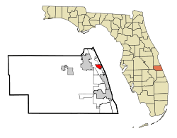 Location in Indian River County and the state of Florida | |
 Orchid, Florida Location in the United States | |
| Coordinates: 27°46′34″N 80°24′48″W / 27.77611°N 80.41333°WCoordinates: 27°46′34″N 80°24′48″W / 27.77611°N 80.41333°W | |
| Country |
|
| State |
|
| County | Indian River |
| Incorporated (town) | 1957 |
| Area | |
| • Total | 1.8 sq mi (4.8 km2) |
| • Land | 1.2 sq mi (3.2 km2) |
| • Water | 0.6 sq mi (1.6 km2) |
| Elevation | 0 ft (0 m) |
| Population (2000) | |
| • Total | 140 |
| • Density | 77.8/sq mi (29.2/km2) |
| Time zone | Eastern (EST) (UTC-5) |
| • Summer (DST) | EDT (UTC-4) |
| ZIP code | 32963 |
| Area code(s) | 772 |
| FIPS code | 12-52175[1] |
| GNIS feature ID | 1675448[2] |
Orchid is a town in Indian River County, Florida, United States. The population was 140 at the 2000 census and was the ninth highest-income place in the United States. As of 2004, the population recorded by the U.S. Census Bureau was 292.[3] It is ranked sixth in Florida locations by per capita income. Orchid is part of the Sebastian–Vero Beach Metropolitan Statistical Area.
Most of the town is actually a gated community called Orchid Island Golf and Beach Club. East of SR A1A, there is a beach front condominium complex. The rest of Orchid is uninhabited islands. Some of the islands are Plug Island, Preachers Island, and Horseshoe Island. North of Horseshoe Island is Pelican Island, the first National Wildlife Refuge in the United States. Running along the town limits (mostly) is the historic, unpaved Jungle Trail.
Geography
Orchid is located at 27°46′34″N 80°24′48″W / 27.776146°N 80.413238°W.[4]
According to the United States Census Bureau, the town has a total area of 1.8 square miles (4.7 km2), of which 1.2 square miles (3.1 km2) is land and 0.6 square miles (1.6 km2) (33.15%) is water.
Demographics
| Historical population | |||
|---|---|---|---|
| Census | Pop. | %± | |
| 1970 | 8 | — | |
| 1980 | 19 | 137.5% | |
| 1990 | 10 | −47.4% | |
| 2000 | 140 | 1,300.0% | |
| 2010 | 415 | 196.4% | |
| Est. 2015 | 439 | [5] | 5.8% |
As of the census[1] of 2000, there were 140 people, 69 households, and 64 families residing in the town. The population density was 113.8 people per square mile (43.9/km²). There were 139 housing units at an average density of 113.0 per square mile (43.6/km²). The racial makeup of the town was 100.00% White. Hispanic or Latino of any race were 0.71% of the population.
There were 69 households out of which 7.2% had children under the age of 18 living with them, 92.8% were married couples living together, and 7.2% were non-families. 7.2% of all households were made up of individuals and none had someone living alone who was 65 years of age or older. The average household size was 2.03 and the average family size was 2.11.
In the town the population was spread out with 4.3% under the age of 18, 0.7% from 18 to 24, 4.3% from 25 to 44, 58.6% from 45 to 64, and 32.1% who were 65 years of age or older. The median age was 61 years. For every 100 females there were 100.0 males. For every 100 females age 18 and over, there were 97.1 males.
The median income for a household in the town was in excess of $200,000, as is the median income for a family. Males had a median income of over $100,000 versus $36,250 for females. The per capita income for the town was $135,870. None of the population is below the poverty line.
Environmental Learning Center
There is an Environmental Learning Center in the Orchid/Wabasso area (website link)
Disney
Disney's Vero Beach Resort, a part of the Disney Vacation resorts, is located in the area.
References
- 1 2 "American FactFinder". United States Census Bureau. Retrieved 2008-01-31.
- ↑ "US Board on Geographic Names". United States Geological Survey. 2007-10-25. Retrieved 2008-01-31.
- ↑ http://www.census.gov/popest/cities/tables/SUB-EST2004-04-12.xls census.gov
- ↑ "US Gazetteer files: 2010, 2000, and 1990". United States Census Bureau. 2011-02-12. Retrieved 2011-04-23.
- ↑ "Annual Estimates of the Resident Population for Incorporated Places: April 1, 2010 to July 1, 2015". Retrieved July 2, 2016.
- ↑ "Census of Population and Housing". Census.gov. Archived from the original on May 11, 2015. Retrieved June 4, 2015.
Municipalities and communities of Indian River County, Florida, United States | ||
|---|---|---|
| Cities |  | |
| Towns | ||
| CDPs | ||
| Unincorporated communities | ||