Osmanabad Tahsil
| Osmanabad Tahsil उस्मानाबाद तालुका | |
|---|---|
| tehsil | |
 Osmanabad Tahsil Location in Maharashtra, India | |
| Coordinates: 18°11′N 076°09′E / 18.183°N 76.150°ECoordinates: 18°11′N 076°09′E / 18.183°N 76.150°E | |
| Country |
|
| State | Maharashtra |
| District | Osmanabad |
| Population (2011) | |
| • Total | 406,647 |
| Languages | |
| • Official | Marathi |
| Time zone | IST (UTC+5:30) |
| Lok Sabha constituency | Osmanabad |
| Vidhan Sabha constituencies | Osmanabad and Tuljapur[1] |
Osmanabad Tahsil is a tahsil/taluka (subdistrict) in Osmanabad district, Maharashtra on the Deccan Plateau of India. The town of Osmanabad is the administrative headquarters of the tahsil. There are 110 panchayat villages in Osmanabad Tahsil.[2]
Outside the city of Osmanabad, the tahsil is divided into five revenue circles: Bembli Dhoki Osmanabad (rural), Padoli and Ter.
Demographics
In the 2001 Indian census, Osmanabad Tahsil had a population of 359,234, with 187,063 (52.1%) males and 172,171 (47.9%) females, for a gender ratio of 920 females per thousand males.[3]
In the 2011 census, Osmanabad Tahsil had 406,647 inhabitants, or 24.5% of the total district population.[4] It had a gender ratio of 920 females per thousand males.[5] The tahsil was 72.4% rural.[4] The literacy rate in 2011 was 79.65% overall in Osmanabad Tahsil, with a rate of 87.65% for males and 71.03% for females.[6] In 2011 in Osmanabad Tahsil, 12.1% of the population was 0 to 6 years of age.[4]
References
- ↑ "Assembly Constituencies-Post delimitation: Maharashtra: Osmanabad District" (PDF). National Informatics Centre, Government of India.
- ↑ "Reports of National Panchayat Directory: Village Panchayat Names of Osmanabad, Osmanabad, Maharashtra". Ministry of Panchayati Raj, Government of India.
- ↑ "Census 2001 Population Finder: Maharashtra: Osmanabad: Osmanabad". Office of The Registrar General & Census Commissioner, Ministry of Home Affairs, Government of India.
- 1 2 3 "Population, Child Population in the age-group 0-6 and Literates by residence and sex, State, Districts, Tahsils 2011: Maharashtra" (PDF). Press Information Bureau, Mumbai. p. 41.
- ↑ "Sex ratio of Population and Child Population in the age-group 0-6, State, Districts, Tahsils 2011: Maharashtra" (PDF). Press Information Bureau, Mumbai. p. 8.
- ↑ "Literacy rates by residence and sex, State, Districts, Tahsils 2011: Maharashtra" (PDF). Press Information Bureau, Mumbai. p. 17.
Osmanabad district topics | ||
|---|---|---|
| History | 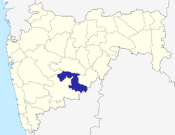 | |
| Cities and towns | ||
| Monuments | ||
| Lok Sabha constituencies | ||
| Vidhan Sabha constituencies | ||