Osolo Township, Elkhart County, Indiana
| Osolo Township | |
|---|---|
| Township | |
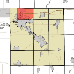 Location of Osolo Township in Elkhart County | |
| Coordinates: 41°43′27″N 85°56′46″W / 41.72417°N 85.94611°WCoordinates: 41°43′27″N 85°56′46″W / 41.72417°N 85.94611°W | |
| Country | United States |
| State | Indiana |
| County | Elkhart |
| Government | |
| • Type | Indiana township |
| Area | |
| • Total | 26.02 sq mi (67.4 km2) |
| • Land | 25 sq mi (60 km2) |
| • Water | 1.02 sq mi (2.6 km2) |
| Elevation[1] | 768 ft (234 m) |
| Population (2010) | |
| • Total | 28,032 |
| • Density | 1,121.3/sq mi (432.9/km2) |
| FIPS code | 18-57150[2] |
| GNIS feature ID | 453696 |
Osolo Township is one of sixteen townships in Elkhart County, Indiana. As of the 2010 census, its population was 28,032.[3]
History
Osolo Township was organized in 1838.[4]
Geography
According to the 2010 census, the township has a total area of 26.02 square miles (67.4 km2), of which 25 square miles (65 km2) (or 96.08%) is land and 1.02 square miles (2.6 km2) (or 3.92%) is water.[3]
Cities and towns
- Elkhart (north quarter)
- Simonton Lake
Unincorporated towns
- East Lake Estates
- Garden Village
- Greenleaf Manor
(This list is based on USGS data and may include former settlements.)
Major highways
References
- ↑ "US Board on Geographic Names". United States Geological Survey. 2007-10-25. Retrieved 2008-01-31.
- ↑ "American FactFinder". United States Census Bureau. Retrieved 2008-01-31.
- 1 2 "Population, Housing Units, Area, and Density: 2010 - County -- County Subdivision and Place -- 2010 Census Summary File 1". United States Census. Retrieved 2013-05-10.
- ↑ History of Elkhart County, Indiana. Chas. C. Chapman Co. 1881. p. 1115.
External links
 |
Ontwa Township, Cass County, Michigan | Mason Township, Cass County, Michigan | | |
| Cleveland Township | |
Washington Township | ||
| ||||
| | ||||
| Concord Township |
Municipalities and communities of Elkhart County, Indiana, United States | ||
|---|---|---|
| Cities | ||
| Towns | ||
| Townships | ||
| CDPs | ||
| Unincorporated communities | ||
| Footnotes | ‡This populated place also has portions in an adjacent county or counties | |
This article is issued from Wikipedia - version of the 10/12/2016. The text is available under the Creative Commons Attribution/Share Alike but additional terms may apply for the media files.