Paige, Texas
| Paige, Texas | |
|---|---|
| City | |
| Coordinates: 30°12′37″N 97°06′54″W / 30.2102146°N 97.1149872°W | |
| Country | United States |
| State | Texas |
| County | Bastrop |
| Elevation | 570 ft (174 m) |
| Population (2010) | |
| • Total | 2,903[1] |
| • Estimate (2014) | 2,799 |
| • Density | 25/sq mi (10/km2) |
| Time zone | Central (CST) (UTC-6) |
| • Summer (DST) | CDT (UTC-5) |
| ZIP code | 78659 |
| Area code(s) | 512, 737 |
Paige is an unincorporated community in Bastrop County, Texas, United States. Although it is unincorporated, Paige has a post office, with the ZIP code of 78659.[2]
Namesake
Paige, Texas was named after Norman Paige, a civil engineer who planned the route of Houston and Texas Central Railway.
History
Paige was created in 1872 near the Houston and Texas Central Railway. The post office of Paige was created in 1874, and in 1876, the railway station near the town was moved three miles east to the location of the current station. In 1877, Fedor Soder arrived at in the town and sold many town lots to Germans. He also created a store and a cotton gin, as the town was growing due to massive production of cotton in the area.[3] The population of Paige in 1884 was about 350 citizens, and it jumped to 500 in 1886. By that time, the town had several businesses, a broom factory, a creamery, a pickle factory, and seven cotton gins. The town was a large shipping joint for butter, cattle, cordwood, cotton, eggs, hogs, potatoes, and many other items. The town gained a bank and telephone service in 1914, but the population slightly decreased up till the 1960s or 1970s. In 1982, the town formed a volunteer fire department. The population soared to 1683 in 1990 and jumped to 2903 in 2010.
Geography
Paige is located 44 miles east from Austin, Texas. Its coordinate location is 30.2102146, −97.1149872.[4] The town is on U.S. Highway 290.
Education
Most children grades kindergarten to 8th grade go to McDade independent school District in McDade, Texas. Some K-8 students and high schoolers go to nearby school districts, such as Giddings independent school District and Lexington independent school District. Other districts that cover the area are Smithville ISD and Bastrop ISD.[5]
References
- ↑ "Paige (zip 78659), Texas". Best Places. Retrieved June 10, 2016.
- ↑ Zip Code Lookup
- ↑ "PAIGE, TX". The Handbook of Texas Online. Retrieved June 10, 2016.
- ↑ "Feature Detail Report for:Paige". GNIS. Retrieved June 10, 2016.
- ↑ "Paige, TX School Districts". usa.com. Retrieved June 10, 2016.
External links
- Paige at the Handbook of Texas Online
- U.S. Geological Survey Geographic Names Information System: Paige, Texas
Municipalities and communities of Bastrop County, Texas, United States | ||
|---|---|---|
| Cities | 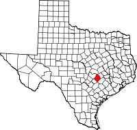 | |
| CDPs | ||
| Other unincorporated communities |
| |
| Ghost towns |
| |
| Footnotes | ‡This populated place also has portions in an adjacent county or counties | |
Coordinates: 30°12′27″N 97°06′54″W / 30.20750°N 97.11500°W