Pallisa
| Pallisa | |
|---|---|
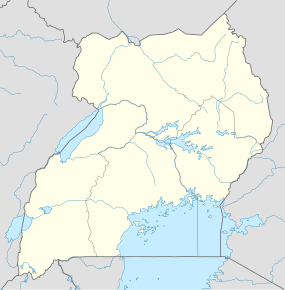 Pallisa Location in Uganda | |
| Coordinates: 01°10′03″N 33°42′36″E / 1.16750°N 33.71000°E | |
| Country |
|
| Region | Eastern Region of Uganda |
| District | Pallisa District |
| Elevation | 3,510 ft (1,070 m) |
| Population (2014 Census) | |
| • Total | 32,681[1] |
Pallisa is a town in Pallisa District of the Eastern Region of Uganda.
Location
Pallisa is approximately 65 kilometres (40 mi), by road, west of Mbale, the largest city in the sub-region.[2] This is approximately 200 kilometres (120 mi), by road, northeast of Kampala, the capital of Uganda.[3] The coordinates of the town are 1°10'03.0"N, 33°42'36.0"E (Latitude:1.1675; Longitude:33.7100).[4]
Overview
The town of Pallisa is in a rural area with limited public transportation. One of the major activities include schooling, with the population of the town swelling to around 40,000 when school is in session. Children come from all around to go to one of the approximately twenty secondary schools in the area, where they live in huts, two to four students per hut, rented to them by villagers. The students fend entirely for themselves while going to school.[5]
Population
The 2002 national census estimated the population of the town at 23,650. In 2010, the Uganda Bureau of Statistics (UBOS) estimated the population to be 31,200. In 2011, UBOS estimated the mid-year population at 32,300.[6] In 2014, the national population census put the population at 32,681.[1]
Points of interest
The following additional points of interest lie within the town limits or near its borders:
- headquarters of Pallisa District Administration
- offices of Pallisa Town Council
- Pallisa central market
- a mobile branch of PostBank Uganda
- Pallisa Campus of Busitema University, one of the public universities in Uganda
- Pallisa Public Library
- the Tirinyi–Pallisa–Kamonkoli–Kumi Road passes through the middle of town.
See also
References
- 1 2 UBOS (29 November 2014). "The Population of The Regions of the Republic of Uganda And All Cities And Towns of More Than 15,000 Inhabitants". Citypopulation.de Quoting Uganda Bureau of Statistics (UBOS). Retrieved 27 February 2015.
- ↑ "Road Distance Between Mbale And Pallisa With Map". Globefeed.com. Retrieved 28 May 2014.
- ↑ "Map Showing Kampala And Pallisa With Distance Marker". Globefeed.com. Retrieved 28 May 2014.
- ↑ Google (19 July 2015). "Location of Pallisa At Google Maps" (Map). Google Maps. Google. Retrieved 19 July 2015.
- ↑ Nawonga, Susan (23 April 2014). "Government Reboots Education Standards in Eastern Uganda". Chimpreports.com. Retrieved 28 May 2014.
- ↑ UBOS. "Estimated Population of Pallisa In 2002, 2010 & 2011" (PDF). Uganda Bureau of Statistics (UBOS). Retrieved 28 May 2014.
External links
Capital: Pallisa | ||
| Towns and villages | ||
| Geography |
| |
| Economy | ||
| Transport | ||
| Notable people | ||
Coordinates: 01°10′03″N 33°42′36″E / 1.16750°N 33.71000°E