Pan de Guajaibón
| Pan de Guajaibón | |
|---|---|
.jpg) | |
| Highest point | |
| Elevation | 699 metres (2,293 ft) |
| Prominence | 699 m (2,293 ft) |
| Coordinates | 22°47′20″N 83°21′52″W / 22.78889°N 83.36444°WCoordinates: 22°47′20″N 83°21′52″W / 22.78889°N 83.36444°W |
| Geography | |
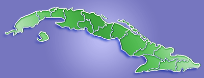
 Pan de Guajaibón Guaniguanico range, western Cuba | |
| Parent range | Guaniguanico |
Pan de Guajaibón is a mountain in the Guaniguanico range of western Cuba. It has two peaks, the highest of which is 699 metres above sea level.[1] It is the highest mountain Guaniguanico range, the highest in Pinar del Río Province, and the 68th highest in Cubain Cuba.[2]
A bust of Antonio Maceo Grajales is situated at the top of the mountain.[3][4]
There are also cave systems at the mountain which contain archeological artifacts.[4]
References
- ↑ Administrator. "cuba naturaleza .org - Pan de Guajaibon, Sierra Rosario, Pinar del Rio". cubanaturaleza.org.
- ↑ "Pan de Guajaibon". peakery.com.
- ↑ "Archivo - CUBARTE". CUBARTE.
- 1 2 "Explorarán Pan de Guajaibón, mayor altura del occidente cubano". Periódico Guerrillero - Pinar del Río, Cuba.
External links
| Wikimedia Commons has media related to Pan de Guajaibón. |
This article is issued from Wikipedia - version of the 8/25/2015. The text is available under the Creative Commons Attribution/Share Alike but additional terms may apply for the media files.