Panorama, Thessaloniki
| Panorama Πανόραμα | |
|---|---|
|
Night view of central Thessaloniki from Panorama. | |
 Panorama | |
|
Location within the regional unit 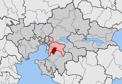 | |
| Coordinates: 40°35′N 23°2′E / 40.583°N 23.033°ECoordinates: 40°35′N 23°2′E / 40.583°N 23.033°E | |
| Country | Greece |
| Administrative region | Central Macedonia |
| Regional unit | Thessaloniki |
| Municipality | Pylaia-Chortiatis |
| • Municipal unit | 21.321 km2 (8.232 sq mi) |
| Elevation | 340 m (1,120 ft) |
| Population (2011)[1] | |
| • Municipal unit | 17,444 |
| • Municipal unit density | 820/km2 (2,100/sq mi) |
| Time zone | EET (UTC+2) |
| • Summer (DST) | EEST (UTC+3) |
| Postal code | 552 xx |
| Area code(s) | 2310 |
| Vehicle registration | Ν |

Panorama (Greek: Πανόραμα) is an affluent suburb and a former municipality in the Thessaloniki regional unit, Greece. Since the 2011 local government reform it is part of the municipality Pylaia-Chortiatis, of which it is the seat and a municipal unit.[2] Panorama has a population of 18,000 and is located at the foot of Mount Chortiatis. The municipal unit has an area of 21.321 km2.[3]
The Thessaloniki Beltway is located to the west. In Panorama there are some of the most expensive and luxurious properties in northern Greece. Best known are the areas of N751 and Villa Ritz. Panorama is connected to the villages of Chortiatis and Asvestochori in the north and with the districts of Pylaia and Charilaou in the south.
Historical population
| Year | Population |
|---|---|
| 1981 | 4,193 |
| 1991 | 10,278 |
| 2001 | 14,456 |
| 2011 | 17,444 |
References
- ↑ "Απογραφή Πληθυσμού - Κατοικιών 2011. ΜΟΝΙΜΟΣ Πληθυσμός" (in Greek). Hellenic Statistical Authority.
- ↑ Kallikratis law Greece Ministry of Interior (Greek)
- ↑ "Population & housing census 2001 (incl. area and average elevation)" (PDF) (in Greek). National Statistical Service of Greece.
See also
This article is issued from Wikipedia - version of the 11/29/2016. The text is available under the Creative Commons Attribution/Share Alike but additional terms may apply for the media files.