Parapotamos
For other uses, see Parapotamos (disambiguation).
| Parapotamos Παραπόταμος | |
|---|---|
 Parapotamos | |
|
Location within the regional unit 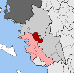 | |
| Coordinates: 39°33′N 20°20′E / 39.550°N 20.333°ECoordinates: 39°33′N 20°20′E / 39.550°N 20.333°E | |
| Country | Greece |
| Administrative region | Epirus |
| Regional unit | Thesprotia |
| Municipality | Igoumenitsa |
| • Municipal unit | 60.3 km2 (23.3 sq mi) |
| Population (2011)[1] | |
| • Municipal unit | 1,168 |
| • Municipal unit density | 19/km2 (50/sq mi) |
| Community[1] | |
| • Population | 754 (2011) |
| Time zone | EET (UTC+2) |
| • Summer (DST) | EEST (UTC+3) |
| Vehicle registration | ΗΝ |
Parapotamos (Greek: Παραπόταμος, before 1928: Βάρφανη - Varfani[2]) is a village and a former municipality in Thesprotia, Epirus, Greece. Since the 2011 local government reform it is part of the municipality Igoumenitsa, of which it is a municipal unit.[3] The municipal unit has an area of 60.334 km2.[4] Population 1,168 (2011). The village of Parapotamos, the former municipality's seat, was home to Cham Albanians, before 1944, when they were expelled for collaborating with Nazi forces.[5][6]
Name
The name of Parapotamos means "riverside" or "by the river" in the Greek language. The village is known as Varfanj in Albanian.
References
- 1 2 "Απογραφή Πληθυσμού - Κατοικιών 2011. ΜΟΝΙΜΟΣ Πληθυσμός" (in Greek). Hellenic Statistical Authority.
- ↑ Name changes of settlements in Greece
- ↑ Kallikratis law Greece Ministry of Interior (Greek)
- ↑ "Population & housing census 2001 (incl. area and average elevation)" (PDF) (in Greek). National Statistical Service of Greece.
- ↑ James Pettifer and Miranda Vickers
- ↑ official site of Parapotamos Municipality
This article is issued from Wikipedia - version of the 12/1/2016. The text is available under the Creative Commons Attribution/Share Alike but additional terms may apply for the media files.