Adelaide Park Lands
Coordinates: 34°56′05″S 138°37′00″E / 34.93467°S 138.61670°E
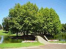

The Adelaide Park Lands are the parks that surround the centre of the South Australian capital city of Adelaide. They measure approximately 7.6 km² in a green belt encircling the city centre.
The parklands were laid out by Colonel William Light in his design for the city. Originally, Light reserved 9.31 km² for parklands, but allocated around 1.53 km² for government purposes. This area has largely been filled with cultural institutions along North Terrace, but further and additional areas have been alienated for railways, cemeteries, sporting facilities and other constructions. The parklands are managed by the Adelaide City Council and, since February 2007, the Adelaide Park Lands Authority.[1][2]
On 7 November 2008 the Federal Minister for Environment, Heritage and the Arts, Peter Garrett, announced that the Adelaide Park Lands had been entered in the Australian National Heritage List as "an enduring treasure for the people of South Australia and the nation as a whole".[3]
History
Adelaide is a planned city, and the Adelaide Park Lands are an integral part of Colonel William Light's 1837 plan. Light chose a site next to the River Torrens, (which runs through the park lands), and planned the city centre on a grid south of the river, with the residential enclave of North Adelaide north of the Torrens on a gentle hill overlooking the river, its flood plain, and the central business district. Influenced by William Penn's design of Philadelphia, Light set out the city of Adelaide on a grid of one square mile, interspaced by wide boulevards and incorporating five large public squares. Light, recognising the importance of public parks, surrounded the entire city with the Adelaide Park Lands, a green-belt and the "lungs of the city".
By 1839 the parklands were threatened by extensive timber cutting, rubbish dumping, quarrying, squatting, and grazing. To check this, a body of special constables was instituted on 9 October 1839 by George Gawler and Superintendent Henry Inman. Inman appointed Nick Boys Bull (c.1800-1846), formerly a police sub-inspector, as Keeper of the Parklands. Bull led an initial team of six park rangers, most being convalescent migrants thrown on government support.[4] This dropped to two by 1840, then back to four by June 1841. Pay and rations were provided by the police department.[5]
Since 1852, the parklands have been managed and maintained by the Adelaide City Council. Public use of the parklands was controlled by a ranger who patrolled the parks, regulating sporting and recreational activities in the parks and supervising the depasturing of stock grazing there.[6]
The parklands saw very little development during the 19th century. Extensive felling of trees, quarrying and dumping of rubbish continued, which combined to give the parklands an unsightly appearance. In the late 19th century J.E. Brown, the government's Conservator of Forests, was commissioned by the City Council to prepare a blueprint for the beautification of the parklands. Brown presented his report in 1880, but it was not acted upon until the turn of the 20th century when A.W. Pelzer became the City Gardener. Major progress was made in planting and landscaping the parklands during his tenure (1899–1932) and further improvements such as creation of new gardens and boating lakes were carried under the authority of W.C.D. Veale, the Town Clerk (1947–1965).[6]
Parklands today
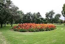
Today, some of the parklands are the location of public and cultural buildings. Many parts have been sculpted into planned gardens and playing fields. Some of the remainder is natural or regenerated Adelaide Plains bushland. Recent developments in the parklands have focused on maintenance and upgrading of recreational facilities, particularly through the Greening of Adelaide tree planting and replacement programs.[6]
Recent years have seen proposals made to redevelop Victoria Park, with the construction of a grandstand to cater for the Clipsal 500 and horse racing events. Due to lobbying by local resident groups this plan was eventually rejected by the Adelaide City Council and subsequently no longer pursued by the South Australian Government.
In December 2006 the Rann Government passed the Adelaide Parklands Act, which established the Adelaide Parklands Authority and a series of statutory protections for Adelaide's Parklands. At the time the Act was proclaimed Premier Mike Rann announced that a major return of alienated parklands would be made at the western edge of the city. The area to be returned lies between Railway Terrace, Port Road and the railway lines.[7]
In 2011 Premier Rann unveiled the plans for the return to parklands of 5.5 hectares of land occupied since 1879 by the Thebarton Water Depot. The land, now known as Narnunnga Park, was developed and landscaped with more than 23,000 trees and shrubs as an 'urban forest'. It features indigenous species including native pine.[8]
Parks


The parklands are made up of 29 individual parks, many shaped into formal or semi-planned gardens.[9]
The roadways crossing through the parklands define the separate parks, all of which are numbered (from "Park 1" through "Park 29"). The numbering starts at the northern end of the Parklands (the North Course of the Adelaide Golf Links), and increases clockwise around the perimeter. Most of the parks are more commonly known by a commemorative name, but some, particularly Park 10, are still known mostly by their number. In recent years, many parks were assigned alternative names as suggested by the indigenous Kaurna people.[10] However, the original English names assigned in the 19th century remain almost universally used.
Park 1
Kaurna Park Name & translation: Piltawodli 'possum place' (‘pilta’ = possum, ‘wodli’ = house or home) 76 hectares[11]
Of an irregular shape, Park 1 wraps around the western end of North Adelaide in a vaguely crescent or banana shape. The southern and western boundaries are provided by War Memorial Drive. The eastern boundary, from south to north, is formed by Montefiore Rd, the western end of North Adelaide (i.e. Strangways Tce, Mills Tce and Barton Tce West) and Jeffcott Rd. The northern boundary is formed by Park Tce.
Contains the Adelaide Golf Links.
Park 2
Padipadinyilla 'swimming place' 17 hectares[12]
Approximately square, the park is bounded by Fitzroy Tce (to the north), Prospect Rd (to the east), Barton Tce West (to the south) and Jeffcott Rd (to the west).
The Park provides a range of formal and informal facilities for cricket, swimming, tennis and family picnics. The north-west corner of the Park contains the Adelaide Aquatic Centre, picnic facilities and the Bush Magic playground. The remainder of the Park includes sporting facilities, open space and vegetation (designed and semi-natural landscapes).
- The Adelaide Swimming Centre was relocated to this Park in 1968/9 to replace the old City Baths on the current site of the Festival Centre. Renovated, enclosed and renamed Adelaide Aquatic Centre in 1985. Renovated again in 1998.
- The Bush Magic Play Park was designed in 1988, and is important as a precedent for the contemporary generation of play spaces around the Park Lands and metropolitan Adelaide. It was the first play park in SA to incorporate wheelchair access.
- Sporting facilities currently held under an annual licence to Blackfriars Priory School include change rooms, five playing fields and four tennis courts. The licence covers an area of approximately 35% of the Park. The school has first right of use of these areas on weekday afternoons after school, and on Saturday mornings.
Park 3
Kandarilla 'kandara root place' 3.3 hectares[13]
A small triangle bounded by Prospect Rd (west), Fitzroy Tce (north) and Main North Rd (east).
Contains open park.
Park 4
Kangattilla 'kangatta berry place' 9.4 hectares[13]
Approximately pentagonal, bounded by O'Connell St (west), Main North Rd (north-west), Lefevre Rd (north-east and east) and Barton Tce East (south).
Contains open and wooded park, with SA Water facilities at the western end. The former Fitzroy Croquet Club was located in the northern corner of the Park, and there were two ovals in the middle of the Park. The main structure of the SA Water facilities is an earth-covered reservoir, dating from the 1870s, that stored and supplied water to Adelaide. Associated with this are a two-storey red brick pumping station, a small brick pumping station "heavily painted in Brunswick green", and an electricity sub-station.
Park 5
Ngampa yerta 'ngampa root ground'[13]
Of irregular shape, the park is bounded by Robe Terrace (NE), Medindie Road (SE), Lefevre Road (W) and Main North Road (NW).
Contains two small ovals, surrounded by wooded park. There is also a Tree Planting Memorial, erected in 1982 by the North Adelaide Society, to recognise the community tree planting efforts in the locality.
Park 6
Nanto Womma 'horse plain' or 'male grey kangaroo plain'[14]
Roughly trapeziodal, the park is bounded by Robe Terrace (NNE), Kingston Terrace (SE), Lefevre Terrace (WSW) and Medindie Road (NW).
Contains open park, mainly used for horse grazing. There are three main paddocks, four feeding yards, five horse troughs, and a number of sandpits for the horses to roll in. There is a limit of 20 horses, and those licensed pay a weekly fee. (In 2005, the fee was $19.50 per week.)
The open areas are surrounded by woodland. There is a playground on the western boundary (Lefevre Tce), one of the Glover Playgrounds originally built in 1920, which also contains BBQ facilities and wide lawn spaces. The eastern third contains assorted playing fields, changing rooms, tennis courts and netball courts. Wilderness School holds a licence for eight tennis courts (also marked for netball), one cricket oval, two cricket practice nets, and three hockey/softball ovals. In 2005, there was also a green-painted brick structure with a flat roof, erected in the late 1960s, which "appears to have an undefined purpose and use".
Parks 7 and 8
Kuntingga 'kunti root place' (park 7)[15] and Barnguttilla 'barngutta root place'[15] (park 8) are small and elongated parks, with a combined area of 4.7 hectares, separating the east end of lower North Adelaide from Gilberton, and contain heritage listed olive groves. They act effectively as an enlarged median strip, with the major ring route of Park Terrace (southbound) and Mann Road (northbound) traversing the perimeter of both parks.
These parks were one of the first sites for the (European settlers) plantings of olives, and are the only section of the Park Lands that have kept the same use since the Council took over formal care of the Park Lands in the 1860s. The olive plantation is listed as a State Heritage Place.
Park 9
Tidlangga 'tidla root place'[16]
A triangular shape, bounded by Mackinnon Parade (NE), Bundeys Road (S) and Hackney Road (W). It has also been referred to as "Bundey's Paddock".
Contains assorted playing fields and changing rooms. An oval is licensed to Prince Alfred College on Saturday afternoons and Thursday evenings. In the past, contained a number of grass and bitumen tennis courts which have fallen into dis-repair and been removed.
Park 10
Warnpangga 'bullrush root place' 19 hectares[17]
Bounded by War Memorial Drive, Bundey’s Road, MacKinnon Road, MacKinnon Parade, Finnis and Frome Road.
The Park is dominated by a number of sporting ovals and associated facilities licensed to the University of Adelaide, including a tennis pavilion, a grandstand, and changing rooms.
The Park also contains:
- The Adelaide Archery Club rooms, in the north eastern corner of the Park.
- The University Loop, a well used 2.2 km gravel running track, which encircles part of the Park.
- The Adelaide City Council Organic Recycling Depot/Nursery, (approx 1.6 hectares), comprising: an Office Building, 3 sheds, 6 glass houses, a shade house, and 6 propagating plant frames.
- The Lower North Adelaide Soldiers’ Memorial Garden, located in the north of the Park.
- A number of sculptures, located in 1994 on the edge of the River Torrens.
- A small playground
Park 11
Tainmundilla 'mistletoe place'
A quite large piece of land bounded by the River Torrens (north), North Terrace (south), Hackney Rd (east) and Frome Rd (west). It contains the Zoological Gardens, the Botanic Gardens, the Botanic Park, the Wine Centre, the Royal Adelaide Hospital (RAH), the Institute of Medical and Veterinary Science (IMVS), the Medical School of the University of Adelaide, and several University of South Australia buildings.
Park 12
Karrawirra 'river red gum forest'
Bisected by the river, the northern part contains the University playing fields. The southern part contains the University of South Australia (City East campus), the University of Adelaide (main campus), the Art Gallery, the Museum, the State Library, the War Memorial, Government House, the Torrens Parade Ground, Jolly's Boat House, the Boer War Memorial, the Jubilee 150 Walkway, numerous statues, and quite a lot of other odds and ends.
Park 13
Kadlitpinna - named after Kaurna "Elder" painted by George French Angas
Park 14
Mullawirraburka - named after Kaurna "King" of the Aldinga-Willunga area
Park 15
Ityamaiitpinna - one of the three main Kaurna "Elders" with whom the colonists negotiated
Park 16
Bakkabakkandi 'trotting' Used to contain Victoria Park Racecourse. Contains part of the Adelaide Street Circuit, et al.
Park 17
TUTTANGGA 'grass place' Contains the Croque Club, et al.
Park 18
WITA WIRRA (wita ‘peppermint tree’ + wirra ‘forest; bush’) Contains Himeji Gardens et al.
Park 19
PITYARRILLA 'marshmallow root place' Open park and playing fields.
Park 20
KURRANGGA 'blue gum place' Contains the French Club and Boule rinks, assorted playing fields, a mountain-bike / BMX-bike track, et al.
Park 21
WALYO YERTA 'waylo root ground' Contains Veale Gardens, assorted playing fields, et al.
MINNO WIRRA ('golden wattle grove') Contains assorted playing fields, et al.
Park 22
WIKAPARNDO WIRRA (wika ‘net’ + parndo ‘ball’ + wirra ‘forest; bush’) Contains about 20 netball courts, aged seating for spectators and a small kiosk and toilet block
Park 23
WIRRANENDI ('to become wirra') Contains West Terrace Cemetery, et al.
Park 24
TAMBAWODLI Contains Adelaide High School and assorted sports grounds
Park 25
NARNUNGGA Contains assorted sports grounds, and until demolished in November 2010, some SA Water buildings in the north-west corner on the far side of the railway line.[18]
Park 26
TARNDANYA WOMMA Like Park 12, it is bisected by the river. The northern part contains the Adelaide Oval, Memorial Drive, St Peter's Cathedral and Light's Vision. The southern part contains Parliament House, Old Parliament House, Adelaide railway station, the Casino, the Riverbank development, the Convention Centre, assorted boat houses, the Festival Centre and Elder Park
Park 27
BONYTHON PARK / TULYA WODLI A large irregular shaped park bounded by the tram line (south, south-west, west), Park Tce (north-west), Memorial Drive (north-east, east, north-east, north) and the Morphett St Bridge (east), and bisected by the River Torrens.
It contains the Torrens Weir, restaurant and Par 3 putting course, the Dame Roma Mitchell Gardens, the Old Adelaide Gaol, the Bonython Park, the Police Barracks, the Road Safety School the Railway Yards (soon to be relocated to Dry Creek), assorted broad gauge and standard gauge railway lines and bridges, the site of the Royal Adelaide Hospital ( under construction ), City Sk8 Park, six Tennis Courts, some boat houses and Rowing Clubs' clubhouses, etc.[18]
Park 28
PALMER GARDENS / PANGKI PANGKI
Park 29
BROUGHAM GARDENS / TANDOTITTINGGA Brougham Gardens are surrounded by Brougham Place, North Adelaide.
Planned parks
Other parks are the location for institutions requiring large expanses of turf or other greenery. Planned parks such as these include:
- Adelaide Botanic Gardens (Park 11)
- Adelaide Botanic Park (Park 11)
- Adelaide High School's sports grounds (Park 24)
- Adelaide Municipal Golf Links (Park 1)
- Victoria Park Racecourse (Park 16)
- Adelaide Street Circuit (Surrounding Parks 14 & 15, and inside Park 16)
- Adelaide Oval (Park 26)
- Elder Park (Park 26)
- Himeji Gardens (Park 18)
- Veale Gardens (Park 21)
Buildings/institutions within bounds of parklands
- Adelaide Aquatic Centre (Park 2)
- Adelaide Botanic Garden* (Park 11)
- Adelaide Convention Centre* (Park 26)
- Adelaide Festival Centre (Park 26)
- Adelaide High School (Park 24)
- Adelaide Oval (Park 26)
- Adelaide Parklands Terminal (Park 23)
- Adelaide railway station* (Park 26)
- Adelaide University Boat Club (Park 12)
- Adelaide Zoo (Park 11)
- Art Gallery of South Australia* (Park 12)
- Government House* (Park 12)
- Institute of Medical and Veterinary Science (Park 11)
- Memorial Drive (Park 26)
- National War Memorial* (Park 12)
- National Wine Centre (Park 11)
- Parliament House* (Park 26)
- Royal Adelaide Hospital* (Park 11)
- South Australian Museum* (Park 12)
- State Library of South Australia* (Park 12)
- University of Adelaide City (main) campus* (Park 12)
- University of South Australia City East campus* (Park 12)
* North Terrace forms the southern boundary of these establishments.
Parkland preservation movement
Since the parklands were intended by the city founders to be reserved for parks, any development can be seen to go against the founding ambitions for Adelaide and be a source of controversy in the community.
In response to incessant pressure and erosion, in 1987 a public meeting was held, which resulted in the formation of the Adelaide Parklands Preservation Association Inc, (APPA).[19] Examples of such pressure and erosion are listed on APPA's "Hot Topics" page.[20]
A recent example of one such source of controversy is the Victoria Park racecourse and associated parklands south-east of the city centre which has been used for motor racing events for short periods of each year. In 2008 these parklands were targeted for development, incurring opposition from members of the community.[21][22] The proposed plans included construction of a permanent facility to house events such as the Adelaide 500 motor racing event.
On 30 August 2007 veteran Adelaide heritage consultant and conservation architect Ron Danvers[23][24] said it was "a myth" that Adelaide's founding fathers created the parklands exclusively for open space, and that it was "self-evident" that Colonel William Light's 1837 plan of Adelaide envisaged development of facilities beyond the CBD.[25] In a submission to the Adelaide City Council, Mr Danvers said the state Government's $55 million plan for a grandstand at Victoria Park for horse and motor racing was "completely consistent with the founding principles for the city". "Under Light's direction, the intention to locate public facilities outside of the main street grid is beyond question," he said in a report commissioned by developers KBR.[25]
Subsequently, numerous counter-arguments demonstrated the fallacies in those points of view, and the proposal was dropped.[26][27][28][29][30][31]
See also
References
- ↑ Jim Daly (2007) New Authority meets Archived 15 April 2010 at the Wayback Machine., Parklands News No.26, Adelaide Parklands Preservation Association, March 2007, pg.2
- ↑ Charter, Adelaide Park Lands Authority, Adelaide City Council, December 2006. Archived 28 September 2011 at the Wayback Machine.
- ↑ Hon. Peter Garrett, Media Release 7 November 2008
- ↑ House of Lords Sessional Papers (Colonial Dept), 1840, p 187
- ↑ Inman: first commander of the SA Police, by Max Slee (Adelaide, 2010), pp 57,138
- 1 2 3 "Parklands: Source Sheet No. 23" (PDF). Adelaide City Council Archives. Archived from the original (PDF) on 20 August 2006. Retrieved 2006-05-16.
- ↑ Adelaide Advertiser December 15, 2006
- ↑ Greg Kelton, Park project will transform site AdelaideNow, 24 August 2011. Accessed 20 December 2013.
- ↑ M. Long (2003) Adelaide Park Lands Management Units, Figure 4, page 11, A Biodiversity Survey of the Adelaide Parklands South Australia in 2003, Science and Conservation Directorate, Department for Environment and Heritage, South Australia. Archived 18 March 2012 at the Wayback Machine.
- ↑ Kaurna Place Naming Archived 16 January 2012 at the Wayback Machine., www.adelaidecitycouncil.com
- ↑ CLMP for Piltawodli (Park 1) Archived 19 November 2010 at the Wayback Machine., formally adopted 26 June 2006. (3Mb, 75 pages.) Community Land Management Plans, Park Lands and Sustainability Business Unit, Adelaide City Council.
- ↑ CLMP for Padipadinyilla (Park 2), formally adopted 22 August 2005. (1Mb, 42 pages.) Community Land Management Plans, Park Lands and Sustainability Business Unit, Adelaide City Council. Archived 28 July 2011 at the Wayback Machine.
- 1 2 3 CLMP for Kandarilla (Park 3), Kangattilla (Park 4) and Ngampa Yerta (Park 5), formally adopted 14 November 2005. (2Mb, 46 pages.) Community Land Management Plans, Park Lands and Sustainability Business Unit, Adelaide City Council. Archived 19 November 2010 at the Wayback Machine.
- ↑ CLMP for Nanto Womma (Park 6), formally adopted 28 November 2005. (2Mb, 52 pages.) Community Land Management Plans, Park Lands and Sustainability Business Unit, Adelaide City Council. Archived 19 November 2010 at the Wayback Machine.
- 1 2 CLMP for Kuntingga (Park 7) and Barnguttilla (Park 8), formally adopted 14 November 2005. (2Mb, 42 pages.) Community Land Management Plans, Park Lands and Sustainability Business Unit, Adelaide City Council. Archived 19 November 2010 at the Wayback Machine.
- ↑ CLMP for Tidlangga (Park 9) Archived 19 November 2010 at the Wayback Machine., formally adopted 27 November 2006. (2Mb, 38 pages.) Community Land Management Plans, Park Lands and Sustainability Business Unit, Adelaide City Council.
- ↑ CLMP for Warnpangga (Park 10) & Tainmundilla (Park 11) Archived 19 November 2010 at the Wayback Machine., formally adopted 27 November 2006. (5Mb, 56 pages.) Community Land Management Plans, Park Lands and Sustainability Business Unit, Adelaide City Council.
- 1 2 Current Land Tenure, 2006 Archived 12 April 2011 at the Wayback Machine., Adelaide City Council
- ↑ About APPA Archived 28 January 2011 at the Wayback Machine., Adelaide Parklands Preservation Association Inc
- ↑ Hot Topics Archived 27 January 2011 at the Wayback Machine., Adelaide Parklands Preservation Association Inc
- ↑ Victoria Park (Bakkabakkandi) Masterplan, Department for Transport, Energy and Infrastructure (DTEI)
- ↑ Adelaide Parklands Preservation Association website
- ↑ Chris Bowe (2004) Restoration of true purpose, The Adelaide Review Archived 8 March 2011 at the Wayback Machine.
- ↑ dasharchitects, Danvers Schultz Holland Architects Pty Ltd website
- 1 2 The Advertiser, page 28, Thursday 30 August 2007
- ↑ Help save the Adelaide Parklands, www.gdp-research.com.au
- ↑ Mark Hamilton (2010) Parkland poachers mar vision for city, 13 April 2010, The Advertiser
- ↑ Brad Crouch (2010) Parklands for plunder, 30 May 2010, Sunday Mail
- ↑ Tim Lloyd (2004) The Race for our Parklands, 21 August 2004, Heritage Matters, The Advertiser
- ↑ Steve Condous (2007) Keep hands off Adelaide's unique parklands, 9 March 2007, The Advertiser
- ↑ Rex Jory (2006) Don't let our parklands be lost forever, 25 September 2006, The Advertiser
- "Adelaide Park Lands Act 2005". Archived from the original on 29 September 2007. Retrieved 2006-05-16.
- Government of South Australia. "Adelaide Parklands map" (PDF). Archived from the original (PDF) on 17 July 2005. Retrieved 2006-05-16.
- Government of South Australia, Department of the Environment, Water, ?Heritage and the Arts. "Adelaide Park Lands and City Layout, South Australia: Location/Boundary plan" (PDF). Archived from the original (PDF) on 6 December 2010. Retrieved 2010-03-10. (PDF)
- Community Land Management Plans, Adelaide City Council
External links
- Park Lands Usage, City of Adelaide fact sheet no.9, March 2009, www.adelaidecitycouncil.com