Paterson, Eastern Cape
| Paterson | |
|---|---|
|
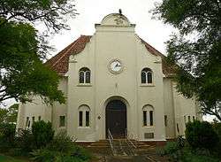
Dutch Reformed Church in Paterson | |
 Paterson  Paterson  Paterson
| |
| Coordinates: 33°26′22″S 25°58′07″E / 33.4394°S 25.9685°ECoordinates: 33°26′22″S 25°58′07″E / 33.4394°S 25.9685°E | |
| Country | South Africa |
| Province | Eastern Cape |
| District | Sarah Baartman |
| Municipality | Sundays River Valley |
| Established | 1879 |
| Area[1] | |
| • Total | 4.3 km2 (1.7 sq mi) |
| Population (2011)[1] | |
| • Total | 5,582 |
| • Density | 1,300/km2 (3,400/sq mi) |
| Racial makeup (2011)[1] | |
| • Black African | 77.0% |
| • Coloured | 20.4% |
| • Indian/Asian | 0.3% |
| • White | 1.5% |
| • Other | 0.8% |
| First languages (2011)[1] | |
| • Xhosa | 66.7% |
| • Afrikaans | 23.2% |
| • English | 5.9% |
| • Sign language | 1.8% |
| • Other | 2.3% |
| Postal code (street) | 6130 |
| PO box | 6130 |
| Area code | 042 |
Paterson is a settlement in Sarah Baartman District Municipality in the Eastern Cape province of South Africa.
Village some 80 km north-west of Alexandria and 21 km north of Ncanaha. It was laid out in 1879 and named after John Paterson (1822–1880), member of Parliament and founder of the Eastern Province Herald and of the Grey Institute for Boys, who established the town.[2]
References
- 1 2 3 4 Sum of the Main Places Paterson and KwaZenzele Census 2011.
- ↑ "Dictionary of Southern African Place Names (Public Domain)". Human Science Research Council. p. 359.
Municipalities and communities of Sarah Baartman District Municipality, Eastern Cape | ||
|---|---|---|
District seat: Port Elizabeth | ||
| Blue Crane Route | .svg.png) | |
| Dr Beyers Naudé | ||
| Kouga | ||
| Kou-Kamma | ||
| Makana | ||
| Ndlambe | ||
| Sunday's River Valley | ||
This article is issued from Wikipedia - version of the 10/11/2016. The text is available under the Creative Commons Attribution/Share Alike but additional terms may apply for the media files.