Patrick (parish)
Coordinates: 54°09′07″N 4°40′23″W / 54.152°N 4.673°W
| Parish of Patrick | |
|---|---|
 | |
| Details | |
| Population | 1,294 (Isle of Man census, 2006)[1] |
| Sheading | Glenfaba |
| Main village | Kirk Patrick |
| Parish church | Kirk Patrick (Anglican) |
| Industry | Agrarian and Tourism |
| Main peaks | |
| Dalby-Mountain, Barrule | |
| Main glens | |
| Rushen, Dhoo | |
| Treens | |
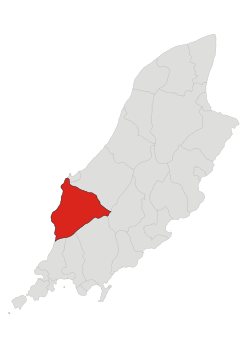
Patrick is a parish in the sheading of Glenfaba, on the west coast of the Isle of Man.
Geography
The parish is a mountainous region including the northern slopes of the South Barrule; Slieauwhallin; and to the west, Dalby Mountain. Glen Rushen is located between Dalby Mountain and the South Barrule, and leads downwards to Glen Mooar and finally Glen Maye. Through these glens flows the Glenmaye river, with the Glenmaye waterfall, about one mile from the coast. There are disused slate quarries in Glen Rushen. In common with other hilly areas of the island, there are several forest plantations.
The population is historically partly agricultural, fishing, and mining, and is sparsely distributed over the parish. There are four small villages, Dalby near the coast on the west side of Dalby Mountain, Foxdale, a former mining village, Patrick in the north, and Glen Maye, on the coast and home to the glen of the same name.[2]
Demographics
The Isle of Man census 2006 listed the population as 1,294.[1]
References
- 1 2 "Isle of Man Census 2006 Summary Results" (PDF). Economic Affairs Division, Isle of Man Treasury. 2006. p. 3. Archived from the original (PDF) on October 29, 2008. Retrieved 2008-10-01.
- ↑ "Parish of Patrick". isleofman.com. 2006. Retrieved 2008-10-05.