Patterson Springs, North Carolina
| Patterson Springs, North Carolina | |
|---|---|
| Town | |
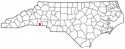 Location of Patterson Springs, North Carolina | |
| Coordinates: 35°13′50″N 81°31′4″W / 35.23056°N 81.51778°WCoordinates: 35°13′50″N 81°31′4″W / 35.23056°N 81.51778°W | |
| Country | United States |
| State | North Carolina |
| County | Cleveland |
| Area | |
| • Total | 0.9 sq mi (2.4 km2) |
| • Land | 0.9 sq mi (2.4 km2) |
| • Water | 0.0 sq mi (0.0 km2) |
| Elevation | 919 ft (280 m) |
| Population (2010) | |
| • Total | 622 |
| • Density | 682.1/sq mi (263.4/km2) |
| Time zone | Eastern (EST) (UTC-5) |
| • Summer (DST) | EDT (UTC-4) |
| ZIP code | 28150 |
| Area code(s) | 704 |
| FIPS code | 37-50700[1] |
| GNIS feature ID | 1021829[2] |
Patterson Springs is a town in Cleveland County, North Carolina, United States. The population was 622 at the 2010 census.
Geography
Patterson Springs is located at 35°13′50″N 81°31′4″W / 35.23056°N 81.51778°W (35.230506, -81.517759).[3]
According to the United States Census Bureau, the town has a total area of 0.9 square miles (2.3 km2), all of it land.
The community is located at the south end of conjoined state highways 180 and 226.
Demographics
| Historical population | |||
|---|---|---|---|
| Census | Pop. | %± | |
| 1980 | 731 | — | |
| 1990 | 690 | −5.6% | |
| 2000 | 620 | −10.1% | |
| 2010 | 622 | 0.3% | |
| Est. 2015 | 604 | [4] | −2.9% |
As of the census[1] of 2000, there were 620 people, 254 households, and 169 families residing in the town. The population density was 682.1 people per square mile (263.1/km²). There were 272 housing units at an average density of 299.3 per square mile (115.4/km²). The racial makeup of the town was 95.48% White, 3.23% African American, 0.16% Native American, and 1.13% from two or more races. Hispanic or Latino of any race were 0.81% of the population.
There were 254 households out of which 32.3% had children under the age of 18 living with them, 52.8% were married couples living together, 8.3% had a female householder with no husband present, and 33.1% were non-families. 24.8% of all households were made up of individuals and 7.5% had someone living alone who was 65 years of age or older. The average household size was 2.44 and the average family size was 2.95.
In the town the population was spread out with 24.4% under the age of 18, 9.0% from 18 to 24, 33.5% from 25 to 44, 24.4% from 45 to 64, and 8.7% who were 65 years of age or older. The median age was 35 years. For every 100 females there were 104.6 males. For every 100 females age 18 and over, there were 113.2 males.
The median income for a household in the town was $32,368, and the median income for a family was $34,500. Males had a median income of $31,591 versus $25,577 for females. The per capita income for the town was $15,092. About 10.4% of families and 16.5% of the population were below the poverty line, including 22.2% of those under age 18 and 2.6% of those age 65 or over.
Economy
Ticona, a German-based maker of polymers, operates a large facility in Patterson Springs, and is the town's major employer. Although the company labels the facility as being in Shelby, and the facility's postal mailing address is Shelby, the plant is actually located near Patterson Springs.
In Popular Culture
In the satirical TV show The Colbert Report, Stephen Colbert has repeatedly mentioned that he spent his early TV career days at the fictitious TV station WPTS, situated in Patterson Springs. This is usually accompanied by a video excerpt from his work there.[6]
References
- 1 2 "American FactFinder". United States Census Bureau. Retrieved 2008-01-31.
- ↑ "US Board on Geographic Names". United States Geological Survey. 2007-10-25. Retrieved 2008-01-31.
- ↑ "US Gazetteer files: 2010, 2000, and 1990". United States Census Bureau. 2011-02-12. Retrieved 2011-04-23.
- ↑ "Annual Estimates of the Resident Population for Incorporated Places: April 1, 2010 to July 1, 2015". Retrieved July 2, 2016.
- ↑ "Census of Population and Housing". Census.gov. Retrieved June 4, 2015.
- ↑ http://www.colbertnation.com/the-colbert-report-videos/429675/october-14-2013/5-x-five---colbert-moments--stephen-s-local-news-days?xrs=synd_facebook_101413_cn_43
Municipalities and communities of Cleveland County, North Carolina, United States | ||
|---|---|---|
| Cities | 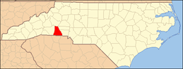 | |
| Towns | ||
| CDP | ||
| Unincorporated communities | ||
| Footnotes | ‡This populated place also has portions in an adjacent county or counties | |