Pico da Antónia
| Pico da Antónia | |
|---|---|
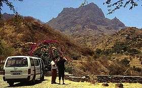 View over Pico da Antónia | |
| Highest point | |
| Elevation | 1,394 m (4,573 ft) |
| Listing | List of mountains in Cape Verde |
| Coordinates | 15°03′4″N 23°38′7″W / 15.05111°N 23.63528°WCoordinates: 15°03′4″N 23°38′7″W / 15.05111°N 23.63528°W |
| Geography | |
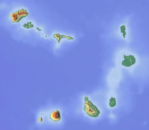 Pico da Antónia central Santiago | |
| Geology | |
| Mountain type | Stratovolcano |
| Climbing | |
| Easiest route | climb |
Pico da Antónia is Santiago's tallest mountain located in the central part of the island in Cape Verde. The mountain is part of the protected area Parque Natural de Rui Vaz e Serra de Pico de Antónia which includes other features as the Órgãos.[1] The mountain is entirely of volcanic origin. The towns Picos and Assomada lie close to the mountain. The area around the peak has been identified by BirdLife International as an Important Bird Area.[2]
The mountain range forms a part of the municipalities of São Salvador do Mundo, São Lourenço dos Órgãos and Ribeira Grande de Santiago.
Its geology consists of the Pico da Antónia formation consisting of calcarenothorizonite rocks, it was formed between 3.3 to 2.3 million years ago during the Piacenzian and the Gelasian periods.[3]
References
- ↑ Protected areas
- ↑ "Serra do Pico da Antónia". Important Bird Areas factsheet. BirdLife International. 2013. Retrieved 2013-08-16.
- ↑ Holm, P. M. (2008). An 40Ar-39Ar study of the Cape Verde hot spot: temporal evolution in a semistationary plate environment. 113. J. Geophys. Res. p. B08201.
Further reading
- Ricardo A. S. Ramalho, "The Pico da Antónia Volcanic Complex", in Building the Cape Verde Islands, Springer, 2011, p. 106-110 ISBN 9783642191022
Geography, features and topics of Santiago and the surrounding islets | ||
|---|---|---|
| Topics |
|  |
| Mountains |
| |
| Streams |
| |
| Points and promontories |
| |
| Reservoirs |
| |
| Other geographic features | ||
| History | ||
| Communities and settlements |
|  |
|---|---|---|
| Geographical features | ||
| Landmarks and points of Interests |
| |
| History | ||
| Communities and settlements | 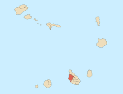 | |
|---|---|---|
| Geographical features | ||
| Landmarks and points of Interests | ||
| History |
| |
| Culture | ||