Plumsteadville, Pennsylvania
| Plumsteadville, Pennsylvania | |
|---|---|
| Census-designated place | |
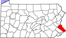
 Location of Plumsteadville in Bucks County | |
| Country | United States |
| State | Pennsylvania |
| County | Bucks |
| Township | Plumstead |
| Population (2010) | |
| • Total | 2,637 |
| Time zone | Eastern (EST) (UTC-5) |
| • Summer (DST) | EDT (UTC-4) |
| ZIP codes | 18949 |
| Area code(s) | 215 and 267 |
Plumsteadville is a census-designated place[1] in Plumstead Township, Bucks County, Pennsylvania. It is located along PA Route 611 about 8 miles north of Doylestown. As of the 2010 census, the population was 2,637 residents.[2]
Community
The local school district is Central Bucks and children attend Groveland Elementary School. Plumsteadville also has plenty of access to outdoor activities. These activities include a bike ride to Tinicum Park, rock climbing at High Rocks and hiking. Neighborhoods in the area are conducive to groups of children gathering for playtime activities.
The Plumsteadville Village Business Alliance was recently launched in May 2016 to organize and start working together with local businesses towards developing future business growth and strong community alliances with their neighbors. In turn, their efforts will build more commerce which will enhance the growth of their businesses, will work towards building the vital local economy and will help local entrepreneurs compete successfully.
References
Coordinates: 40°23′14″N 75°08′48″W / 40.38722°N 75.14667°W