Pointe-à-la-Croix, Quebec
| Pointe-à-la-Croix | |
|---|---|
| Municipality | |
 | |
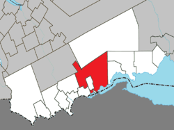 Location within Avignon RCM. | |
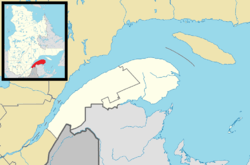 Pointe-à-la-Croix Location in eastern Quebec. | |
| Coordinates: 48°01′N 66°41′W / 48.017°N 66.683°WCoordinates: 48°01′N 66°41′W / 48.017°N 66.683°W[1] | |
| Country |
|
| Province |
|
| Region |
Gaspésie– Îles-de-la-Madeleine |
| RCM | Avignon |
| Settled | 1750s |
| Constituted | May 7, 1983 |
| Government[2] | |
| • Mayor | Jean-Paul Audy |
| • Federal riding |
Gaspésie— Îles-de-la-Madeleine |
| • Prov. riding | Bonaventure |
| Area[2][3] | |
| • Total | 416.90 km2 (160.97 sq mi) |
| • Land | 394.39 km2 (152.27 sq mi) |
| Population (2011)[3] | |
| • Total | 1,472 |
| • Density | 3.7/km2 (10/sq mi) |
| • Pop 2006-2011 |
|
| • Dwellings | 725 |
| Time zone | EST (UTC−5) |
| • Summer (DST) | EDT (UTC−4) |
| Postal code(s) | G0C 1L0 |
| Area code(s) | 418 and 581 |
| Highways |
|
| Website |
www a-la-croix |
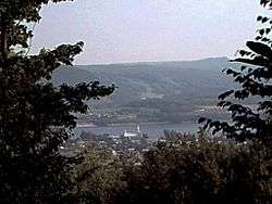
Pointe-à-la-Croix (Cross Point in English) is a municipality located on the Restigouche River in the Gaspésie region of eastern Quebec, Canada. It is situated across from the city of Campbellton, New Brunswick.
In addition to Pointe-à-la-Croix itself, the municipality also includes the communities of L'Alverne, Oak Bay, and Saint-Fidèle-de-Ristigouche.
The municipality is home to the site of the Battle of the Restigouche, a National Historic Site of Canada, and the Petite Rochelle interpretive centre.
History
The adoption of the name Pt-a-la-Croix for this municipality was obviously done in haste without giving any consideration of its important historical heritage. It seems that their only consideration at the time was rapid francisation. I have no objections to that but I must state my objections on the choice of the name. As historian since more than thirty years in this area I have gained some insight on our history, and can state for a fact that Jacques Cartier declared this bay and river as a dead end therefore insuring its neglect in being populated; Jean Marie Thibault, (C E G E P de la Gaspésie) teaches that this is one of the most important reasons, besides the fact that in the days of sailing there simply was no reason to venture into the Bay of Chaleur and waste precious time while travelling between Canada and France. This place was never a crossroads to anywhere. Inventing history is called creationism.
The history of Cross-Point is based on a cross planted on a small point of land or a small barachois created by a small brook. It is a geographic point located about a half mile west of pleasant point, indicating a new border between land claimed by Isaac Mann and the newly surveyed Restigouche Indian Reserve. It in fact represents the usurping of one of the five parcels of land discussed in the recent settlement on which Pt-a-la-Croix is built. In historical documents, it is sometimes referred to as crossing point or Pt de la traverse. So it is debatable whether the name derived from the fact that this was the customary crossing point on this part of the river, or did the name derive from the wooden cross indicating a border marking stolen property. Isaac Mann resided at Pleasant point not Cross point. Changing the name from Cross Point to Pt-a-la-Croix does not change history.
The local Migamagi had remained relatively isolated from intrusion except by the European fishermen and a few fur traders and missionaries. The events leading up to the Battle of the Ristigouche were the beginning of a significant intrusion into the heart of Northern Migamagi. The arrival of such a large population of destitute refugees had serious repercussions on the local Amerindian population by the obligation to hunt for survival amid depleting local game. Before the Battle of the Restigouche they had lived in freedom all around the Bay of Chaleur especially in the Listuguj River. The census taken in 1760 also shows the presence of 500 Gaspesiens Métis; no one today can deny that all of these people were involved in a life or death struggle. There are plenty of historical documents that testify to the increase of Mic-mac discontent and tension between all these newcomers.
The name La Petite Rochelle if it were chosen as the new name of this municipality would have instantly reconnected with the most important and heroic part of our local history. The origin of the name dates to 1684 when it was granted to Charles Damours youngest of the five sons of Mathieu Damours owner of the concession de Matane. La Seigneurie de Petite Rochelle extended from Ruisseau de L`Officier west and also included the concession of Matapedia. Charles was a fir trader with a questionable reputation. We have discovered many artefacts from a site in Restigouche-Sud Est. that may indicate a French establishment of the period (late 1600s). Further professional archaeological research should be done in this site. The Seigneurie was one of many which remained undeveloped. During the Battle of the Ristigouche an eyewitness description of the events of the third of July 1760 refers to a sort of village or group of Acadian dwellings numbering between 150 and 200, burned by the English. He says this village was called La Petite Rochelle. It was populated by 1003 Acadian refugees and 500 Métis Gaspesiens. Historically this was the one and only French place name ever used in reference to this area. The actual village, if one can call it that, had a short life span. It began as a stopping point for watercraft forced to wait at this place before being able to continue upriver. Just below and north of battery point a ship is well protected from the westerly wind. Off Battery point the channel is narrow creating a current of up to seven knots. To proceed upriver under sail from this place required an east wind and a rising tide; needless to say, the wait was sometimes long. This spot seems to have better suited the desperate Acadian refugee families arriving from southern Acadia. The first large group had arrived in 1757 with Joseph Leblanc dit Le Maigre. This group had spent the first winter near the Sugarloaf Mountain but transferred across to the place referred to as La Petite Rochelle in spring of 1760.
Situated in a relatively pristine undeveloped area Mc Neil's cove is our most important on land archaeological site located so far. Yet no effort comes from this municipality to assist the Societe Historique in its efforts in the Mise en Valeur of our incredible local historical heritage. The Acadian people may have been destined to disappear but their history will not. The Gaspe Peninsula is an integral part of Historic Acadian territory. The Battle of the Ristigouche and the Acadian resistance at La Petite Rochelle are also considered as an integral part of Le Grand Derangement Acadiens. Denial of Acadian history has always had the reverse effect of reinforcing their identity.
Andre Gregoire
The first Euro-American settlement in the town was by Acadians fleeing the Expulsion in 1755. Retreating as far as possible up the Restigouche River, they were trapped by a huge British fleet in the Battle of Restigouche. Approximately 1500 Acadian and Métis took refuge here, with the local Mi'kmaq Native Americans. Their combined resistance was not able to prevent an English landing at their village, which they had named La Petite Rochelle, after the Seingeurie de La Petite Rochelle, situated at Point au Bourdon. The village was completely destroyed by fire on August 23, 1760. Further upriver near Listuguj, the Battle of the Restigouche ended with all the French ships and most of the Acadians' boats sunk, but the English were not successful in landing because of the number of muskets on shore. The Acadians had made their last stand here and survived. Their resistance was in effect a success.
After the conquest, Pointe-à-la-Croix was primarily a fishing, forestry, and farming community until the opening of the J. C. Van Horne Bridge to Campbellton in 1962. In 1969, the town was still incorporated as Cross Point, but changed to the French name in 1970. The town now is nearly fully integrated economically with the Campbellton area. Despite its economical ties and geographical proximity with Campbellton, the municipality observes Eastern Standard Time (UTC -5), which puts it one hour behind Campbellton.
Demographics
Population
| Canada census – Pointe-à-la-Croix, Quebec community profile | |||
|---|---|---|---|
| 2011 | 2006 | 2001 | |
| Population: | 1,472 (-7.2% from 2006) | 1,587 (+4.9% from 2001) | 1,513 (-5.8% from 1996) |
| Land area: | 394.39 km2 (152.27 sq mi) | 394.39 km2 (152.27 sq mi) | 394.39 km2 (152.27 sq mi) |
| Population density: | 3.7/km2 (9.6/sq mi) | 4.0/km2 (10/sq mi) | 3.8/km2 (9.8/sq mi) |
| Median age: | 47.0 (M: 47.5, F: 46.3) | 42.8 (M: 42.3, F: 43.1) | 38.9 (M: 38.7, F: 39.0) |
| Total private dwellings: | 725 | 780 | 751 |
| Median household income: | $37,675 | $35,560 | $24,054 |
| References: 2011[3] 2006[4] 2001[5] | |||
| Historical Census Data - Pointe-à-la-Croix, Quebec[6] | ||||||||||||||||||||||||||
|---|---|---|---|---|---|---|---|---|---|---|---|---|---|---|---|---|---|---|---|---|---|---|---|---|---|---|
|
|
| ||||||||||||||||||||||||
Language
Mother tongue:[7]
- English as first language: 10.8%
- French as first language: 86.3%
- English and French as first language: 0.6%
- Other as first language: 2.2%
See also
References
- ↑ Reference number 50083 of the Commission de toponymie du Québec (French)
- 1 2 "Pointe-à-la-Croix". Répertoire des municipalités (in French). Ministère des Affaires municipales, des Régions et de l'Occupation du territoire. Retrieved 2012-01-04.
- 1 2 3 "Pointe-à-la-Croix census profile". 2011 Census data. Statistics Canada. Retrieved 2012-01-04.
- ↑ "2006 Community Profiles". Canada 2006 Census. Statistics Canada. March 30, 2011. Retrieved 2012-01-04.
- ↑ "2001 Community Profiles". Canada 2001 Census. Statistics Canada. February 17, 2012. Retrieved 2012-01-04.
- ↑ Statistics Canada: 1996, 2001, 2006, 2011 census
- ↑ "Pointe-à-la-Croix community profile". 2006 Census data. Statistics Canada. Retrieved 2012-01-04.
- "A la recherche de La Petite-Rochelle: Memory and Identity in Restigouche", Acadiensis, XXVIII, 2 (Spring 1999), pp. 3–40; article p4
External links
 |
Routhierville | Rivière-Nouvelle | | |
| St-André-de-Restigouche | |
Nouvelle Escuminac | ||
| ||||
| | ||||
| Ristigouche-Partie-Sud-Est, Listuguj | Restigouche River / |
Restigouche River / |
| Cities & Towns | |
|---|---|
| Municipalities | |
| Townships | |
| Unorganized Territories | |
| |