Dalhousie Parish, New Brunswick
| Dalhousie | |
|---|---|
| Parish | |
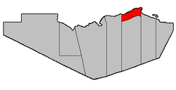 Location within Restigouche County. | |
| Coordinates: 48°00′09″N 66°31′08″W / 48.0025°N 66.51889°W | |
| Country |
|
| Province |
|
| County | Restigouche |
| Established | 1839 |
| Area[1] | |
| • Land | 121.32 km2 (46.84 sq mi) |
| Population (2011)[1] | |
| • Total | 2,247 |
| • Density | 18.5/km2 (48/sq mi) |
| • Pop 2006-2011 |
|
| • Dwellings | 1,053 |
| Time zone | AST (UTC-4) |
| • Summer (DST) | ADT (UTC-3) |
Dalhousie is a Canadian parish in Restigouche County, New Brunswick.[2]
Delineation
Dalhousie Parish is defined in the Territorial Division Act[3] as being bounded:
- West by Addington Parish, north by the Restigouche River; east and south by a line beginning on the east side of Eel River Gully, at the forty-eight mile post placed on the great road[lower-alpha 1] leading from Bathurst to Dalhousie, thence running true south to the southwest limit of Lot Number Five, fronting on Chaleur Bay, granted to Sebastian Doucett, thence in a northwesterly direction following the southwest limits of Lots Numbers Five, Four, Three, Two and One, and said limits of Lots Letters “O”, “N”, “M”, “L” and “K” to the most westerly angle of the last mentioned lot; thence in a northeasterly direction along the northwest limit of said lot to the most easterly angle of the 100 acre lot granted to Archibald Chisholm; thence in a westerly, southerly, westerly and southerly direction following the bounds of said lot to the southeast angle of Lot Number Five, Eel River Crossing,[lower-alpha 2] granted to William Searls; thence in a westerly direction along the south limit of said lot and its prolongation to the east limit of Lot Number Seventy-two, Range One, Balmoral [Settlement], granted to Robert Good; thence in a northerly direction along said limit to the northeast angle of said lot; thence in a westerly direction along the northern limit of Range One, Balmoral, to the Addington Parish Line, including all the islands in front.
Communities
Parish population total does not include incorporated municipalities (in bold or italics).
|
Demographics
Population
| Canada census – Dalhousie Parish, New Brunswick community profile | |||
|---|---|---|---|
| 2011 | 2006 | 2001 | |
| Population: | 2,247 (-2.9% from 2006) | 2,323 (-9.1% from 2001) | 2,555 (-9.6% from 1996) |
| Land area: | 121.32 km2 (46.84 sq mi) | 121.73 km2 (47.00 sq mi) | 121.73 km2 (47.00 sq mi) |
| Population density: | 18.5/km2 (48/sq mi) | 19.1/km2 (49/sq mi) | 21.0/km2 (54/sq mi) |
| Median age: | 47.4 (M: 48.0, F: 47.0) | 43.5 (M: 43.6, F: 43.3) | 38.6 (M: 38.4, F: 38.8) |
| Total private dwellings: | 1,053 | 1,044 | 1,047 |
| Median household income: | $49,743 | $46,609 | $37,692 |
| References: 2011[1] 2006[4] 2001[5] | |||
| Historical Census Data - Dalhousie Parish, New Brunswick[6] | |||||||||||||||||||||||||||||
|---|---|---|---|---|---|---|---|---|---|---|---|---|---|---|---|---|---|---|---|---|---|---|---|---|---|---|---|---|---|
|
|
| |||||||||||||||||||||||||||
(A) adjustment due to boundary change. | |||||||||||||||||||||||||||||
Language
| Canada Census Mother Tongue - Dalhousie Parish, New Brunswick[6] | ||||||||||||||||||
|---|---|---|---|---|---|---|---|---|---|---|---|---|---|---|---|---|---|---|
| Census | Total | French |
English |
French & English |
Other | |||||||||||||
| Year | Responses | Count | Trend | Pop % | Count | Trend | Pop % | Count | Trend | Pop % | Count | Trend | Pop % | |||||
| 2011 |
2,215 |
1,490 | |
67.27% | 660 | |
29.80% | 40 | |
1.80% | 25 | |
1.13% | |||||
| 2006 |
2,330 |
1,490 | |
63.95% | 785 | |
33.69% | 25 | |
1.07% | 30 | |
1.29% | |||||
| 2001 |
2,510 |
1,585 | |
63.15% | 810 | |
32.27% | 90 | |
3.59% | 25 | |
1.00% | |||||
| 1996 |
2,855 |
1,790 | n/a | 62.70% | 1,000 | n/a | 35.03% | 55 | n/a | 1.92% | 10 | n/a | 0.35% | |||||
Access Routes
Highways and numbered routes that run through the parish, including external routes that start or finish at the parish limits:[7]
|
|
|
See also
Footnotes
References
- 1 2 3 2011 Statistics Canada Census Profile: Dalhousie Parish, New Brunswick
- ↑ New Brunswick Provincial Archives - Dalhousie Parish
- ↑ "Territorial Division Act (R.S.N.B. 1973, c. T-3)". Government of New Brunswick website. Retrieved 18 August 2016.
- ↑ "2006 Community Profiles". Canada 2006 Census. Statistics Canada. March 30, 2011. Retrieved 2014-03-16.
- ↑ "2001 Community Profiles". Canada 2001 Census. Statistics Canada. February 17, 2012. Retrieved 2014-03-16.
- 1 2 Statistics Canada: 1996, 2001, 2006, 2011 census
- ↑ Atlantic Canada Back Road Atlas ISBN 978-1-55368-618-7 Pages 5-6
 |
Restigouche River | | ||
| Addington Parish | |
Chaleur Bay | ||
| ||||
| | ||||
| Balmoral Parish | Colborne Parish |
| Subdivisions | |
|---|---|
| Cities | |
| Counties | |
| |
Coordinates: 48°00′09″N 66°31′08″W / 48.00250°N 66.51889°W
This article is issued from Wikipedia - version of the 8/18/2016. The text is available under the Creative Commons Attribution/Share Alike but additional terms may apply for the media files.