Popponesset, Massachusetts
| Popponesset, Massachusetts | |
|---|---|
| Census-designated place | |
|
Community Building | |
 Popponesset | |
| Coordinates: 41°34′26″N 70°27′48″W / 41.57389°N 70.46333°WCoordinates: 41°34′26″N 70°27′48″W / 41.57389°N 70.46333°W | |
| Country | United States |
| State | Massachusetts |
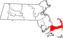
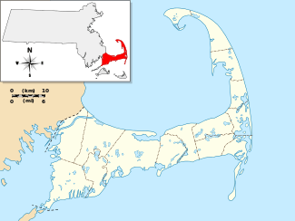
| County | Barnstable |
| Town | Mashpee |
| Area | |
| • Total | 0.32 sq mi (0.82 km2) |
| • Land | 0.31 sq mi (0.79 km2) |
| • Water | 0.01 sq mi (0.03 km2) |
| Elevation[1] | 13 ft (4 m) |
| Population (2010) | |
| • Total | 220 |
| • Density | 720/sq mi (277.9/km2) |
| Time zone | Eastern (EST) (UTC-5) |
| • Summer (DST) | EDT (UTC-4) |
| FIPS code | 25-55070 |
| GNIS feature ID | 2378205[1] |

Popponesset is a census-designated place (CDP) in the town of Mashpee in Barnstable County, Massachusetts, United States. The population was 220 at the 2010 census.[2]
Geography
Popponesset is located in the southern part of the town of Mashpee.[3] It is shown on topographic maps as Popponesset Beach. It is bordered to the north and west by the New Seabury CDP and to the northeast, across Popponesset Creek, by the Popponesset Island CDP. Its southern edge is Nantucket Sound.
According to the United States Census Bureau, the Popponesset CDP has a total area of 0.31 square miles (0.8 km2), of which 0.012 square miles (0.03 km2), or 3.66%, is water.[2]
This Cape Cod village takes its name from Popponesset Bay, a branch of Nantucket Sound.
Demographics
As of the census[4] of 2000, there were 310 people, 167 households, and 102 families residing in the CDP. The population density was 399.0/km² (1,046.0/mi²). There were 624 housing units at an average density of 803.1/km² (2,105.5/mi²). The racial makeup of the CDP was 100.00% White.
There were 167 households out of which 7.2% had children under the age of 18 living with them, 51.5% were married couples living together, 6.6% had a female householder with no husband present, and 38.9% were non-families. 34.7% of all households were made up of individuals and 22.8% had someone living alone who was 65 years of age or older. The average household size was 1.86 and the average family size was 2.29.
In the CDP the population was spread out with 7.1% under the age of 18, 3.9% from 18 to 24, 12.3% from 25 to 44, 26.5% from 45 to 64, and 50.3% who were 65 years of age or older. The median age was 65 years. For every 100 females there were 85.6 males. For every 100 females age 18 and over, there were 80.0 males.
The median income for a household in the CDP was $48,250, and the median income for a family was $49,350. Males had a median income of $51,023 versus $23,661 for females. The per capita income for the CDP was $27,805. None of the population or families were below the poverty line.
References
- 1 2 U.S. Geological Survey Geographic Names Information System: Popponesset, Massachusetts
- 1 2 "Geographic Identifiers: 2010 Demographic Profile Data (G001): Popponesset CDP, Massachusetts". U.S. Census Bureau, American Factfinder. Retrieved December 11, 2013.
- ↑ "US Gazetteer files: 2010, 2000, and 1990". United States Census Bureau. 2011-02-12. Retrieved 2011-04-23.
- ↑ "American FactFinder". United States Census Bureau. Retrieved 2008-01-31.