Ransom Township, Michigan
| Ransom Township, Michigan | |
|---|---|
| Township | |
 Ransom Township, Michigan Location within the state of Michigan | |
| Coordinates: 41°46′14″N 84°31′50″W / 41.77056°N 84.53056°WCoordinates: 41°46′14″N 84°31′50″W / 41.77056°N 84.53056°W | |
| Country | United States |
| State | Michigan |
| County | Hillsdale |
| Area | |
| • Total | 30.2 sq mi (78.2 km2) |
| • Land | 30.1 sq mi (78.1 km2) |
| • Water | 0.1 sq mi (0.2 km2) |
| Elevation | 1,001 ft (305 m) |
| Population (2000) | |
| • Total | 982 |
| • Density | 32.6/sq mi (12.6/km2) |
| Time zone | Eastern (EST) (UTC-5) |
| • Summer (DST) | EDT (UTC-4) |
| FIPS code | 26-67120[1] |
| GNIS feature ID | 1626952[2] |
Ransom Township is a civil township of Hillsdale County in the U.S. state of Michigan. The population was 982 at the 2000 census.
Communities
- Ransom is an unincorporated community within the township at 41°46′31″N 84°32′03″W / 41.77528°N 84.53417°W.[3]
Geography
According to the United States Census Bureau, the township has a total area of 30.2 square miles (78 km2), of which 30.1 square miles (78 km2) is land and 0.1 square miles (0.26 km2) (0.20%) is water.
Demographics
As of the census[1] of 2000, there were 982 people, 324 households, and 256 families residing in the township. The population density was 32.6 per square mile (12.6/km²). There were 353 housing units at an average density of 11.7 per square mile (4.5/km²). The racial makeup of the township was 98.07% white, 0.10% Asian, 0.41% from other races, and 1.43% from two or more races. Hispanic or Latino of any race were 1.43% of the population.
There were 324 households out of which 40.1% had children under the age of 18 living with them, 68.5% were married couples living together, 5.6% had a female householder with no husband present, and 20.7% were non-families. 17.9% of all households were made up of individuals and 6.5% had someone living alone who was 65 years of age or older. The average household size was 2.97 and the average family size was 3.34.
In the township the population was spread out with 31.6% under the age of 18, 7.1% from 18 to 24, 27.0% from 25 to 44, 24.1% from 45 to 64, and 10.2% who were 65 years of age or older. The median age was 35 years. For every 100 females there were 110.3 males. For every 100 females age 18 and over, there were 106.1 males.
The median income for a household in the township was $40,069, and the median income for a family was $43,264. Males had a median income of $31,806 versus $22,438 for females. The per capita income for the township was $15,904. About 8.0% of families and 13.4% of the population were below the poverty line, including 19.9% of those under age 18 and 7.4% of those age 65 or over.
Transportation
Trunk Line Bridge No. 237, located in the township, is an arch bridge listed on the National Register of Historic Places. Built in 1918, it carries Burt Road over Silver Creek.[4][5]
References
- 1 2 "American FactFinder". United States Census Bureau. Retrieved 2008-01-31.
- ↑ U.S. Geological Survey Geographic Names Information System: Ransom Township, Michigan
- ↑ U.S. Geological Survey Geographic Names Information System: Ransom, Michigan
- ↑ Staff. "Trunk Line Bridge No. 237". State Historic Preservation Office. Michigan State Housing Development Authority. Retrieved August 20, 2012.
- ↑ "Burt Rd. / Silver Creek". Historic Bridges. Michigan Department of Transportation. Retrieved August 20, 2012.
Municipalities and communities of Hillsdale County, Michigan, United States | ||
|---|---|---|
| Cities | 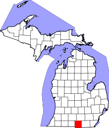 | |
| Villages | ||
| Townships | ||