Rathaspick, County Westmeath (civil parish)
| Rathaspick Ráth Easpaig | |
|---|---|
| Civil parish | |
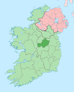
 Rathaspick Location of Rathaspick within County Westmeath in the Republic of Ireland | |
| Coordinates: 53°38′25″N 7°32′21″W / 53.64028°N 7.53917°WCoordinates: 53°38′25″N 7°32′21″W / 53.64028°N 7.53917°W | |
| Country |
|
| Province | Leinster |
| County | County Westmeath |
| Irish grid reference | N305656 |
Rathaspick (Irish: Ráth Easpaig)[1] is a civil parish in County Westmeath, Ireland. It is located about 18.17 kilometres (11 mi) north–west of Mullingar.
Rathaspick is one of 6 civil parishes in the barony of Moygoish in the Province of Leinster. The civil parish covers 7,661.3 acres (31.004 km2).
Rathaspick civil parish comprises the village of Rathowen and 26 townlands: Ballydorey, Ballygarran, Ballygarvey, Ballygarveybeg, Bardanstown, Caraun aka Kilmacahill, Carrigagh, Clonaboy, Corry, Cross, Crumlin aka Rockfield, Curristeen, Derrydooan Lower, Derrydooan Middle, Derrydooan Upper, Henfield, Joanstown, Killinagh, Kilmacahill aka Caraun, Mace, Newpass Demesne, Rathaspick, Rathclittagh, Rathowen, Rathowen (Edward), Rockfield aka Crumlin, Stongaluggaun and Windtown.
The neighbouring civil parishes are: Russagh to the north, Lackan (barony of Corkaree) to the east, Kilbixy and Kilmacnevan to the south and Ardagh, Mostrim and Rathreagh (all in the barony of Ardagh, County Longford) to the west.[2][3]
References
- ↑ Rathaspick civil parish Logainm.ie Retrieved on 25 June 2015.
- ↑ Rathaspick civil parish, Co. Westmeath Townlands.ie Retrieved on 26 June 2015.
- ↑ Rathaspick civil parish, Co. Westmeath The IreAtlas Townland Data Base Retrieved on 25 June 2015.
External links
- Rathaspick civil parish at the IreAtlas Townland Data Base
- Rathaspick civil parish at Townlands.ie
- Rathaspick civil parish at Logainm.ie