Rathgarve
| Rathgarve Ráth Garbh | |
|---|---|
| Civil parish | |
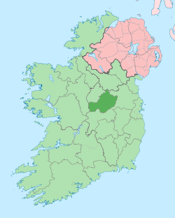
 Rathgarve Location of Rathgarve within County Westmeath in the Republic of Ireland | |
| Coordinates: 53°46′12″N 7°19′48″W / 53.77000°N 7.33000°WCoordinates: 53°46′12″N 7°19′48″W / 53.77000°N 7.33000°W | |
| Country |
|
| Province | Leinster |
| County | County Westmeath |
| Irish grid reference | N469719 |
Rathgarve (Irish: Ráth Garbh),[1] is a civil parish in County Westmeath, Ireland. It is located about 19.24 kilometres (12 mi) north of Mullingar.
Rathgarve is one of 8 civil parishes in the barony of Fore in the Province of Leinster. The civil parish covers 6,258.7 acres (25.328 km2).
Rathgarve civil parish comprises the town of Castlepollard and 27 townlands: Ballycomoyle, Ballymanus, Ballynagall, Caslanakirka, Curraghboy, Deerpark, Drumman, Freaghmore, Glen, Kinturk Demesne, Knockroe, Loughanalla, Loughanstown, Millcastle, Mullanakill, Raheen Beg, Raheen More, Rathgarve, Robinstown Lower, Robinstown Upper, Sheskernagh, Slieveboy, Srunahella, Stonestown, Teevrevagh, Townparks and Tromra.
The neighbouring civil parishes are: Foyran to the north, St. Feighin's to the east, Faughalstown to the south and Lickbla and Mayne to the west.[1][2][3]
References
- 1 2 Rathgarve civil parish The Placename Database of Ireland. Retrieved on 20 July 2015.
- ↑ Rathgarve civil parish townlands.ie Retrieved on 20 July 2015.
- ↑ Rathgarve civil parish The IreAtlas Townland Database. Retrieved on 20 July 2015
External links
- Rathgarve civil parish at the IreAtlas Townland Data Base
- Rathgarve civil parish at townlands.ie
- Rathgarve civil parish at The Placename Database of Ireland