Regions of New South Wales
In the state of New South Wales, Australia, there are many areas which are commonly known by regional names. Regions are areas that share similar characteristics. These characteristics may be natural such as the Murray River, the coastline, or the Snowy Mountains. Alternatively, the characteristics may be cultural, such as a viticulture land use. New South Wales is divided by numerous regional boundaries, based on different characteristics. In many cases boundaries defined by different agencies are coterminous.
Local government
In New South Wales on the third tier of elected government after the federal and state governments are the local government authorities, which are responsible for the local government areas. The types of LGAs in New South Wales are cities, municipalities, shires and regions.
New South Wales has more than 150 local government areas[1] which have an elected council and carry out various functions delegated to them by the Government of New South Wales.
Australian Bureau of Statistics
The Australian Bureau of Statistics has moved towards a new Geographical Classification called the Australian Statistical Geography Standard.[2] Geography is now divided into Statistical Area Level 1, 2, 3, and 4. Statistical Area Level 4 is the highest (regions of a State) and Statistical Area Level 1 being the lower (Mesh blocks are more refined but not readily available apart from the Census of Population and Housing).
| NSW rank | Statistical Area Level 4 and 3 | Population December 2014[3] | 10 year growth rate | Population density (people/km2) |
|---|---|---|---|---|
| 1 | Greater Sydney | 4,840,628 | 15.7 | 391.4 |
| 2 | Newcastle and Lake Macquarie | 368,131 | 9.0 | 423.1 |
| 3 | Illawara | 296,845 | 9.3 | 192.9 |
| 4 | Hunter Valley excluding Newcastle | 264,087 | 16.2 | 12.3 |
| 5 | Richmond Tweed | 242,116 | 8.9 | 23.6 |
| 6 | Capital region | 220,944 | 10.9 | 4.3 |
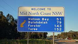
| 7 | Mid North Coast | 212,787 | 9.2 | 11.3 |
| 8 | Central West | 209,850 | 7.9 | 3.0 |
| 9 | New England and North West | 186,262 | 5.3 | 1.9 |
| 10 | Riverina | 158,144 | 4.7 | 2.8 |
| 11 | Southern Highlands and Shoalhaven | 146,388 | 10.4 | 21.8 |
| 12 | Coffs Harbour-Grafton | 136,418 | 7.6 | 10.3 |
| 13 | Far West and Orana | 119,742 | 0.3 | 0.4 |
| 14 | Murray | 116,130 | 4.0 | 1.2 |
| New South Wales | 7,518,472 | 10.4 | 13.0 | |
For older statics, such as the 2006 Census of Population and Housing, the Australian Bureau of Statistics has multiple regional structures for which it analyses and reports data. These regional structures derive from the Australian Standard Geographical Classification (AGSC). The AGSC defines at the very smallest level, the Census Collection District (CCD). These CCD's aggregate to form the Statistical Local Area (SLA), which is the common base unit for each of the larger regional structures.[4] The boundaries of the SLA are designed to be typically coterminous with Local Government Areas unless the LGA does not fit entirely into a Statistical Subdivision (SSD), or is not of a comparative nature to other LGA's.[4] Bureau of Statistics provides statistics for Local Government Areas, as well as three other statistical structures: Statistical Divisions, Statistical Regions, and Statistical Districts.
Statistical Divisions
Statistical Divisions (SD) form the main structural hierarchy of statistical analysis. These regions are structured to provide a broad range of social, demographic and economic statistics.[4] The basis for the boundary delineations center on socioeconomic criteria.[4] The thirteen divisions for New South Wales are:
- Central West, Far West, Hunter, Illawarra, Mid-North Coast, Murray, Murrumbidgee, North Western, Northern, Off-Shore Areas & Migratory, Richmond-Tweed, South Eastern, Sydney [5]
Statistical Regions
The Statistical Region (SR) structure was established in 1986 as a means for labor force analysis.[6]
- Sydney: Canterbury-Bankstown, Central Northern Sydney, Central Western Sydney, Eastern Suburbs, Fairfield-Liverpool, Gosford-Wyong, Inner Sydney, Inner Western Sydney, Lower Northern Sydney, North Western Sydney, Northern Beaches, Outer South Western Sydney, St George-Sutherland
- Balance of New South Wales: Central West, Far West-North Western, Hunter, Illawarra, Mid-North Coast, Murray-Murrumbidgee, Northern, Richmond-Tweed, South Eastern
Statistical Districts
The Statistical District (SDist) is a non-capital, urban region of one or more adjoining areas, with a population of 25,000 or more. The SDist is defined with consideration of a 20-year growth forecast. The SDist does not need to conform to LGA boundaries or to state territory boundaries.[7] The thirteen Statistical Districts in New South Wales are:
- Newcastle, Wollongong, Nowra-Bomaderry, Bathurst-Orange, Lismore, Coffs Harbour, Port Macquarie, Tamworth, Dubbo, Wagga Wagga, Albury-Wodonga (New South Wales and Victoria), Gold Coast-Tweed (New South Wales and Queensland), Canberra-Queanbeyan (New South Wales and the Australian Capital Territory)
Biogeographic regions

The Interim Biogeographic Regionalisation for Australia (IBRA) is a biogeographic regionalisation of Australia; divided into 89 bioregions and 419 subregions. Each region is a land area made up of a group of interacting ecosystems that are repeated in similar form across the landscape. Regions and subregion cross state and territory boundaries. The bioregions that are located within all or part of New South Wales include:[8]
- Australian Alps (part)
- Brigalow Belt South (part)
- Broken Hill Complex (part)
- Channel Country (part)
- Cobar Peneplain
- Darling Riverine Plains (part)
- Flinders Lofty Block (part)
- Mulga Lands (part)
- Murray Darling Depression (part)
- Nandewar (part)
- New England Tablelands
- NSW North Coast
- NSW South Western Slopes (part)
- Riverina (part)
- Simpson Strzelecki Dunefields (part)
- South East Corner (part)
- South Eastern Highlands (part)
- South East Queensland (part)
- Southern Volcanic Plain (part)
- Sydney Basin
Informal divisions
New South Wales is also informally divided into a smaller number of regions. These regions have no general administrative function or status. Many of them are only vaguely defined, or are defined in different ways for different purposes. For example, departments of the New South Wales government, such as the New South Wales Police Force, or the Ministry of Health, define regions of the State for their own internal administrative purposes. These regions may be defined in completely different ways, as shown by the maps in the references.
The original basis for descriptive regional names in New South Wales is based on the geography of the State.
The State can be divided into four components:
- the coastal regions fronting the Tasman Sea in the east of the State
- the highlands which form part of the Great Dividing Range
- the western (inland) slopes of the highlands, which form the main agricultural region of the State
- the arid western plains
These four components are then typically divided into north, central and southern components based upon their location relative to Sydney.
This two-way subdivision gives rise to the generic pattern of regions, and in some cases, subregions:
| Informal divisions of New South Wales | ||
|---|---|---|
| Region name | Subregion name | Comments |
| North Coast | Mid North Coast | North of Seal Rocks to as far north as Woolgoolga. |
| Northern Rivers | North of Woolgoolga to the Queensland border. | |
| Central Coast | Central Coast | North of the Hawkesbury River to as far north as Lake Macquarie. |
| Hunter | Lies between the North Coast and the Central Coast, and includes the valley of the Hunter River (which extends far inland between the Northern Tablelands and the Central Tablelands), as well as the Newcastle–Lake Macquarie conurbation. | |
| South Coast | Illawarra | Between Royal National Park and Nowra. |
| South Coast | South of Nowra to the Victorian border. | |
| Northern Tablelands | New England | Includes the towns and districts of Tenterfield, Glen Innes, Guyra, Inverell, Armidale and Walcha.[9][10] |
| Northern Tablelands | ||
| Central Tablelands | Greater Blue Mountains Area | Generally that area west of the Nepean River and east of Lithgow, stretching to Capertee Valley in the north, and Wombeyan Caves in the south. The majority of the region is contained within a series of national parks. |
| Central West | Generally that region centred around the cities of Bathurst and Orange and the three large towns Cowra, Parkes and Lithgow and other smaller centres which include Oberon, Mudgee, and Forbes, and other small towns and villages, | |
| Southern Tablelands | Southern Highlands | Generally that region centered around the towns of Mittagong, Bowral, Moss Vale, Bundanoon and Robertson, as well as the historic town of Berrima. |
| Capital Country | Taking in the region surround Canberra, including the cities of Queanbeyan and Goulburn and the towns of Crookwell, Yass and Young. | |
| Snowy Mountains | Monaro | The main towns in the region are Cooma, Jindabyne, Berridale and Bombala. |
| North-West Slopes | ||
| South-West Slopes | Riverina | Lies in the central south of the State, around the Murray, Murrumbidgee and Lachlan rivers. This region may, or may not, include the South-West Slopes, depending on the context. |
| South-West Slopes | ||
| Orana | Far West | Its only city is Broken Hill and other significant towns are Bourke, Brewarrina, Cobar, Ivanhoe and Wentworth. |
| Orana/Western Plains | The major localities are Dubbo, Cobar and Mudgee.[11] | |
Specific uses of regions for different purposes
Weather forecasting
The Australian Bureau of Meteorology divides New South Wales into sixteen districts.[12]
- Northern Rivers
- Mid North Coast
- Hunter
- Northern Tablelands
- Sydney Metropolitan
- Illawarra
- South Coast
- Central Tablelands
- Southern Tablelands
- Snowy Mountains
- North West Slopes & Plains
- Central West Slopes & Plains
- South West Slopes
- Riverina
- Lower Western
- Upper Western
Regional Organisations of Councils
The local government areas in New South Wales have created regional groupings. The NSW Regional Organisations of Councils, typically with names like "Western Sydney Regional Organisation of Councils" ( WSROC ) have the main function of lobbying the State Government on various matters, coordinating economic development, joint purchasing between councils and regional promotion. They have no formal administrative function.
Historically, groupings of local governments were also involved in sharing electricity and water supply undertakings.
New South Wales Government
Department of State and Regional Development
The Department of State and Regional Development lists fourteen regions in New South Wales.
- Far South Coast, Central Coast, Central West, Greater Western Sydney, Far West, The Hunter, Illawarra, Mid North Coast, Murray, New England - North West, Northern Rivers, Orana, Riverina, and Sydney [13]
Office of Local Government
The Office of Local Government lists twelve regions
- Central West, Mid North Coast, North Western, Far West, Murray, Richmond Tweed, Hunter, Murrumbidgee, South Eastern, Illawarra, Northern, and Sydney Surrounds [14]
Department of Planning
The Department of Planning divides New South Wales into seven regions:
- Alpine region, Central Coast, Hunter, Illawarra, South Coast, North Coast, Western NSW [15]
Ministry of Health
The New South Wales Ministry of Health divided New South Wales into fifteen separate regions, called Local Health Districts. These are:
- Metropolitan Local Health Districts
- Central Coast
- Illawarra Shoalhaven
- Nepean Blue Mountains
- Northern Sydney
- South Eastern Sydney
- South Western Sydney
- Sydney
- Western Sydney
- Rural & Regional NSW Local Health Districts
- Far West
- Hunter New England
- Mid North Coast
- Murrumbidgee
- Northern NSW
- Southern NSW
- Western NSW
Additionally, a small number of non-geographic specialty networks cover paediatric health, justice and forensic health, and the St' Vincent's Health network.
New South Wales Police Force
The New South Wales Police Force is organised into approximately 81 local area commands, which are aggregated into six regions:
- Central Metro Region
- North West Metro Region
- Northern Region
- South West Metro Region
- Southern Region
- Western Region
New South Wales National Parks and Wildlife Service
The NSW National Parks & Wildlife Service uses the Interim Biogeographic Regionalisation for Australia bioregions based on ecological factors. These bioregions extend into neighbouring States.
Australia travel
Yet another subdivision of New South Wales into regions is as follows:
- Sydney
- Central Coast
- Hunter
- Blue Mountains
- Southern Highlands
- Snowy Mountains
- Illawarra
- South Coast
- Capital Country (similar to Southern Tablelands in other lists)
- Northern Rivers
- North Coast NSW (which is actually what other lists call the Mid North Coast)
- New England North West (Northern Tablelands and North West Slopes)[16]
- Central New South Wales
- Riverina
- The Murray
- Outback New South Wales
This classification subdivides the most commonly accepted notion of "The Riverina" into two separate regions, "Riverina" and "The Murray".
See also
- Regions of Sydney
- Regional Organisations of Councils
- NSW Regional Organisations of Councils
- Western Sydney Regional Organisation of Councils
References
- ↑ "Local Government Area populations". Regional Population Growth, Australia, 2006-2007. Australian Bureau of Statistics. 22 April 2009. Retrieved 19 July 2013.
- ↑
- ↑ "3218.0 – Regional Population Growth, Australia, 2013–14". Australian Bureau of Statistics.
- 1 2 3 4 1216.0 - Australian Standard Geographical Classification (ASGC) - Electronic Publication, 2005 Australian Bureau of Statistics website, accessed 13 November 2006
- ↑ 1216.0 - Australian Standard Geographical Classification (ASGC), 2001: Statistical Divisions Structure Australian Bureau of Statistics, accessed 12 November 2006
- ↑ 1216.0 - Australian Standard Geographical Classification (ASGC), 2001: Purpose and structure Australian Bureau of Statistics, accessed 12 November 2006
- ↑ 1216.0 - Australian Standard Geographical Classification (ASGC), 2001: The spatial units Australian Bureau of Statistics, accessed 12 November 2006
- ↑ "Australia's bioregions (IBRA)". Department of Sustainability, Environment, Water, Population and Communities. Commonwealth of Australia. 2012. Retrieved 14 April 2013.
- ↑ Shaw, John H., "Collins Australian Encyclopedia", William Collins Pty Ltd., Sydney, 1984, ISBN 0-00-217315-8
- ↑ Delbridge, Arthur, The Macquarie Dictionary, 2nd ed., Macquarie Library, North Ryde, 1991
- ↑ "Orana". NSW Regions. NSW Department of Trade & Investment, Regional Infrastructure & Services. 19 July 2011. Retrieved 26 August 2011.
- ↑ "Regional map". Bureau of Meteorology (Australia). Retrieved 2006-11-12.
- ↑ "Regional New South Wales". Department of State and Regional Development. Retrieved 2006-11-13.
- ↑ "Local Areas In NSW - Regional Map". Office of Local Government. Government of New South Wales. Retrieved 13 November 2006.
- ↑ Regional Planning NSW Department of Planning website, accessed 13 November 2006
- ↑ New England North West Retrieved 2009-10-14
External links
- Map of NSW weather forecasting zones - website
- NSW Department of Local Government Directory - Regional Organisations of Councils.
- WSROC website - example of a regional organisation of councils.
- Map of Health NSW regions - NSW Health Department website
- NSW Police regions
- Department of State and Regional Development Regions
- National Parks Bioregions - website
- Description of bioregions - website
- About Australia Travel - website
| General | ||
|---|---|---|
| Regions |
| |
| Cities | ||
New South Wales portal | ||