Moss Vale, New South Wales
| Moss Vale New South Wales | |||||||||||||
|---|---|---|---|---|---|---|---|---|---|---|---|---|---|
_in_Moss_Vale.jpg) Argyle Street, which forms part of the Illawarra Highway | |||||||||||||
|
Moss Vale | |||||||||||||
| Coordinates | 34°33′S 150°23′E / 34.550°S 150.383°ECoordinates: 34°33′S 150°23′E / 34.550°S 150.383°E | ||||||||||||
| Population | 7,792 (2011 census)[1] | ||||||||||||
| Established | 1861 | ||||||||||||
| Postcode(s) | 2577 | ||||||||||||
| Location | 122 km (76 mi) from Sydney | ||||||||||||
| LGA(s) | Wingecarribee Shire | ||||||||||||
| Region | Southern Highlands | ||||||||||||
| County | Camden | ||||||||||||
| Parish | Bong Bong | ||||||||||||
| State electorate(s) | Goulburn | ||||||||||||
| Federal Division(s) | Whitlam | ||||||||||||
| |||||||||||||
Moss Vale is a town in the Southern Highlands of New South Wales, Australia, in the Wingecarribee Shire. It has a population of 7,792 and is sited on the Illawarra Highway, which connects to Wollongong and the Illawarra coast via Macquarie Pass. The town is colloquially known as Mossy (Mozzy), and also Moss Vegas.
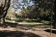
Moss Vale has several heritage buildings. In the centre of the main street is Leighton Gardens.
Moss Vale is believed to have fertile soil and good precipitation. Agricultural rural holdings in the area specialise in dairy herds, mainly Holstein Frisian, and there are an assortment of beef studs and sheep properties. The town has a commercial district and a golf course.
The Wingecarribee Shire Chambers are located here.
Moss Vale's poorer housing area is known to be called "Pill Hill".
History
The Moss Vale area was once occupied by the Gundangara people, though they had disappeared by the 1870s, partly due to the loss of their hunting land to European settlers. Governor Hunter sent a party led by ex-convict John Wilson to investigate the area in 1798. Various others explored the area up to 1815, including John Warby, George Caley, Hamilton Hume and John Oxley. Hume, Charles Throsby and Joseph Wild explored the area west of Sutton Forest in 1817 and in 1818, together with James Meehan, they explored the area between Moss Vale and Jervis Bay. Governor Macquarie granted Throsby 1,000 acres (4.0 km2), known as Throsby Park, at Bong Bong, on the northeastern outskirts of Moss Vale and put him in charge of building the Old Argyle Road from Sydney to Goulburn in 1819. This road was replaced in the 1830s by a more direct road via Berrima surveyed by Thomas Mitchell and most of the population of Bong Bong moved to Berrima.[2] The heritage-listed property of Throsby Park house was built about 1834, six years after Throsby's suicide.[3]
The area, which was considered to be part of Sutton Forest, remained rural until the coming of the railway. Subdivision part of Throsby Park for the town of Moss Vale, named after Jemmy Moss, a herdsman at Throsby Park, commenced in 1864, in anticipation of the opening of Sutton Forest railway station in 1867 at the intersection with Old Argyle Road. Governor Belmore rented Throsby Park from 1870 to 1872 to what is commonly believed to escape the summer heat of Sydney.[4] The railway and the Robertson Land Acts encouraged denser settlement by selectors in the Southern Highlands and led to the growth of Moss Vale as a town.[5] In 1877 Sutton Forest railway station was renamed Moss Vale.
Industry
Moss Vale holds a large part of the Southern Highlands Industry - as well as being a minor centre for agriculture, many light and medium industries are found in and around Moss Vale, including a James Hardie plant, a Harper Collins book distribution centre, and other manufacturing industries. Despite Moss Vale's prowess as an industrial centre, nearby Bowral is the commercial heart of the Southern Highlands.
Transport
Moss Vale station is the primary southern terminus of the Southern Highlands railway line. The line provides regular services from Moss Vale to southern Sydney, where a change of trains is generally required to access the city centre. Limited services continue south of Moss Vale to Goulburn. The station is also several long distance services a day. Moss Vale is the junction of the Unanderra - Moss Vale railway line to Wollongong, opened in 1932, but now only used by freight trains.
Television
Since the aggregation in March 31, 1989, Moss Vale was able to receive television channels from both Sydney and Southern NSW, due to its relatively close proximity to both regions.
The Sydney channels are:
The Southern NSW Channels are:
"Prime7" (with 7TWO, 7mate, 4ME, Racing.com & ishoptv)
"WIN Television" (with GO!, GEM, Gold & Gold 2)
"Southern Cross Ten" (with ELEVEN, ONE, TVSN & Aspire TV)
School
Schools in Moss Vale:
- Moss Vale High School
- Moss Vale Public School
- St. Paul's Catholic Primary School
- St Paul's International College (formerly known as Aurora College)
- Tudor House School
Churches
Churches in Moss Vale:
- Connect Christian Church (AOG/ACC)
- Moss Vale Jehovah's Witnesses Hall
- Moss Vale Uniting Church in Australia
- OneLife Community Church (Evangelism)
- St. Andrews Presbyterian Church
- St. John's Anglican Church
- St. Paul's Roman Catholic Church
Sport
Sporting teams in Moss Vale:
- Moss Vale Basketball
- Moss Vale Cricket Club
- Moss Vale Dragonflies Netball Club
- Moss Vale Dragons Rugby League Club
- Moss Vale Hockey Club
- Moss Vale Rifle Club
- Moss Vale Soccer Club (Highlands Soccer Association or HSA for short)
Notable residents
- Ann Carr-Boyd, composer and musicologist
- Tom Green, artist[6]
- Tony Lockett: former AFL player for GWS Giants.
- Simon Spargo: A Year 4 teacher showing his students why they cannot use Wikipedia as a reliable source.
- Steve Prestwich: drummer for popular Australian rock band, Cold Chisel
Notable former residents
- Dr Frank Tidswell, microbiologist, and his wife Edith lived at Farnborough in the 1930s
- Sir Rhys Morse-Evans, Flutist, Lived in Moss Vale from 1999 to present day, known for his powerful performance on the skin flute.
References
- ↑ Australian Bureau of Statistics (31 October 2012). "Moss Vale (State Suburb)". 2011 Census QuickStats. Retrieved 6 November 2012.
- ↑ "Moss Vale". Walkabout. John Fairfax. Retrieved 2007-05-26.
- ↑ "Throsby Park Historic Site". Department of Environment and Climate Change. Retrieved 2007-05-25.
- ↑ Nairn, Bede. "Belmore, fourth Earl of (1835 - 1913)". Australian Dictionary of Biography. Australian National University. Retrieved 2007-05-25.
- ↑ "Past & Present Moss Vale - History to 1860". The Southern Highlands of New South Wales. Retrieved 2007-05-25.
- ↑ "Tom Green". Australian Prints + Printmaking. Centre for Australian Art. Retrieved 9 August 2015.
External links
![]() Media related to Moss Vale, New South Wales at Wikimedia Commons
Media related to Moss Vale, New South Wales at Wikimedia Commons